
Madikeri Height From Sea Level – Altitude, Climate, Geography & Complete Travel Insight
Madikeri height from sea level is approximately 1,152 meters (around 3,780 feet), placing it among the most scenic mid-altitude hill towns of South India. Located in the heart of Coorg (Kodagu district), Karnataka, Madikeri is known for its cool climate, misty hills, coffee plantations, dense forests, and colonial charm.
Unlike coastal Karnataka cities that lie close to sea level, Madikeri’s elevation gives it a completely different geographical identity. Its height directly influences the region’s weather patterns, biodiversity, agriculture, tourism appeal, and overall lifestyle.
In this detailed guide, we explore Madikeri’s exact height from sea level, how altitude shapes its climate and environment, and why this hill town is considered the cultural and geographical capital of Coorg.
Madikeri Height From Sea Level (Exact Elevation)
The average height of Madikeri from sea level is around 1,152 meters (≈3,780 feet).
This elevation places Madikeri:
-
On the Western Ghats mountain range
-
Higher than most towns in Karnataka
-
Lower than high Himalayan hill stations
Because of this moderate-to-high altitude, Madikeri enjoys pleasant weather throughout the year, making it a popular hill retreat.
Geographical Location of Madikeri
Madikeri is located in:
-
Kodagu district (Coorg), Karnataka
-
Western Ghats region of South India
-
Elevated plateau surrounded by forested hills
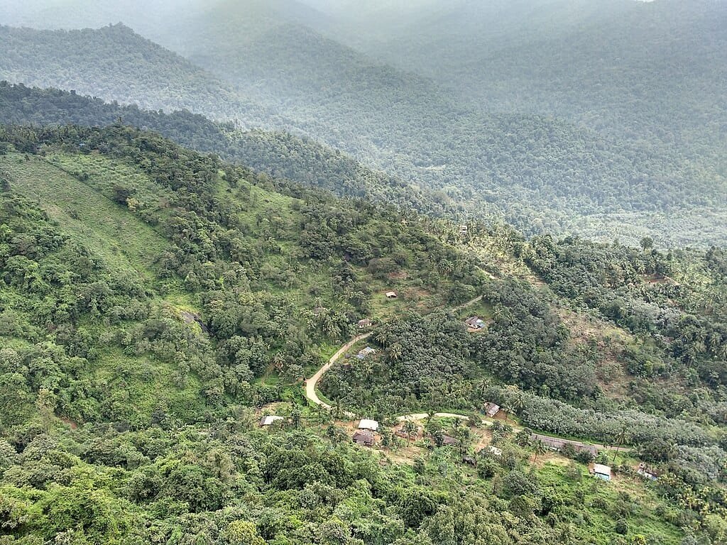
The town sits on a ridge with valleys on either side, offering panoramic views of:
-
Coffee estates
-
Forest-covered slopes
-
River catchment areas
Its height from sea level also makes Madikeri a crucial watershed zone for rivers like the Cauvery.
Why Madikeri Height From Sea Level Is Important
The height of Madikeri from sea level plays a vital role in:
-
Cool and misty climate
-
Heavy monsoon rainfall
-
Rich biodiversity
-
Coffee and spice cultivation
-
Tourism growth
At 1,152 meters, Madikeri benefits from altitude-driven ecological balance that is rare in peninsular India.
Climate of Madikeri Based on Altitude
Madikeri’s elevation gives it a pleasant tropical highland climate.
Average Temperature Range
-
Summer (Mar–May): 18°C to 28°C
-
Monsoon (Jun–Sep): 16°C to 24°C
-
Winter (Dec–Feb): 10°C to 22°C
Even during peak summer, Madikeri remains significantly cooler than nearby cities like Mysuru or Mangaluru due to its height.
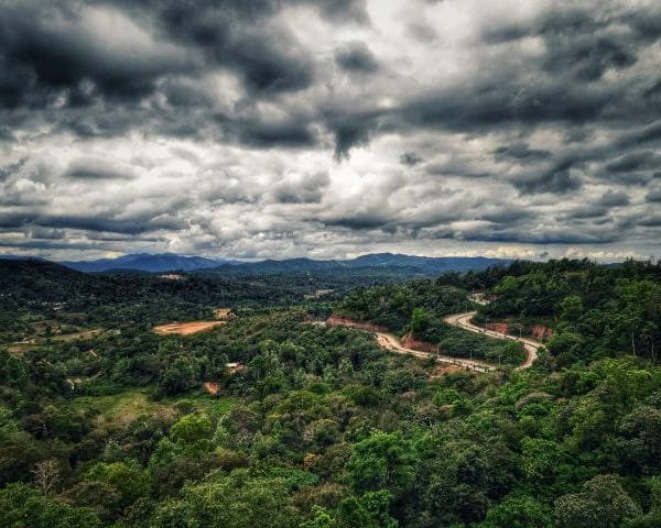
Monsoon and Rainfall at Madikeri’s Elevation
Madikeri receives very heavy rainfall, largely due to:
-
Western Ghats orographic effect
-
Moist winds from the Arabian Sea
-
Elevated terrain
Key Rainfall Facts
-
Annual rainfall often exceeds 3,000 mm
-
Monsoon clouds frequently blanket the town
-
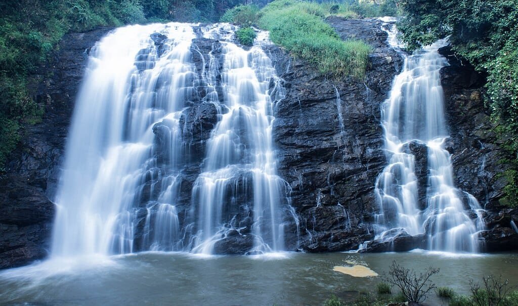
Waterfalls and streams remain active year-round
The height from sea level amplifies rainfall, making Madikeri one of Karnataka’s wettest regions.
Does Madikeri Receive Snowfall?
Despite its elevation of over 1,100 meters, Madikeri does not receive snowfall.
Reasons:
-
Tropical latitude
-
Moderate altitude compared to Himalayan regions
However, winters can be:
-
Cold and foggy
-
Frosty in open plantation areas
-
Misty during early mornings
Madikeri Elevation Compared to Nearby Places
| Location | Height From Sea Level |
|---|---|
| Madikeri | ~1,152 meters |
| Mysuru | ~770 meters |
| Mangaluru | ~22 meters |
| Chikmagalur | ~1,090 meters |
| Ooty | ~2,240 meters |
This comparison shows that Madikeri lies at an ideal mid-hill elevation, balancing accessibility and climate comfort.
Impact of Altitude on Coffee Cultivation
Madikeri’s height from sea level is perfect for coffee farming, especially Arabica and Robusta varieties.
Why Altitude Helps Coffee
-
Cooler temperatures slow bean growth
-
High rainfall nourishes soil
-
Shade from forest trees improves quality
The elevation contributes directly to Coorg’s reputation as one of India’s finest coffee-producing regions.
Biodiversity and Forest Cover at This Elevation
At 1,152 meters, Madikeri supports rich biodiversity.
Vegetation
-
Evergreen and semi-evergreen forests
-
Coffee plantations under shade trees
-
Spices like pepper and cardamom
Wildlife
-
Birds
-
Deer
-
Small mammals
-
Butterflies and insects
The elevation ensures moderate temperatures and moisture levels suitable for diverse ecosystems.
Tourism Benefits of Madikeri’s Height
Madikeri altitude makes it one of South India’s most pleasant hill destinations.
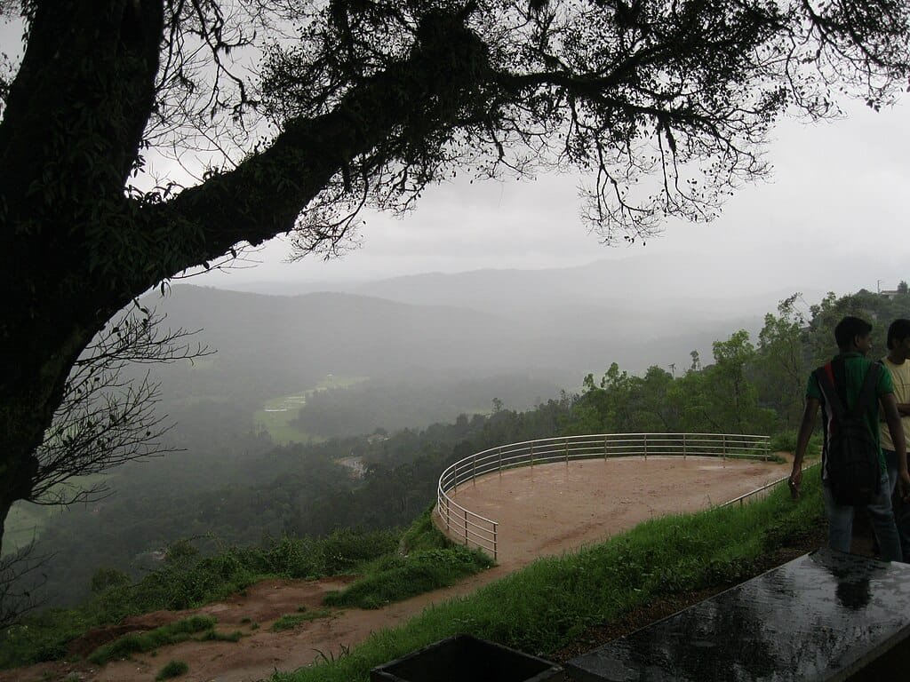
Popular Attractions Influenced by Elevation
-
Raja’s Seat – panoramic sunset views
-
Madikeri Fort – hilltop location
-
Abbey Falls – fed by high rainfall
-
Talakaveri – river origin at higher elevation
Cool air, misty mornings, and green landscapes are direct results of its height from sea level.
Health and Living Conditions at Madikeri’s Elevation
At 1,152 meters above sea level, Madikeri poses no serious altitude health risks.
Advantages include:
-
Fresh mountain air
-
Lower pollution levels
-
Comfortable oxygen levels
People of all age groups can comfortably live or travel here without altitude sickness concerns.
Best Time to Visit Madikeri Based on Altitude
Best Seasons
-
October to March: Cool, dry, scenic
-
April to May: Pleasant summer escape
Monsoon (June–September)
-
Lush greenery
-
Active waterfalls
-
Occasional travel disruptions
The elevation keeps temperatures moderate even during warmer months.
Transportation and Altitude Accessibility
Despite being at over 1,100 meters, Madikeri is well connected by road.
Connectivity
-
Road access from Mysuru and Mangaluru
-
No direct railway station
-
Nearest airports: Mangaluru & Kannur
The gradual ascent makes travel comfortable even for first-time hill visitors.
Urban Development and Elevation Challenges
Madikeri altitude also presents challenges:
-
Landslides during heavy monsoon
-
Limited flat land for expansion
-
Ecological sensitivity
Urban planning must respect the fragile hill ecosystem shaped by this elevation.
Cultural Importance and Altitude
Madikeri elevation has historically made it:
-
A defensive hill settlement
-
Administrative center of Coorg
-
Cultural hub for Kodava traditions
The town’s hilltop location influenced its fort, layout, and strategic importance.
Quick Facts: Madikeri Height From Sea Level
-
Average elevation: ~1,152 meters
-
State: Karnataka
-
Region: Western Ghats
-
Climate: Tropical highland
-
Snowfall: No
Final Thoughts
The height of Madikeri from sea level—around 1,152 meters—is the defining factor behind its cool climate, lush landscapes, rich biodiversity, and tourism appeal. Neither too high nor too low, this elevation gives Madikeri a unique identity among Indian hill towns.
Whether for coffee plantations, scenic views, pleasant weather, or cultural richness, Madikeri’s altitude makes it one of the most naturally gifted destinations in South India.
Siliguri Height From Sea Level – Altitude, Climate, Geography & City Profile