
Tawang Height From Sea Level – Altitude, Climate & Complete Travel Guide
Tawang Height From Sea Level – Tawang is one of India’s most iconic high-altitude hill towns, perched in the remote Western Arunachal Pradesh near the China border. Famed for its ancient monasteries, stunning Himalayan views, and rich cultural heritage, it’s a must-visit for mountain lovers and adventure seekers. In this comprehensive guide, we explain Tawang height from sea level, why elevation matters, how it affects weather and travel, and essential tips for visitors. Tawang District+1
What Is Tawang Height From Sea Level?
Tawang town is situated at an elevation of approximately 3,048 metres (10,000 feet) above sea level. Tawang District+1
While some government-linked sources list a similar figure (~10,000-11,000 ft), the average consensus from official tourism sites and topographic data affirms that Tawang lies around 3,000 m above mean sea level, making it one of India’s highest inhabited towns. Tawang District+1
This high altitude gives Tawang its crisp mountain air, cool temperatures, and dramatic Himalayan landscape that few places in India can match.
Why Tawang’s Elevation Matters
1. Climate & Weather Patterns
Because Tawang sits so high:
-
Summers (May–Sept): Cool to mild, ranging between ~10°C to 20°C. WebIndia123 Tourism
-
Winters (Nov–Mar): Very cold, often below freezing with snow. WebIndia123 Tourism
The high altitude sharply affects air temperature and weather variability — even summer nights can be chilly. Visitors should plan accordingly, especially if traveling outside the summer peak. WebIndia123 Tourism
How Tawang’s Elevation Influences Climate
At over 3,000 m above sea level, Tawang experiences:
✔ Cool and Refreshing Summers
Compared with India’s plains, Tawang’s summer is a natural escape from heat — think gentle winds, cool days, and clear mountain skies. WebIndia123 Tourism
✔ Snow-Filled Winters
Tawang often sees snowfall from late November to March. Snow blankets the valleys, monasteries, and passes nearby, drawing winter tourists despite challenging road access. WebIndia123 Tourism
✔ High-Altitude Health Considerations
At 10,000 ft, some visitors — especially those not acclimatised — may feel mild altitude effects like breathlessness or fatigue. Staying hydrated and ascending gradually is recommended if coming from lower altitudes.
Tawang Elevation vs Nearby High Points
| Place | Height From Sea Level |
|---|---|
| Tawang Town | ~3,048 m (10,000 ft) Tawang District |
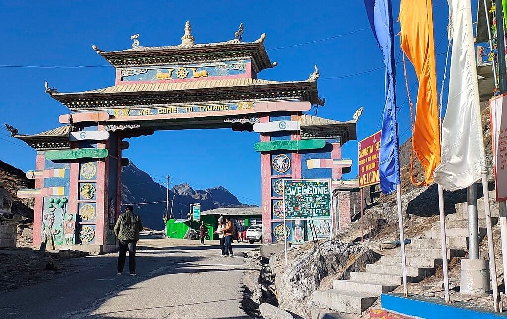
| Sela Pass (gateway to Tawang) | ~4,170 m (13,700 ft) Wikipedia |
| Bumla Pass (Indo-China border) | ~4,630 m (15,200 ft) Tawang District |
| Gorichen Peak (highest in region) | ~6,858 m (22,500 ft) hikerwolf.com |
This comparison shows that while Tawang is a high-altitude settlement itself, the surrounding region climbs dramatically into some of the highest and most rugged Himalayan terrain in India. Tawang District+1
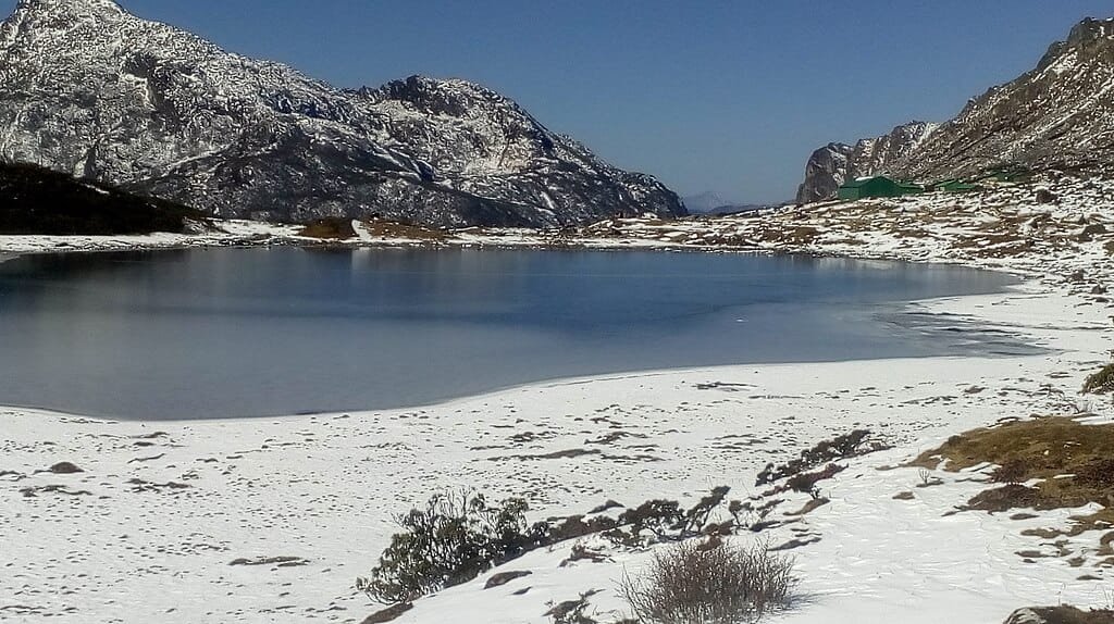
Geography & Landscape at 3,048 m
Tawang stands in a broad Himalayan valley carved by the Tawang Chu River, surrounded by rugged peaks, pristine lakes, and high passes. Tawang District
This unique location makes Tawang a mix of dramatic vistas, cultural depth, and biodiversity — all shaped by its high altitude:
-
Snow-capped summits frame the skyline
-
Prayer flags flutter in crisp mountain winds
-
High-altitude lakes and passes are within reach Tawang District
The elevation also fosters distinct mountain ecosystems and affects how locals live and build infrastructure — often adapted to remote, cold conditions.
Travel Access – How to Reach Tawang
Reaching high-altitude Tawang is part of the adventure itself:
By Road
The main route to Tawang is via the scenic Sela Pass, which lies at ~4,170 m before descending into the Tawang valley. Wikipedia
By Rail & Air
-
Nearest major railway: Rangapara Railway Station or Tezpur. bharatrannbhoomidarshan.gov.in
-
Nearest airport: Tezpur Airport, with onward road journeys required. bharatrannbhoomidarshan.gov.in
Because of its remote Himalayan location, road journeys to Tawang are scenic but can be strenuous and weather-dependent — especially in winter months. Wikipedia
Best Time to Visit Based on Elevation & Weather
| Season | Experience in Tawang |
|---|---|
| Spring (Mar–May) | Cool days, blossoming valleys |
| Summer (Jun–Sept) | Pleasant weather, lush terrain |
| Autumn (Oct–Nov) | Clear views, ideal photography |
| Winter (Dec–Mar) | Snowfall, frozen beauty |
Summer and autumn are highest in demand due to accessible roads and tolerable weather, though winter transforms Tawang into a snow-filled wonderland. WebIndia123 Tourism
Why Tawang’s Elevation Enhances Its Charm
Tawang altitude isn’t just a number — it’s a defining feature that shapes:
Scenic Himalayan Beauty
Mountains feel closer, skies seem bigger, and valleys open up more dramatically at this elevation. Tawang District
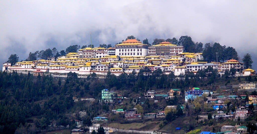
Spiritual Significance
Tawang Monastery — one of India’s largest Buddhist monasteries — rests among lofty hills, creating an atmosphere of serenity and spiritual depth enhanced by cool mountain air. Tawang District
Adventure & Nature
From nearby passes and high lakes to wildlife sightings and trekking trails, the region’s high elevation offers something for thrill-seekers and nature lovers alike. Tawang District
Quick Facts – Tawang Height From Sea Level
✔ Tawang town elevation: ~3,048 m (10,000 ft) above sea level. Tawang District
✔ Tawang district altitude range: ~3,500 ft to over 22,500 ft above sea level. apspcb.net
✔ Nearby high passes: Sela Pass (~4,170 m) and Bumla Pass (~4,630 m). Tawang District+1
✔ Highest peak near region: Gorichen Peak (~22,500 ft). hikerwolf.com
These figures highlight the dramatic elevation shift from the town into the surrounding Himalayan wilderness. apspcb.net
Travel Tips for High-Altitude Tawang
-
Acclimatise gradually: High altitudes affect oxygen levels; take time to adjust.
-
Pack warm clothing year-round: Even summers can bring chilly nights.
-
Check road conditions: Mountain passes may close in winter.
-
Carry permits: An Inner Line Permit (ILP) is required for Arunachal Pradesh. Tawang District
Conclusion
Understanding Tawang height from sea level helps you appreciate why this Himalayan town is so unique. At about 3,048 metres (10,000 feet), Tawang offers cool high-altitude climate, breathtaking Himalayan landscapes, and a rich cultural tapestry tied to its geography. Whether you’re into adventure, photography, spirituality, or serene mountain views, Tawang’s elevation amplifies every experience.