
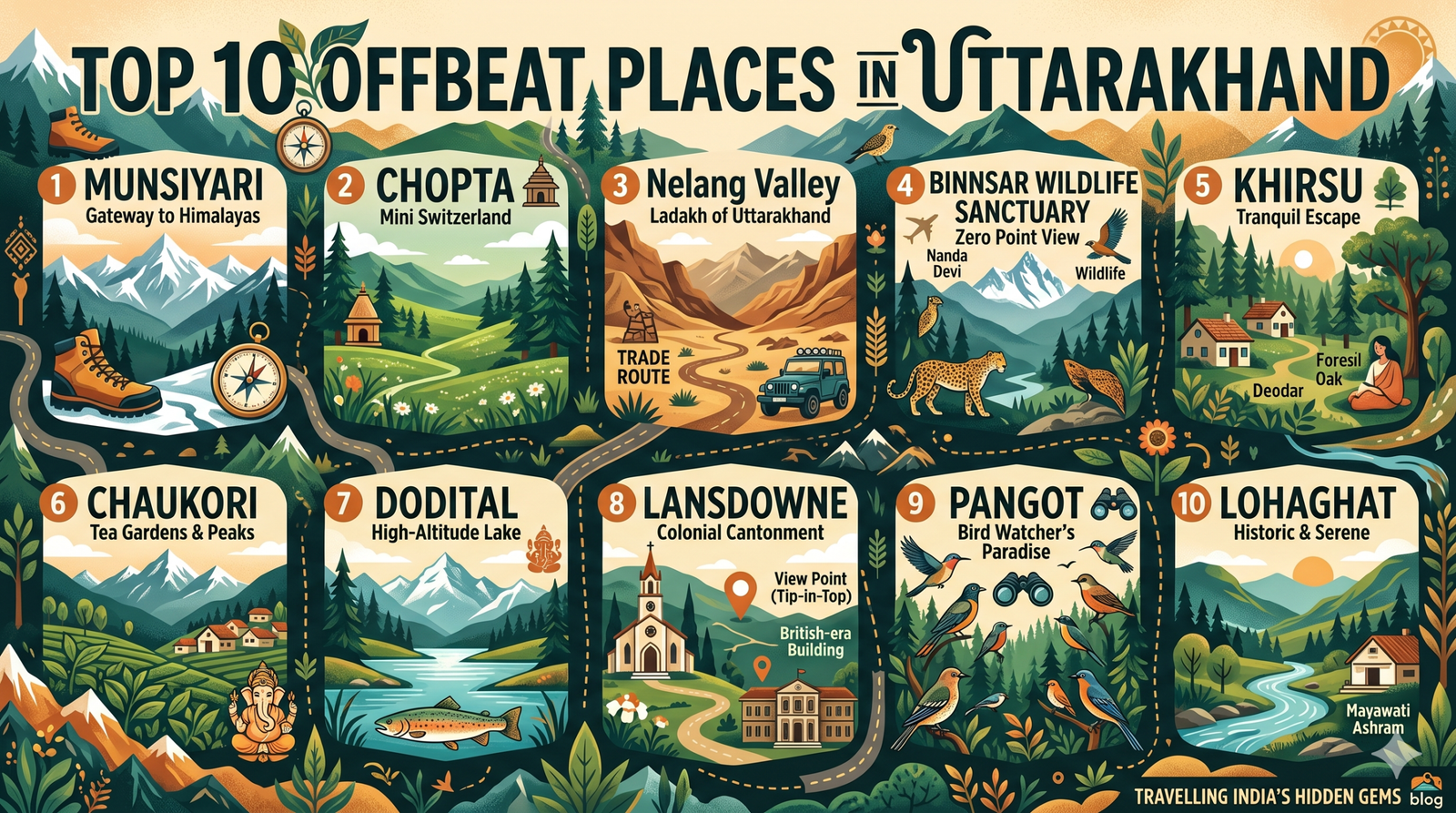
Top 10 Offbeat places in Uttarakhand
Top 10 Best Offbeat Places in Uttarakhand (2026 Travel Guide, Hidden Hamlets & Routes) – While mainstream hill stations like Nainital, Mussoorie, Rishikesh, and Haridwar attract millions of tourists annually, peak travel seasons often bring packed promenades, parking bottlenecks, and crowded viewpoints. Tucked deep within the Garhwal and Kumaon Himalayas lies an untouched world of peaceful alpine meadows (bugyals), ancient slate-roofed villages, dense oak and deodar sanctuaries, and colonial hamlets that remain blissfully uncommercialized.
Whether you are looking for close-up vistas of the Panchachuli peaks in Munsiyari, avian biodiversity in Pangot, untouched pine trails in Khirsu, or the rhododendron slopes of Chopta, the state offers countless peaceful getaways. In this definitive 2026 travel guide, we explore the Top 10 offbeat places in Uttarakhand, complete with exact elevations, distances from Delhi and Dehradun, key highlights, and seasonal weather advice.
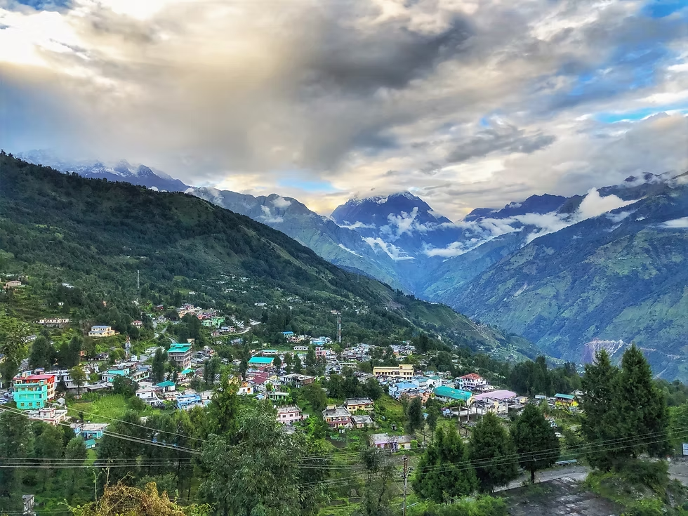 Often referred to as the “Little Kashmir of Uttarakhand,” Munsiyari sits at an elevation of 2,200 meters (7,218 feet) along the banks of the Goriganga River in eastern Kumaon. Dominated by the dramatic backdrop of the five snow-capped summits of the Panchachuli range, this former outpost on the historic salt trading route into Tibet is a haven for mountaineers, trekkers, and peace seekers.
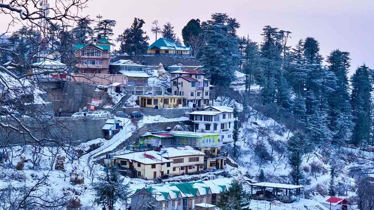 Situated 15 kilometers beyond Pauri at an altitude of 1,700 meters (5,577 feet), Khirsu is a quiet hill village encircled by dense canopies of ancient oak, pine, and deodar trees. Far removed from commercial tourism, Khirsu offers silence interrupted only by birdsong, with clear days revealing wide views of over 300 Himalayan peaks, including Chaukhamba and Nanda Devi.
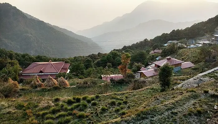 Located just 15 kilometers past Nainital over the forested Kilbury ridge, Pangot rests at an elevation of 1,984 meters (6,509 feet). While Nainital stays busy with boating crowds, Pangot remains peaceful, surrounded by dense rhododendron and oak woodlands designated as the Kilbury and Pangot Bird Sanctuary.
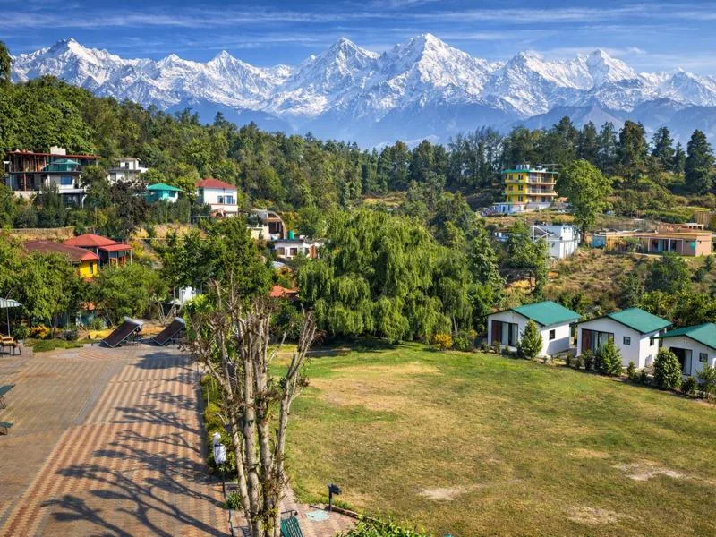 Tucked within the Pithoragarh district at 2,010 meters (6,594 feet), Chaukori is famous for its emerald green tea estates established during the British era. Shaped like a natural amphitheater, the village provides sweeping, unobstructed panoramas of the Nanda Devi, Nanda Kot, and Trishul peaks rising directly across the northern sky.
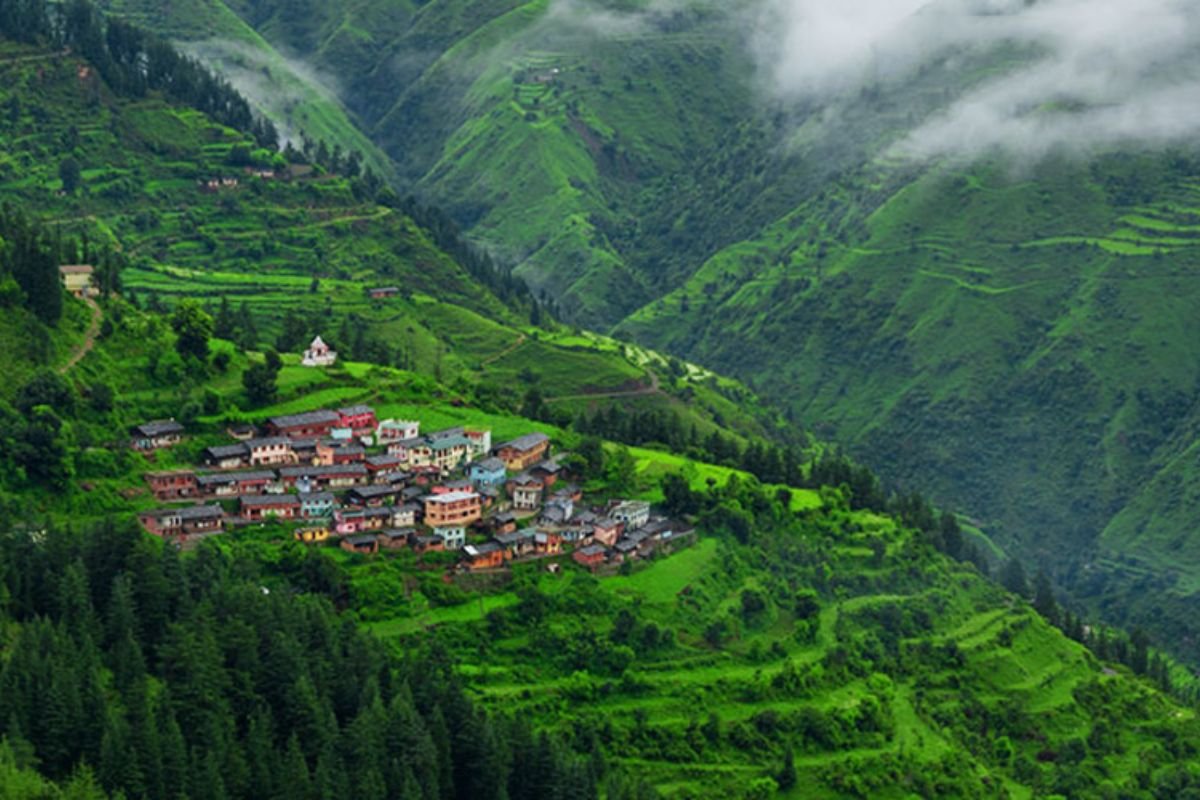 Perched between the Tons and Yamuna rivers in the Dehradun district at an altitude of 2,118 meters (6,949 feet), Chakrata was originally developed in 1869 as a British Indian Army cantonment. Thanks to ongoing military jurisdiction, commercial high-rise construction is strictly prohibited, preserving its vintage stone buildings, peaceful roads, and native Jaunsari heritage.
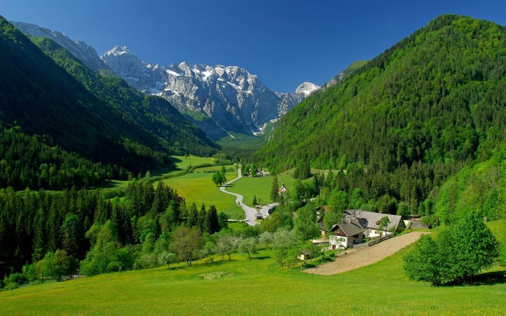 Located 33 kilometers north of Almora at an elevation of 2,420 meters (7,940 feet), Binsar was once the summer residence of the Chand Kings of Kumaon. Today, it forms the core of the Binsar Wildlife Sanctuary, an oak and rhododendron forest reserve that prohibits commercial urban encroachment.
 Situated along the Mussoorie–Chamba highway at an impressive altitude of 2,590 meters (8,500 feet), Kanatal sits nearly 580 vertical meters higher than nearby Mussoorie. Famous for its thick snowfall from December through February, Kanatal is a popular weekend base for nature lovers looking to avoid tourist lines.
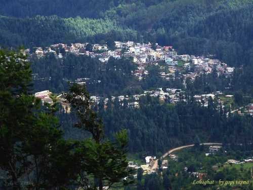 Set along the banks of the Lohawati River in the southeastern corner of Kumaon at 1,754 meters (5,754 feet), Lohaghat is steeped in history and folklore. Just 8 kilometers uphill lies Abbott Mount (2,100 m), a peaceful colonial settlement founded in 1914 by British businessman John Harold Abbott, featuring 13 historic stone bungalows nestled among oak forests.
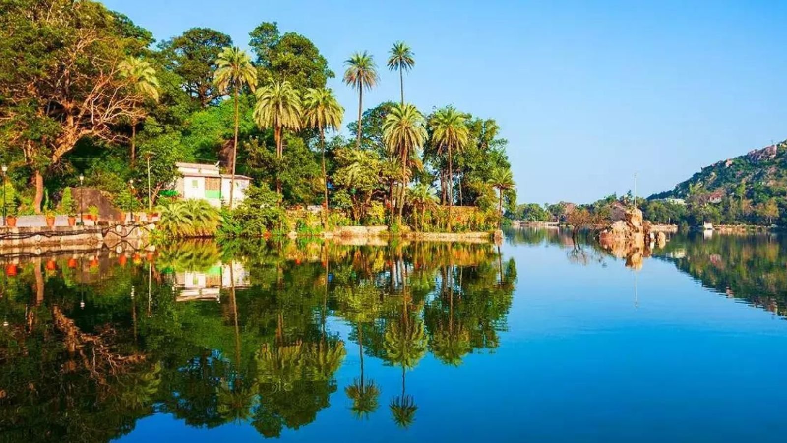 Positioned midway between Almora and Mukteshwar at an elevation of 1,900 meters (6,233 feet), Peora is an authentic Kumaoni village surrounded by terraced plum, peach, and apricot orchards. A model for sustainable rural tourism, Peora invites travelers into traditional stone-and-slate homestays where days are spent walking unpaved village footpaths, supporting local herbal cooperatives, and enjoying valley silence.
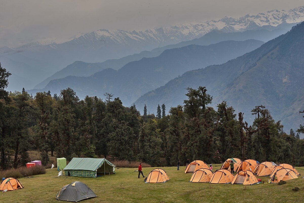 Often referred to as the “Mini Switzerland of Uttarakhand,” Chopta is an alpine meadow settlement situated at 2,680 meters (8,790 feet) in the Rudraprayag district. Surrounded by the protected forests of Kedarnath Wildlife Sanctuary, Chopta has no commercial electricity grid or permanent concrete hotels, preserving its pristine alpine ecosystem.
| Offbeat Destination | Region / District | Elevation (Meters / Feet) | Primary Attraction / Vibe | Best Season to Visit |
|---|---|---|---|---|
| Munsiyari | Pithoragarh (Kumaon) | 2,200 m (7,218 ft) | Panchachuli Peaks & Milam Glacier Base | Mar–Jun | Sep–Nov |
| Khirsu | Pauri Garhwal (Garhwal) | 1,700 m (5,577 ft) | Silent Pine Forests & Trishul Views | All Year Round |
| Pangot | Nainital (Kumaon) | 1,984 m (6,509 ft) | Kilbury Bird Sanctuary (500+ Avian Species) | Oct–Jun |
| Chaukori | Pithoragarh (Kumaon) | 2,010 m (6,594 ft) | Tea Gardens & Nanda Devi Sunrise | Oct–May |
| Chakrata | Dehradun (Garhwal) | 2,118 m (6,949 ft) | Tiger Falls, Deoban & Jaunsari Culture | Apr–Jun | Dec–Feb |
| Binsar | Almora (Kumaon) | 2,420 m (7,940 ft) | Zero Point & Binsar Wildlife Sanctuary | Oct–Apr |
| Kanatal | Tehri Garhwal (Garhwal) | 2,590 m (8,500 ft) | Kaudia Forest & Surkanda Devi Temple | Sep–Jun |
| Lohaghat | Champawat (Kumaon) | 1,754 m (5,754 ft) | Abbott Mount & Colonial Cottages | All Year Round |
| Peora | Nainital (Kumaon) | 1,900 m (6,233 ft) | Eco-Village Tourism & Fruit Orchards | Mar–Jun | Sep–Nov |
| Chopta | Rudraprayag (Garhwal) | 2,680 m (8,790 ft) | Tungnath Temple Trek & Alpine Bugyals | Apr–Jun | Dec–Feb |
1. Munsiyari – The Himalayan Gateway in Pithoragarh
Often referred to as the “Little Kashmir of Uttarakhand,” Munsiyari sits at an elevation of 2,200 meters (7,218 feet) along the banks of the Goriganga River in eastern Kumaon. Dominated by the dramatic backdrop of the five snow-capped summits of the Panchachuli range, this former outpost on the historic salt trading route into Tibet is a haven for mountaineers, trekkers, and peace seekers.
- Key Highlights: Unobstructed sunrise and sunset reflections over the Panchachuli peaks, Birthi Waterfalls (126-meter drop), and the tribal heritage displays at the Darkot weaving village.
- Trekking Launchpad: The official starting basecamp for high-altitude glacial expeditions to the Milam, Ralam, and Namik Glaciers.
- How to Reach: Located ~295 km from Kathgodam Railway Station via Almora, Bageshwar, and Thal.
2. Khirsu – A Silent Forest Sanctuary in Pauri Garhwal
Situated 15 kilometers beyond Pauri at an altitude of 1,700 meters (5,577 feet), Khirsu is a quiet hill village encircled by dense canopies of ancient oak, pine, and deodar trees. Far removed from commercial tourism, Khirsu offers silence interrupted only by birdsong, with clear days revealing wide views of over 300 Himalayan peaks, including Chaukhamba and Nanda Devi.
- Key Highlights: Apple and pear orchards, Ghandiyal Devta temple, shaded forest walking trails, and budget-friendly GMVN tourist rest houses.
- Ideal For: Solo travelers, writers, and families seeking a calm stay without city noises.
- How to Reach: Accessible from Rishikesh (~135 km via Devprayag and Srinagar Garhwal).
3. Pangot – A Birdwatcher’s Paradise in the Kumaon Hills
Located just 15 kilometers past Nainital over the forested Kilbury ridge, Pangot rests at an elevation of 1,984 meters (6,509 feet). While Nainital stays busy with boating crowds, Pangot remains peaceful, surrounded by dense rhododendron and oak woodlands designated as the Kilbury and Pangot Bird Sanctuary.
- Key Highlights: Over 500 documented avian species, including the lammergeier, cheer pheasant, blue-winged minla, and spotted forktail; forest glamping; and scenic hikes to Corbett Peak.
- Best Time: October to June for birding excursions and crisp mountain air.
4. Chaukori – Tea Gardens & Nanda Devi Horizons
Tucked within the Pithoragarh district at 2,010 meters (6,594 feet), Chaukori is famous for its emerald green tea estates established during the British era. Shaped like a natural amphitheater, the village provides sweeping, unobstructed panoramas of the Nanda Devi, Nanda Kot, and Trishul peaks rising directly across the northern sky.
- Key Highlights: High-altitude organic tea garden trails, peaceful boutique cottages, and close proximity to the historic underground cave shrine of Patal Bhuvaneshwar (37 km away).
- Best Time: October to May for sharp winter views and mild summer weather.
5. Chakrata – The Untouched British Cantonment
Perched between the Tons and Yamuna rivers in the Dehradun district at an altitude of 2,118 meters (6,949 feet), Chakrata was originally developed in 1869 as a British Indian Army cantonment. Thanks to ongoing military jurisdiction, commercial high-rise construction is strictly prohibited, preserving its vintage stone buildings, peaceful roads, and native Jaunsari heritage.
- Tiger Falls (Approx. 1,400 m): One of India’s tallest direct waterfalls (dropping over 312 feet into a rocky natural pool), reachable via an unpaved 5 km forest trek.
- Deoban (2,865 m / 9,400 ft): A high-altitude ridge set amidst ancient deodar forests offering vistas of 55 Himalayan peaks.
- Important Note: Foreign nationals require prior permits from the Cantonment Board to enter select parts of Chakrata due to military security zones.
6. Binsar – Wildlife Wilderness & The 300-km Himalayan Arc
Located 33 kilometers north of Almora at an elevation of 2,420 meters (7,940 feet), Binsar was once the summer residence of the Chand Kings of Kumaon. Today, it forms the core of the Binsar Wildlife Sanctuary, an oak and rhododendron forest reserve that prohibits commercial urban encroachment.
- Zero Point: A forest watchtower reachable via a 2-kilometer nature walk, delivering a 300-kilometer panoramic arc of Himalayan summits (Kedarnath, Chaukhamba, Trishul, Nanda Devi, and Panchachuli).
- Flora & Fauna: Common leopard, barking deer, Himalayan black bear, and red foxes roaming through ancient moss-covered tree canopies.
7. Kanatal – High-Altitude Forest Glamping Near Mussoorie
Situated along the Mussoorie–Chamba highway at an impressive altitude of 2,590 meters (8,500 feet), Kanatal sits nearly 580 vertical meters higher than nearby Mussoorie. Famous for its thick snowfall from December through February, Kanatal is a popular weekend base for nature lovers looking to avoid tourist lines.
- Kaudia Forest: An expansive coniferous woodland crisscrossed with unpaved jeep tracks, natural water springs, and picnic clearings.
- Surkanda Devi Temple (2,757 m / 9,045 ft): A revered Shakti Peeth shrine perched atop the highest peak on the ridge, accessible via a paved 2 km uphill trail or passenger ropeway.
- Regional Engineering Link: Easily linked with a visit down to the Bhagirathi reservoir featured in our guide to the Highest Dam in India (Tehri Dam).
8. Lohaghat – Colonial Remnants in Champawat
Set along the banks of the Lohawati River in the southeastern corner of Kumaon at 1,754 meters (5,754 feet), Lohaghat is steeped in history and folklore. Just 8 kilometers uphill lies Abbott Mount (2,100 m), a peaceful colonial settlement founded in 1914 by British businessman John Harold Abbott, featuring 13 historic stone bungalows nestled among oak forests.
- Key Highlights: Mayawati Advaita Ashrama (where Swami Vivekananda meditated in 1901), Banasur Fort ruins, and fishing along the Pancheshwar confluence where the Saryu meets the Mahakali river along the Nepal border.
9. Peora – Organic Fruit Country & Slow Living
Positioned midway between Almora and Mukteshwar at an elevation of 1,900 meters (6,233 feet), Peora is an authentic Kumaoni village surrounded by terraced plum, peach, and apricot orchards. A model for sustainable rural tourism, Peora invites travelers into traditional stone-and-slate homestays where days are spent walking unpaved village footpaths, supporting local herbal cooperatives, and enjoying valley silence.
- Best Suited For: Creative workations, digital detox retreats, and travelers seeking an authentic cultural experience in rural Kumaon.
10. Chopta – Alpine Meadows & The Tungnath Trail
Often referred to as the “Mini Switzerland of Uttarakhand,” Chopta is an alpine meadow settlement situated at 2,680 meters (8,790 feet) in the Rudraprayag district. Surrounded by the protected forests of Kedarnath Wildlife Sanctuary, Chopta has no commercial electricity grid or permanent concrete hotels, preserving its pristine alpine ecosystem.
- Tungnath Temple Trek (3,680 m / 12,073 ft): The basecamp for a 3.5 km stone-paved hike leading to the highest Shiva temple on Earth. (Review complete trail elevations in our guide to Tungnath Height From Sea Level and compare regional benchmarks in Chamoli Height From Sea Level).
- Chandrashila Summit (4,000 m / 13,123 ft): A steep 1.5 km climb beyond Tungnath providing a 360-degree vista of Nanda Devi, Trishul, Kedar Dome, and Chaukhamba.
- Winter Snow Trekking: Covered under deep snowdrifts from late December through March, making it ideal for snow camping.
Essential Travel Tips for Offbeat Uttarakhand
- Transit Staging Hubs: Most Garhwal destinations branch out from Rishikesh or Haridwar, while Kumaon offbeat circuits are best accessed from Kathgodam Railway Station. Travelers departing from Punjab or Haryana can coordinate interstate Volvo buses from Sector 17 Chandigarh Bus Stand.
- Cash & Connectivity: While UPI works in larger transit towns, remote villages like Munsiyari, Khirsu, and Chopta frequently experience cellular network drops and offline ATMs. Carry sufficient cash for local homestays and meals.
- Vehicle Selection: Narrow mountain single-lane roads in Kumaon and Garhwal benefit from vehicles with healthy ground clearance. Ensure your brakes, tires, and cooling systems are inspected before climbing high passes.
- Himachal Pradesh Alternatives: Looking across state borders for similar secluded mountain valleys? Explore our companion guide to the Top 10 Offbeat Places in Himachal.
Frequently Asked Questions (FAQs)
Which is the best Offbeat places in Uttarakhand to see snow?
Munsiyari (2,200 m), Chopta (2,680 m), and Kanatal (2,590 m) are the top offbeat snow destinations, receiving consistent, deep winter snowfall between late December and February without the massive crowds seen in Mussoorie or Nainital.Which offbeat destination in Uttarakhand is closest to Delhi and Dehradun?
Chakrata (approx. 85 km from Dehradun) and Kanatal (approx. 78 km from Dehradun) are the most accessible offbeat hill destinations, reachable in under 3 to 4 hours from the state capital.Is Chopta suitable for visiting with family?
Yes, especially between April and June when the meadows are green and weather is pleasant. However, because Chopta relies primarily on solar power and eco-camps without central heating, families with infants or elderly members should plan for colder night temperatures.Do foreign tourists need permits for Chakrata?
Yes. Because Chakrata contains an active military cantonment, foreign nationals require prior permission and security clearance from the Ministry of Defence / Cantonment Board before visiting select parts of the town.Explore More Regional Mountain Elevation, Travel & Transit Guides: Tungnath Height From Sea Level | Chamoli Height From Sea Level | Rishikesh Height From Sea Level | Haridwar Height From Sea Level | Top 10 Offbeat Places in Himachal | Highest Dam in India (Tehri Dam)