
Vagamon Height From Sea Level – Altitude, Climate & Travel Facts Explained
Vagamon Height From Sea Level: Altitude, Climate & Complete Travel Guide
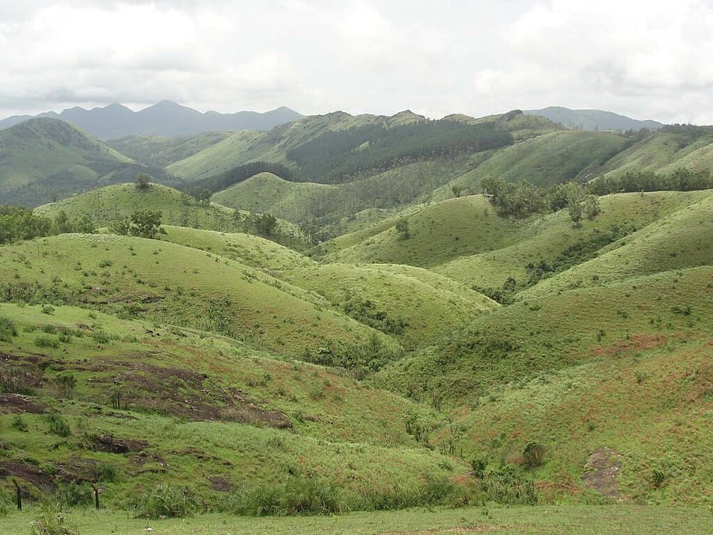
Vagamon height from sea level is approximately 1,100 meters (3,600 feet), making it one of the most serene and elevated hill stations in Kerala. Located on the border of Kottayam and Idukki districts, Vagamon sits on the Western Ghats, offering cool weather, misty landscapes, and rolling meadows year-round.
Unlike many of Kerala’s coastal towns, Vagamon’s higher elevation gives it a distinct climate and geography that draws nature lovers, honeymooners, trekkers, and spiritual seekers alike. Here’s the full picture: exact elevation, how it shapes weather and tourism, and how it compares to nearby hill stations.
Vagamon Height From Sea Level (Exact Elevation)
The average height of Vagamon from sea level is around 1,100 meters (≈3,600 feet). The altitude varies slightly across different parts of the area:
- Vagamon Meadows: ~1,100 meters
- Kurisumala Hills: ~1,150 meters
- Murugan Mala: ~1,120 meters
- Pine Forest Area: ~1,080 meters
This places Vagamon higher than Wayanad but lower than Munnar — see our full Munnar Height From Sea Level guide for a direct comparison.
Why Vagamon’s Height Matters
The altitude of Vagamon shapes its pleasant year-round climate, rich biodiversity, foggy hill views, adventure activities like paragliding, and calm, pollution-free environment. At 1,100 meters, Vagamon avoids the extreme heat and humidity common in Kerala’s low-lying coastal regions.
Climate of Vagamon, Based on Altitude
Average Temperature by Season
- Summer (March–May): 20°C – 25°C
- Monsoon (June–September): 18°C – 22°C
- Winter (October–February): 10°C – 20°C
The altitude keeps nights cool even in summer, making Vagamon a popular escape from cities like Kochi and Thiruvananthapuram.
Vagamon Geography and Topography
Vagamon lies within the Western Ghats mountain range, a UNESCO World Heritage Site. Its elevation produces rolling grasslands, steep valleys, dense pine forests, tea plantations, and rocky hill slopes — with viewpoints where clouds float below eye level, especially in early mornings and monsoon months.
How Elevation Shapes Tourism
Key Attractions Influenced by Altitude
Vagamon Meadows: Wide open grasslands at high elevation.
Pine Forests: The cool climate here supports pine growth rare elsewhere in Kerala.
Paragliding Point: Ideal wind conditions thanks to the elevation.
Kurisumala Trek: A popular high-altitude pilgrimage trek.
Suicide Point: Deep valley views formed by the terrain’s elevation.
Is Vagamon Safe for Altitude-Sensitive Travelers?
At 1,100 meters, Vagamon is considered safe for most travelers, including children and elderly visitors, and does not typically cause altitude sickness. Travelers with respiratory conditions should avoid heavy trekking on the first day, stay hydrated, and keep warm during evenings — sensible precautions rather than genuine altitude risk at this elevation.
Best Time to Visit, Based on Elevation
Best overall: October to March.
Best for greenery: June to September (monsoon).
Best for adventure: January to May.
Winter brings fog and chilly mornings that add to the hill-station charm.
Flora and Fauna at Vagamon’s Height
The altitude supports pine trees (rare in Kerala), wild orchids, medicinal plants, and a healthy population of butterflies and hill birds — the cooler climate also keeps insect populations down compared to lower-altitude regions.
Vagamon Compared to Other Hill Stations
| Place | Height From Sea Level |
|---|---|
| Vagamon | ~1,100 m |
| Munnar | ~1,532 m |
| Wayanad | ~700 m |
| Coorg | ~900 m |
| Ooty | ~2,240 m |
This shows Vagamon sits at a moderate yet ideal hill altitude, balancing accessibility with genuine climate comfort.
Frequently Asked Questions
What is Vagamon’s exact height from sea level?
Approximately 1,100 meters (3,600 feet) above sea level.
Is Vagamon higher or lower than Munnar?
Lower — Munnar sits at around 1,532 meters, compared to Vagamon’s roughly 1,100 meters.
Does Vagamon cause altitude sickness?
No — at 1,100 meters, it’s well below the range where altitude sickness becomes a concern, making it comfortable for most travelers, including children and seniors.
What’s the best time to visit Vagamon?
October to March overall, June to September for the greenest scenery, and January to May for adventure activities like paragliding.
Final Thoughts
Vagamon’s elevation of around 1,100 meters is the foundation of its appeal — cool weather, peaceful landscapes, and adventure opportunities, without the challenges of extreme high-altitude travel. Whether it’s a family trip, honeymoon, or spiritual retreat, the altitude ensures a genuinely refreshing experience.
For more travel guides like this, visit TopChandigarh.com.
Comments are closed.