Ranchi Height From Sea Level (2026 Exact Elevation, Chota Nagpur Plateau Topography & Climate Guide) – Serving as the bustling legislative and administrative capital of Jharkhand, India, Ranchi sits at an average elevation of 651 meters (2,136 feet) above sea level. Positioned on the undulating southern expanse of the ancient Chota Nagpur Plateau—an eastern projection of the broader Deccan Plateau—Ranchi features a varied topography ranging from 458 meters in low valley corridors to nearly 896 meters on surrounding forested ridges.
This plateau elevation gives Ranchi a reputation as one of eastern India’s most pleasant capital cities, offering a humid subtropical climate tempered by altitude, cool evening breezes, and dramatic waterfalls like Hundru and Dassam. In this comprehensive 2026 geographic reference guide, we examine Ranchi’s exact altitude in meters and feet, zone-wise plateau variations, climate impacts across seasons, waterfalls, and travel connectivity.
Geographic Landmark / Parameter
Elevation (Meters)
Elevation (Feet)
Topographical & Regional Significance
Ranchi City Municipal Average
651 m
2,136 ft
Official municipal plateau baseline datum
Pahari Mandir (Hilltop Landmark)
652 m
2,140 ft
Prominent volcanic/rocky knoll overlooking Ranchi lake and urban center
Minimum Plateau Basins
458 m
1,502 ft
Low-lying river valleys and agricultural drainage floors
Maximum Hilly Outcrops
896 m
2,939 ft
Highest undulating ridge points surrounding the metropolitan district
Unlike river-delta capitals situated on flat alluvial plains, Ranchi’s landscape is defined by the geological stability and undulating relief of the Chota Nagpur Plateau:
The Central Tableland: The urban core of Ranchi occupies a gently rolling plateau surface punctuated by isolated granitic and gneissic hillocks. This terrain prevents severe urban heat-trapping during summer afternoons.
The Waterfall Escarpment: As rivers drain outward from the 651-meter plateau toward the lower Gangetic plains, they drop over sheer cliff edges, creating some of India’s most dramatic waterfalls. Notable examples include Hundru Falls (98 m drop), Dassam Falls, Jonha Falls, and Hirni Falls. (Compare plateau topography with southern tablelands in our guide to Mysore Height From Sea Level and Bangalore Height From Sea Level).
How 651-Meter Elevation Influences Ranchi’s Climate
Because Ranchi sits at over 650 meters above sea level, its weather patterns differ significantly from neighboring low-altitude plains in Bihar, West Bengal, and Odisha:
Season
Calendar Months
Temperature Range
Climate Experience & Highlights
Summer
March to May
20°C to 38°C
Warm daytime temperatures tempered by low humidity and breezy plateau evenings.
Monsoon
June to September
23°C to 30°C
Consistent rainfall, lush green forests, and swollen plateau waterfalls.
Post-Monsoon
October to November
15°C to 28°C
Clear blue skies, pleasant sunshine, and crisp evening breezes.
Winter
December to February
10°C to 24°C
Cool days and chilly nights (dropping occasionally to 7°C), ideal for outdoor tourism.
Elevation Comparison: Ranchi vs. Other Indian Capitals & Cities
To put Ranchi’s altitude in perspective, compare its 651-meter elevation with other major Indian cities:
City / Capital
State / Region
Elevation (Meters)
Elevation (Feet)
Elevation Difference vs. Ranchi (651 m)
Bengaluru
Karnataka (Deccan Plateau)
920 m
3,020 ft
+269 m Higher
Ranchi
Jharkhand (Chota Nagpur Plateau)
651 m
2,136 ft
Baseline Altitude
Mysore
Karnataka (Southern Plateau)
763 m
2,503 ft
+112 m Higher
Hyderabad
Telangana Plateau
542 m
1,778 ft
-109 m Lower
Guwahati
Assam (Brahmaputra Valley)
55 m
180 ft
-596 m Lower
Patna
Bihar (Gangetic Plain)
53 m
174 ft
-598 m Lower
Kolkata
West Bengal (Delta Plain)
9 m
30 ft
-642 m Lower
New Delhi
National Capital Region
216 m
709 ft
-435 m Lower
Top High-Altitude Landmarks & Attractions in Ranchi
The city’s plateau topography supports several notable viewpoints and recreational landmarks:
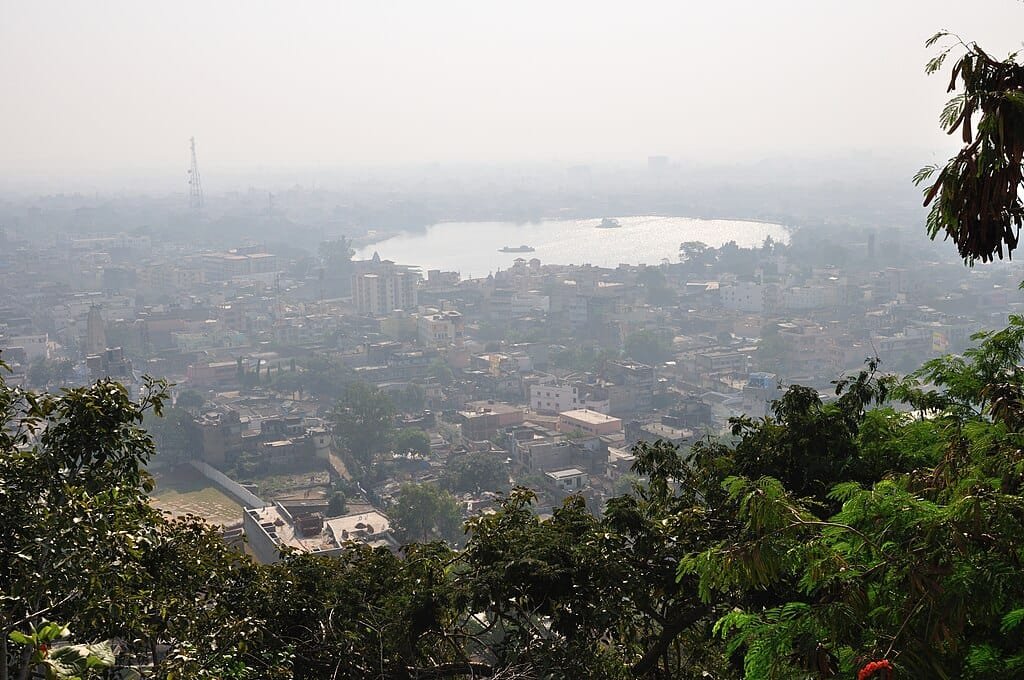
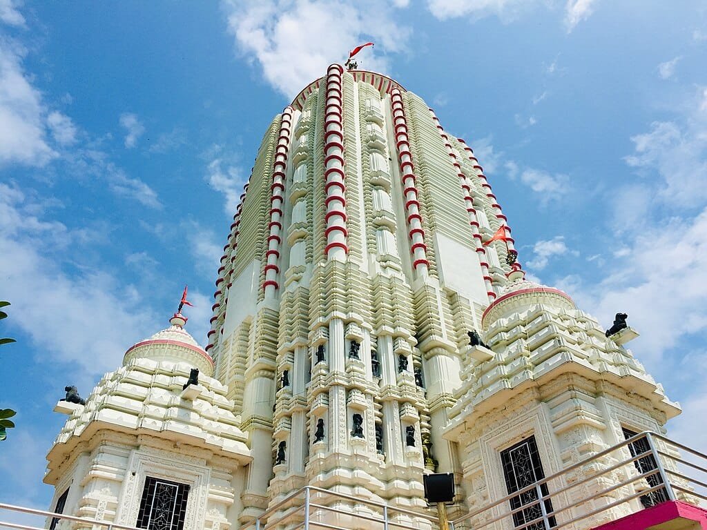
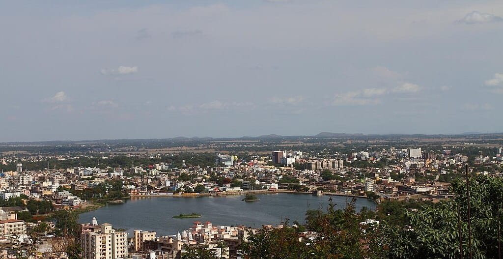
Pahari Mandir (652 m): A historic Shiva temple perched on a volcanic rock hillock in the heart of the city. Visitors climb 468 steps to reach the summit, which offers a 360-degree panorama over Ranchi Lake and the urban skyline.
Rock Garden & Kanke Dam: Built around the picturesque Gonda Hill and Kanke Dam reservoir, this landscaped park features sculptures carved directly from local rock formations and elevated walking trails.
Tagore Hill (Morabadi): Named after the Nobel laureate Rabindranath Tagore, who spent time writing here, this elevated hilltop offers sweeping views of sunset over Ranchi’s forested valleys.
Hundru & Dassam Waterfalls: Spectacular natural waterfalls formed where plateau rivers cascade over sheer vertical rock faces. (For mountain elevations across other states, explore our guides to Highest Mountain Peak in India and Mahabaleshwar Height From Sea Level).
How to Reach Ranchi: Transit & Plateau Ascent
Reaching Ranchi’s 651-meter plateau is straightforward via air, rail, and highway networks:
By Air: Birsa Munda Airport (IXR) handles direct domestic flights from New Delhi, Mumbai, Bengaluru, Kolkata, and Patna. As aircraft descend toward the runway, passengers enjoy aerial views of the Chota Nagpur plateau’s rolling green forests.
By Train: Ranchi Junction (RNC) and Namkum stations connect the city to major national rail corridors, winding through scenic plateau cuttings and river bridges.
By Road: National Highways (NH-20 and NH-33) approach Ranchi from Patna, Jamshedpur, and Dhanbad, ascending gently from the lowlands onto the plateau. (Travelers connecting across northern transit hubs can reference our guide to Sector 17 Chandigarh Bus Stand).
Frequently Asked Questions (FAQs)
What is the exact ranchi height from sea level?
Ranchi sits at an average elevation of approximately 651 meters (2,136 feet) above sea level on the Chota Nagpur Plateau.
What is the highest point in Ranchi city?
The highest prominent urban landmark is the Pahari Mandir hilltop viewpoint at 652 meters (2,140 feet), while surrounding rural outcrops reach up to 896 meters.
Does Ranchi’s altitude cause altitude sickness?
No. At 651 meters, Ranchi’s elevation is well below the threshold for altitude sickness, making it comfortable for travelers of all ages.
Why is Ranchi’s climate cooler than surrounding plains?
Its elevation on the Chota Nagpur Plateau, combined with surrounding tropical forests and natural water bodies, keeps temperatures significantly milder than adjacent low-altitude plains.