

McLeodganj Height From Sea Level
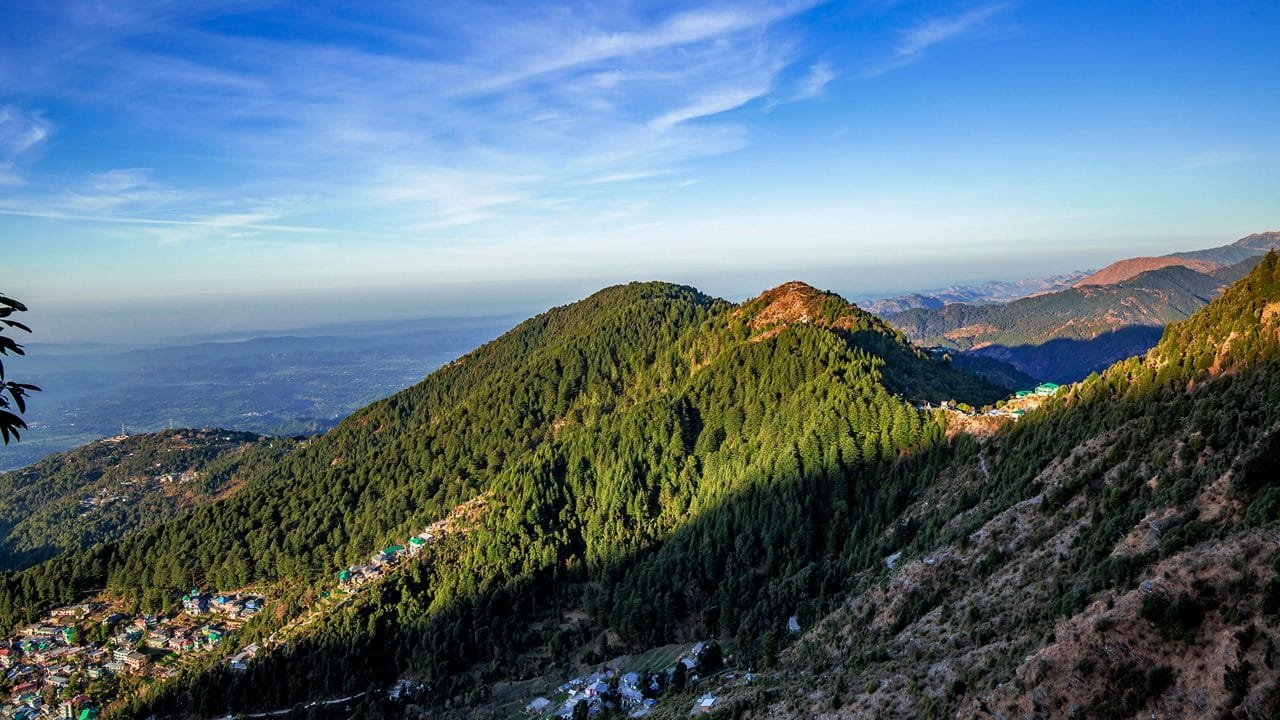
McLeodganj Height From Sea Level (2026 Elevation, Climate & Dhauladhar Travel Guide) – Perched along the forested spurs of the dramatic Dhauladhar mountain range in the Kangra district of Himachal Pradesh, McLeodganj sits at an average elevation of 2,082 meters (6,831 feet) above sea level. Affectionately known as “Little Lhasa” or the “Little Tibet of India,” this vibrant mountain suburb of Dharamshala serves as the official seat of His Holiness the 14th Dalai Lama and the Central Tibetan Administration.
Rising more than 600 vertical meters above the valley floor of Lower Dharamshala, McLeodganj’s height produces a crisp temperate microclimate, rhododendron-forested slopes, and immediate access to Himalayan trekking ridges. In this complete 2026 geographic and travel guide, we examine McLeodganj’s exact altitude in meters and feet, Dharamshala vs. McLeodganj elevation contrasts, Triund trek logistics, weather patterns, and the Dharamshala Skyway ropeway.
| Geographic Parameter | Specification & Elevation Details |
|---|---|
| McLeodganj Town Elevation | 2,082 meters (6,831 feet) above sea level |
| Lower Dharamshala Elevation | 1,457 meters (4,780 feet) |
| Triund Trek Ridge Summit | 2,828 meters (9,278 feet) |
| Highest Surrounding Peak (Hanuman Ka Tibba) | 5,639 meters (18,500 feet) |
| Mountain Range | Dhauladhar Range (Outer / Lesser Himalayas) |
| Administrative District & State | Kangra District, Himachal Pradesh, India |
| Climate Classification | Subtropical Highland Climate (Köppen: Cwb) |
| Risk of Altitude Sickness (AMS) | Extremely Low (Well below the 2,400 m medical risk threshold) |
Topography Explained: Lower Dharamshala vs. McLeodganj vs. Triund
Travelers planning their trip often confuse Dharamshala with McLeodganj. Geographically, they represent distinct elevation steps along the mountain slope:
- Lower Dharamshala (1,457 m / 4,780 ft): The bustling commercial and administrative center of Kangra district, housing the famous HPCA International Cricket Stadium and Kotwali Bazaar.
- Forsyth Ganj (1,750 m / 5,740 ft): The intermediate wooded ridge between Dharamshala and McLeodganj, home to the historic neo-Gothic stone church of St. John in the Wilderness (built in 1852).
- McLeodganj Main Town (2,082 m / 6,831 ft): The cultural and spiritual core, housing the Tsuglagkhang Complex (Dalai Lama Temple), Tibetan monasteries, handicraft markets, and popular rooftop cafes.
- Naddi Village & Sunset Point (2,164 m / 7,100 ft): Located 3 km beyond McLeodganj, this high vantage point offers panoramic views of the Dhauladhar snowline.
- Triund Ridge (2,828 m / 9,278 ft): The iconic alpine meadow situated 9 km uphill from McLeodganj, offering a front-row view of the granite Dhauladhar wall.
How Altitude Shapes McLeodganj’s Weather & Seasons
Because McLeodganj sits at over 2,000 meters, it remains noticeably cooler than the plains of Punjab and Haryana:
- Summer (March to June): Daytime temperatures stay comfortable between 16°C and 28°C. Even when midday sun warms the town, evening mountain breezes cool temperatures down to 14°C–16°C, making light layers essential.
- Monsoon Deluge (July to September): Dharamshala and McLeodganj receive the second-highest rainfall in India after Mawsynram, averaging over 3,000 mm annually. Cloud cover drapes the pine forests and Bhagsu Waterfall swells, though mountain roads require careful driving during landslides.
- Autumn (October to November): The best season for trekking. Post-monsoon skies clear up, offering unobstructed views of snow-dusted massifs and pleasant daytime temperatures (12°C to 20°C).
- Winter (December to February): Crisp and chilly. Temperatures fluctuate between -1°C and 11°C, with occasional snowfall transforming town rooftops and the upper slopes of Triund into a winter wonderland.
Elevation Comparison: McLeodganj vs. North Indian Hill Stations
To see how McLeodganj’s altitude compares with other popular hill destinations across Northern and Southern India, review this comparison:
| Hill Station / Destination | Mountain Range | Elevation in Meters | Elevation in Feet | Climate Profile |
|---|---|---|---|---|
| Gulmarg | Pir Panjal (J&K) | 2,650 m | 8,690 ft | Alpine Meadows & Heavy Snow |
| Shimla | Lesser Himalayas (HP) | 2,276 m | 7,467 ft | Colonial Ridge, Pine Forests |
| McLeodganj | Dhauladhar (Himachal) | 2,082 m | 6,831 ft | Temperate Mountain Air & Monasteries |
| Manali | Pir Panjal / Dhauladhar (HP) | 2,050 m | 6,725 ft | River Valley, Cedar Woods |
| Mussoorie | Garhwal Himalayas (UK) | 2,005 m | 6,578 ft | Mountain Ridge Panoramas |
| Kasol | Parvati Valley (HP) | 1,580 m | 5,180 ft | Riverbed Valley, Conifer Woods |
| Lower Dharamshala | Kangra Valley (HP) | 1,457 m | 4,780 ft | Subtropical Foothill Basin |
Ascending to McLeodganj: Dharamshala Skyway Ropeway vs. Road
Travelers ascending from Lower Dharamshala to McLeodganj can choose between two main routes:
- Dharamshala Skyway (Aerial Ropeway): A modern mono-cable gondola system that covers the 1.8-kilometer aerial distance from Lower Dharamshala to the McLeodganj bus stand in just 5 to 10 minutes. This bypasses the narrow, winding hill roads that often suffer 45-minute traffic delays during peak summer and weekend seasons.
- By Road (9 km via Khara Danda / Forsyth Ganj): State transport HRTC buses, shared jeeps, and private taxis wind up the 9-kilometer mountain road through cedar forests, entering McLeodganj via the main square.
- Long-Distance Transit: Regular deluxe Volvo buses operate from New Delhi (ISBT Kashmiri Gate) and Chandigarh directly to McLeodganj. If departing from Chandigarh, check counter details in our guide to Sector 17 Chandigarh Bus Stand or consult our vetted directory of the Top 10 Travel Agents in Chandigarh.
- Nearest Airport & Railway: Kangra Airport at Gaggal (DHMS) is just 20 km away (approx. 45 minutes drive), while Pathankot Junction (PTK) is the nearest major broad-gauge railway station at ~90 km.
Is Altitude Sickness (AMS) a Concern in McLeodganj?
No. Acute Mountain Sickness (AMS) generally only manifests at elevations exceeding 2,400 to 2,500 meters (8,000+ feet). At 2,082 meters, oxygen levels in McLeodganj remain comfortable for children, senior citizens, and travelers of all fitness levels without special acclimatization.
However, if you plan to hike from McLeodganj up to the Triund Ridge (2,828 m) or continue toward Indrahar Pass (4,342 m), the climb crosses into high-altitude terrain. Carry ample drinking water, ascend at an easy pace, and avoid strenuous trekking on your very first afternoon in town.
Frequently Asked Questions (FAQs)
What is the exact McLeodganj Height From Sea Level?
McLeodganj is situated at an elevation of 2,082 meters (6,831 feet) above sea level in the Dhauladhar foothills of Kangra district, Himachal Pradesh.
Is McLeodganj higher than Dharamshala?
Yes. McLeodganj (2,082 m) sits more than 600 vertical meters higher than Lower Dharamshala (1,457 m), which explains why McLeodganj is noticeably cooler and receives more frequent winter snowfall.
What is the altitude of the Triund Trek from McLeodganj?
The summit ridge of Triund sits at an altitude of 2,828 meters (9,278 feet), requiring a 9-kilometer gradual hike that ascends roughly 746 vertical meters from McLeodganj.
How long does the Dharamshala to McLeodganj ropeway take?
The Dharamshala Skyway covers the 1.8 km aerial distance between Lower Dharamshala and McLeodganj in approximately 5 to 10 minutes, bypassing road traffic delays.
Explore More Regional Elevation & Hill Station Guides: Kasol Height From Sea Level | Yercaud Height From Sea Level | Sector 17 Chandigarh Bus Stand | Top 10 Travel Agents in Chandigarh