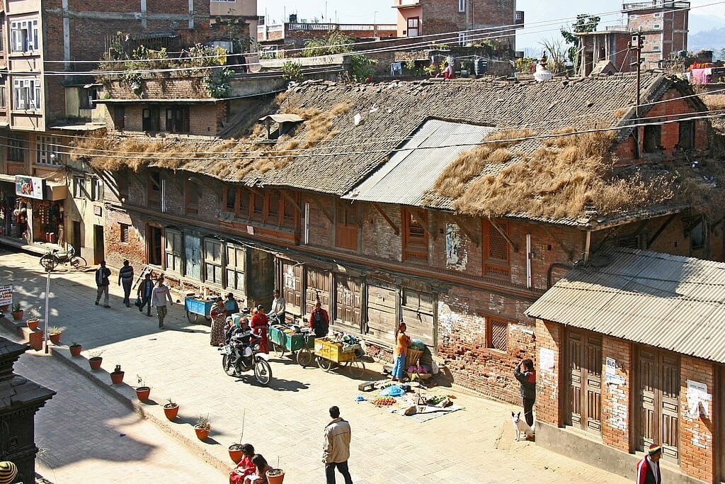
Kathmandu Height From Sea Level – Kathmandu, the historic capital and cultural heart of Nepal, is situated at an average elevation of 1,400 meters (4,593 feet) above sea level. Nestled within an expansive, bowl-shaped intermontane basin in the central Lesser Himalayas, Kathmandu’s altitude plays a defining role in its pleasant subtropical highland climate, architectural heritage, and role as the global staging ground for Himalayan mountaineering expeditions. In this comprehensive geographic and travel guide, we examine Kathmandu’s exact elevation profile, surrounding hill ridges, acclimatization dynamics for trekkers, climate patterns, and altitude comparisons across South Asia.
Geographic Attribute
Elevation / Measurement Details
City Centre Elevation
1,400 meters (4,593 feet) above sea level
Kathmandu Valley Floor Range
1,280 m to 1,420 m (4,199 ft to 4,658 ft)
Highest Surrounding Ridge (Phulchoki)
2,791 meters (9,157 feet)
Airport Elevation (Tribhuvan – KTM)
1,338 meters (4,390 feet)
Climate Classification
Subtropical Highland Climate (Köppen: Cwb)
Geographic Formation
Ancient Lacustrine Basin (Paleo-Lake Kathmandu)
Risk of Altitude Sickness (AMS)
Negligible (Well below the 2,500 m risk threshold)
Topography of Kathmandu Valley: The Ancient Lake Basin
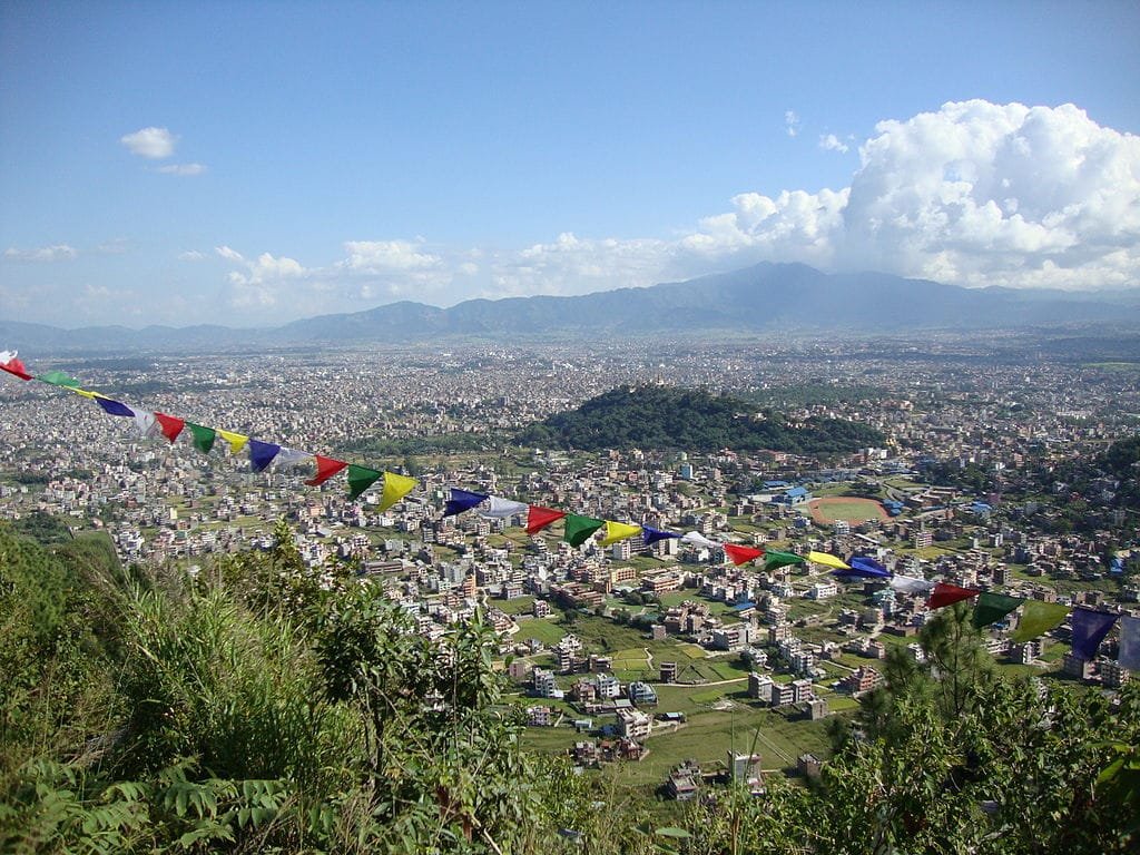
Geologically, Kathmandu occupies the bed of an ancient lake that drained approximately 10,000 to 30,000 years ago through the Chobhar Gorge to the south, leaving behind deep layers of fertile alluvial clay (known locally as Kalimati). The valley floor is not completely flat; it slopes gently from north to south, drained by the sacred Bagmati River and its tributaries:
Valley Floor Base (~1,280 m / 4,199 ft): Near Chobhar and the southern river outlets where the waters exit the rim.
Urban Center (~1,350 m – 1,400 m / 4,429 ft – 4,593 ft): Spanning central hubs like Thamel, Durbar Marg, and Ratna Park.
Tribhuvan International Airport (~1,338 m / 4,390 ft): The single runway sits on an elevated terrace east of downtown.
Northern Foothills (~1,450 m – 1,550 m / 4,757 ft – 5,085 ft): Residential suburbs like Budhanilkantha leading to the base of Shivapuri National Park.
Elevation of Surrounding Hills Around the Kathmandu Basin
The Kathmandu Valley is encircled by four prominent mountain hills that rise significantly higher than the city floor, creating a natural amphitheater:
Phulchoki Peak (South-East): 2,791 m (9,157 ft) – The highest point on the valley rim, renowned for snow dustings in winter, bird sanctuaries, and panoramic views of the Langtang range.
Shivapuri Peak (North): 2,732 m (8,963 ft) – Protected within Shivapuri Nagarjun National Park; forms the primary freshwater watershed for the Bagmati River.
Chandragiri Hill (South-West): 2,551 m (8,369 ft) – Accessible by modern cable car, offering direct views of Mount Everest on crystal-clear autumn mornings.
Nagarjun Hill (West): 2,128 m (6,981 ft) – A forested wildlife ridge housing ancient Buddhist meditation caves and panoramic city overlooks.
One of the most common questions travelers ask before visiting Nepal is whether they will experience Acute Mountain Sickness (AMS) upon landing in Kathmandu. Clinically, altitude sickness typically manifests only above 2,400 to 2,500 meters (8,000 feet). Because Kathmandu sits at roughly 1,400 meters:
No Direct AMS Risk in the City: Travelers arriving at Tribhuvan International Airport will not experience thinning oxygen or altitude sickness. The barometric pressure remains comfortable for travelers of all ages.
Staging Ground for High-Altitude Treks: Kathmandu serves as the logistics and gear-procurement staging base. However, taking a direct flight from Kathmandu (1,400 m) to Lukla Airport (2,846 m) for the Everest Base Camp trek produces an immediate 1,446-meter elevation jump, requiring a mandatory acclimatization halt at Namche Bazaar (3,440 m).
Comparison with Indian Pilgrimages: In contrast to high-altitude Himalayan shrines like Kedarnath (3,583 m / 11,755 ft) where oxygen saturation drops noticeably, Kathmandu requires zero prior acclimatization medication.
How Elevation Influences Kathmandu’s Climate & Weather
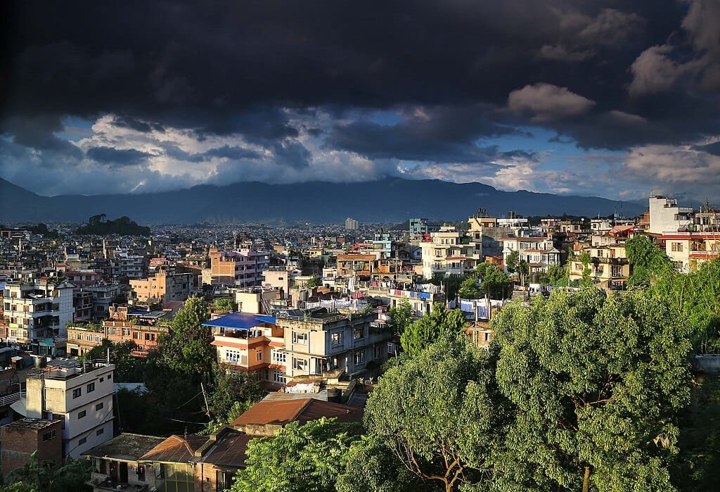
Due to its moderate altitude of 1,400 meters, Kathmandu avoids the sweltering heat of the Indo-Gangetic plains as well as the deep permafrost of the upper Himalayas:
Spring (March to May): Pleasant daytime highs between 22°C and 28°C with rhododendrons blooming across surrounding hills.
Monsoon (June to September): Moist maritime air masses from the Bay of Bengal trigger frequent evening downpours, cooling the valley floor and greening terrace farms.
Autumn (October to November): The premier tourist season. Clear post-monsoon skies provide sharp Himalayan horizon visibility, with comfortable temperatures around 20°C to 24°C.
Winter (December to February): Crisp, dry, and sunny days (15°C–18°C) paired with chilly nights (dropping to 2°C–5°C). The bowl shape causes morning temperature inversions that hold fog until midday sun breaks through.
Elevation Comparison: Kathmandu vs. Other Himalayan Hubs
Kathmandu is situated at an average elevation of 1,400 meters (4,593 feet) above sea level, with the broader Kathmandu Valley floor ranging between 1,280 and 1,420 meters.
Is altitude sickness a problem in Kathmandu?
No. Acute Mountain Sickness (AMS) typically does not occur until reaching elevations above 2,500 meters (8,000 feet). Visitors landing in Kathmandu will not experience thin air symptoms.
Does it ever snow in Kathmandu city?
Snowfall on the Kathmandu city floor is extremely rare (having occurred only a couple of times in modern recorded history). However, surrounding hill peaks like Phulchoki and Chandragiri frequently experience winter snow flurries.

 Due to its moderate altitude of 1,400 meters, Kathmandu avoids the sweltering heat of the Indo-Gangetic plains as well as the deep permafrost of the upper Himalayas: