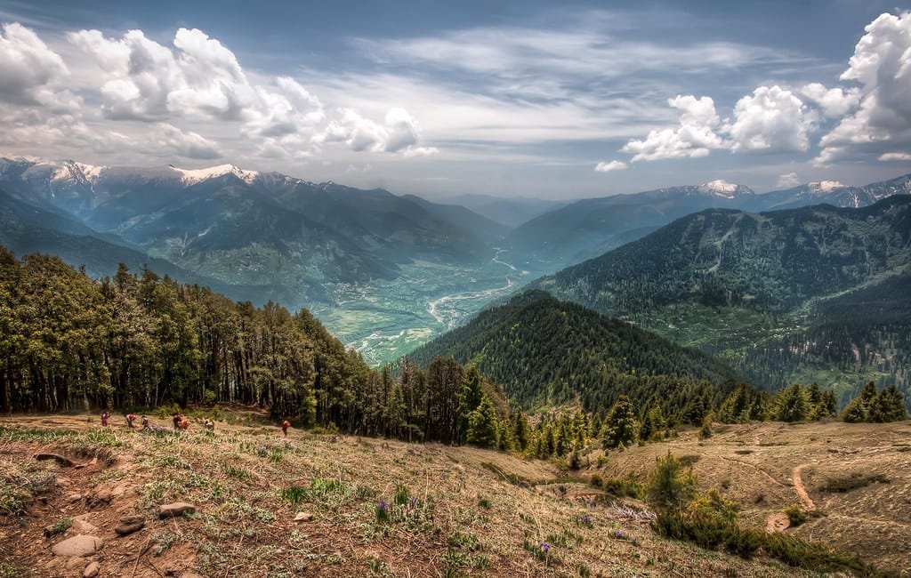
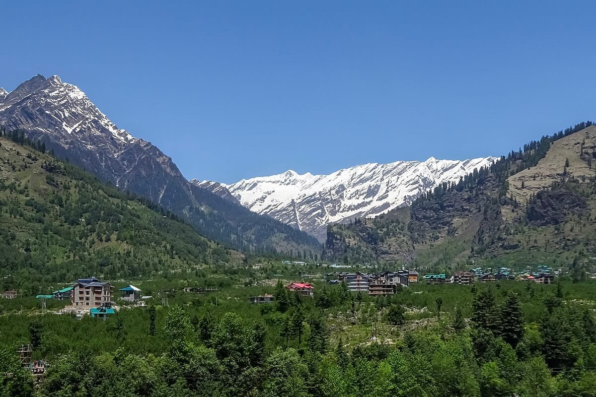
Kullu Height From Sea Level (2026 Elevation, Valley Map & Weather Guide) – Framed by the snow-crowned crests of the Pir Panjal and Greater Himalayan ranges in central Himachal Pradesh, Kullu town sits at an official elevation of 1,279 meters (4,196 feet) above sea level. Affectionately known as the “Valley of the Gods” (Devbhumi), the broader Kullu Valley forms an expansive river corridor carved by the glacial waters of the Beas River.
While the administrative headquarters in Kullu town rests at a comfortable sub-montane elevation of nearly 1,280 meters, the district’s vertical span stretches from 830 meters in the southern gorges up to towering summits exceeding 6,200 meters at Mount Indrasan. In this comprehensive 2026 geographic reference guide, we explore Kullu’s exact altitude in meters and feet, Kullu vs. Manali elevation differences, apple belt agro-climates, trekking passes, and travel routes.
Topography Explained: Kullu Town vs. Upper Valley (Manali)
Travelers planning trips across Himachal Pradesh often treat Kullu and Manali as interchangeable entities, but they occupy distinctly different altitude tiers along the Beas River basin:
Kullu Town (1,279 m / 4,196 ft): Lies in a broader, sunlit valley basin. It features a milder climate, making it ideal for the famous week-long International Kullu Dussehra held on the expansive Dhalpur Maidan.
The Elevation Climb to Manali (+771 meters): Traveling north from Kullu to Manali covers roughly 40 kilometers along NH-3, climbing from 1,279 meters to 2,050 meters. This ascent transforms the surroundings from mixed deciduous farmland into dense deodar pine forests and colder sub-alpine air.
Bhuntar Valley Basin (1,089 m / 3,573 ft): Located 10 km south of Kullu town, Bhuntar sits at the lowest commercial elevation in the central valley, housing the Kullu–Manali Airport along the gravel banks where the Parvati River flows into the Beas.
Elevation Comparison: Kullu vs. Major North Indian Hill Stations
Because of its valley floor location, Kullu town is positioned lower than high-altitude ridgeline hill stations:
How Altitude Influences Kullu’s Climate & Apple Orchards
Sitting at 1,279 meters, Kullu town experiences a temperate highland climate that escapes both the extreme heat of the plains and the freezing winters of higher elevations:
Summer Season (April to June): Daytime temperatures stay comfortable between 20°C and 30°C. Even when afternoon sun warms the valley floor, cool evening mountain breezes descending from the surrounding snow peaks keep nights refreshing (14°C–18°C).
Monsoon Deluge (July to August): The south-facing slopes of the valley receive moderate-to-heavy monsoonal rainfall (around 1,000 mm annually). River rafting on the Beas is typically suspended during peak rains due to turbulent glacial currents.
Winter Weather & Snowfall Realities (December to February): Kullu town experiences crisp, chilly winters with daytime highs around 12°C to 16°C and nighttime lows dipping between 0°C and 4°C. While surrounding peaks receive heavy snow, snowfall in Kullu town itself is rare, usually limited to light flurries during severe cold waves.
Agro-Climatic Advantage: The moderate altitude, warm daytime sunshine, and cool nighttime drainage provide ideal conditions for cultivating Royal Delicious apples, plums, peaches, and pomegranates along the terraces of the Beas basin.
Adventure Hub: River Rafting & High-Altitude Passes
Kullu’s unique elevation profile makes it the hub for river sports and Himalayan trekking expeditions:
White-Water River Rafting on the Beas: The stretch from Pirdi (near Kullu) down to Jhiri drops through Class II to IV rapids over a 14-kilometer course, offering one of the most accessible rafting corridors in India.
Great Himalayan National Park (GHNP): Spanning elevations from 1,500 meters to over 5,800 meters, this UNESCO World Heritage Site provides sanctuary to endangered Himalayan monals, western tragopans, musk deer, and snow leopards.
High-Altitude Trekking Corridors: Kullu serves as the launchpad for challenging expeditions, including the Pin Parbati Pass (5,319 m) connecting to Spiti, Hampta Pass (4,270 m), and Chanderkhani Pass (3,660 m) leading into the ancient village of Malana.
Altitude Sickness (AMS) & Health Preparation
At 1,279 meters, Acute Mountain Sickness (AMS) is not a risk in Kullu town. Blood oxygen saturation levels remain within normal sea-level parameters (98%–99%), making it a comfortable stay for young children, seniors, and travelers with cardiac concerns without requiring medical acclimatization.
However, if your travel itinerary takes you from Kullu up through the Atal Tunnel (3,048 m) or toward Rohtang Pass (3,978 m), the rapid climb of over 2,000 vertical meters in a single morning can trigger altitude headaches and shortness of breath. Drink plenty of water and ascend gradually.
How to Reach Kullu: Transit Routes
By Road via NH-3 (Chandigarh–Manali Four-Lane Expressway): Direct highway access from Chandigarh via Kiratpur, Bilaspur, Sundernagar, and Mandi (~235 km, approx. 5 to 6 hours drive). Travel from New Delhi spans approximately 480 km.
Interstate Bus Services: HRTC and private luxury Volvo buses run daily from New Delhi (ISBT Kashmiri Gate) and Chandigarh. Commuters from Chandigarh can check boarding bays and schedules in our guide to Sector 17 Chandigarh Bus Stand.
By Air: Kullu–Manali Airport at Bhuntar (KUU) is located just 10 km south of Kullu town, offering regular regional flights connecting to Delhi, Chandigarh, and Amritsar.
Nearest Broad-Gauge Railway: Chandigarh Junction (~240 km) or Pathankot (~260 km).
Frequently Asked Questions (FAQs)
What is the exact kullu height from sea level?
The municipal town of Kullu sits at an official altitude of 1,279 meters (4,196 feet) above sea level in the central Beas River valley of Himachal Pradesh.
Does it snow in Kullu town during winter?
Snowfall in Kullu town (1,279 m) is rare. While higher valley points like Manali, Solang Valley, and Rohtang receive heavy winter snow, Kullu town experiences cold winter days with temperatures dropping near freezing, but mostly sees light rain or occasional brief flurries.
How much higher is Manali compared to Kullu?
Manali (2,050 m) is approximately 771 vertical meters (2,530 feet) higher than Kullu town (1,279 m), which is why Manali remains significantly colder throughout the year.
Which is the highest mountain peak in Kullu district?
The highest mountain peak in Kullu district is Mount Indrasan, which rises to a monumental summit elevation of 6,221 meters (20,410 feet) along the Pir Panjal range.


Comments are closed.