
Auli Height From Sea Level – Altitude, Climate, Skiing & Travel Guide
Auli Height From Sea Level (2026 Exact Elevation, Ski Slopes, Artificial Lake & Cable Car Guide) – Perched along the snow-covered ridgelines of the Garhwal Himalayas in Uttarakhand’s Chamoli district, Auli sits at an average altitude of 2,800 meters (9,186 feet) above sea level. Known as the premier skiing capital of India, this pristine alpine haven spans an undulating vertical gradient ranging from 2,519 meters (8,264 feet) at the lower motorable roadhead to 3,050 meters (10,006 feet) at the upper cable car terminal, culminating in the high alpine meadows of Gorson Bugyal at 3,510 meters (11,515 feet).
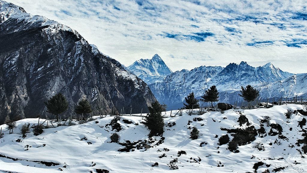
Facing the colossal 7,816-meter pyramid of Nanda Devi (India’s second-highest mountain peak) alongside Trishul, Kamet, and Dunagiri, Auli’s high altitude delivers reliable sub-zero winter temperatures, pristine dry powder snow, and international-standard FIS ski runs. In this comprehensive 2026 geographic reference guide, we examine Auli’s exact height in meters and feet, the Joshimath-Auli ropeway gradient, the world’s highest artificial snowmaking lake, comparative hill station altitudes, weather patterns, and mountain travel advice.
| Geographic Landmark / Zone | Height in Meters (MSL) | Height in Feet (MSL) | Topographical Significance & Role |
|---|---|---|---|
| Auli Central Ski Slopes (Average) | 2,800 meters | 9,186 feet | Main winter sports hub, ski school & GMVN resort complex |
| Lower Entry Point (Roadhead) | 2,519 meters | 8,264 feet | Motorable road terminus, private cottages & homestays |
| Auli Artificial Snow Lake | 2,850 meters | 9,350 feet | World’s highest man-made reservoir for ski slope snow-guns |
| Upper Cable Car Station (Tower 10) | 3,050 meters | 10,006 feet | Upper gondola terminal, view deck & chairlift terminus |
| Gorson Bugyal (Gurso Meadow) | 3,510 meters | 11,515 feet | Alpine summer pasture, rhododendron woods & winter snow trail |
| Joshimath (Base Valley Town) | 1,890 meters | 6,200 feet | Commercial staging base on NH-7; vertical rise of 910+ meters |
| Nanda Devi (Backdrop Summit) | 7,816 meters | 25,643 feet | India’s second-highest mountain peak guarding the eastern skyline |
Topographical Gradient: From Joshimath to Gorson Bugyal
Unlike plateau-based tourist hill stations, Auli is situated along a dramatic mountain slope on the southern bank of the Alaknanda river gorge:
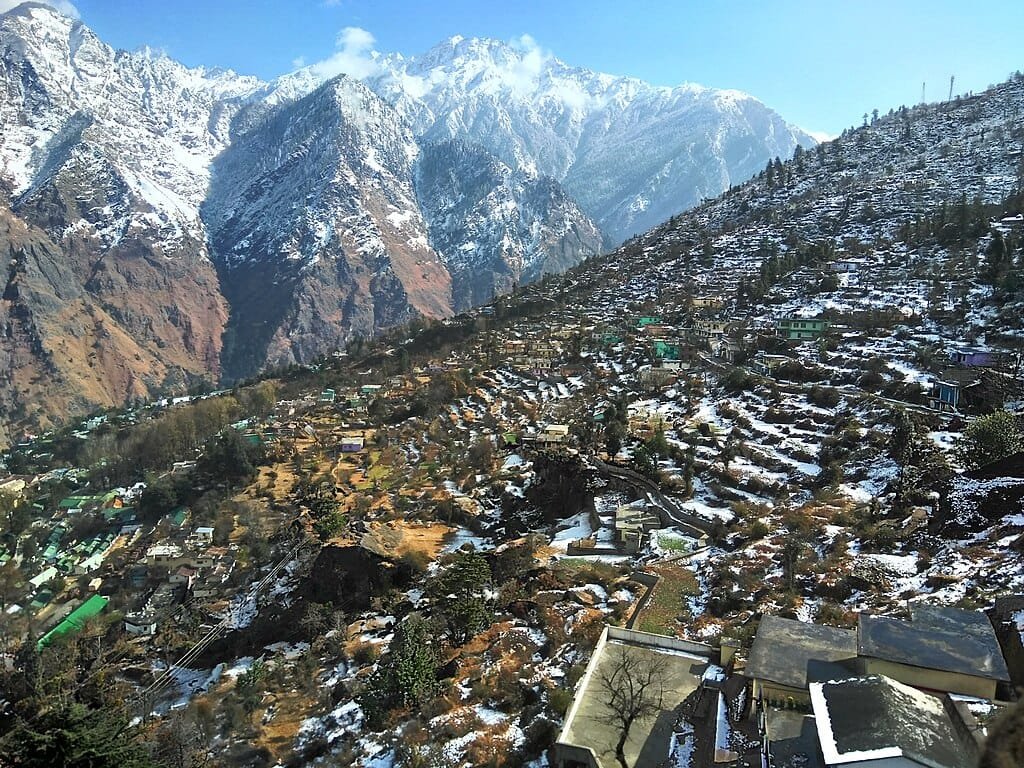
- Joshimath Foothill Base (1,890 m / 6,200 ft): The historic cantonment and spiritual hub established by Adi Shankaracharya. Located along the Badrinath highway corridor (NH-7), it serves as the basecamp where vehicles refuel and tourists acclimatize before ascending.
- The Ski Slopes (2,800 m / 9,186 ft): Extending over natural terraced slopes lined with dense stands of deodar, oak, and conifer forests. Slopes feature natural inclines between 20° and 45°, recognized by the International Ski Federation (FIS) for giant slalom championships.
- Upper Cable Car Ridge (3,050 m / 10,006 ft): Marked by Tower 10 of the passenger ropeway system, this elevation marks the tree-line transition where thick evergreen forests open into windswept alpine bugyals.
- Gorson Bugyal (3,510 m / 11,515 ft): A scenic 3-kilometer trek above Auli leads into Gorson Bugyal, a vast high-altitude meadow carpeted with vibrant alpine blossoms in spring and knee-deep powder snow during winter, serving as the gateway trail toward the historic Kuari Pass (3,650 m).
Engineering Marvel: The Joshimath to Auli Ropeway & Chairlift
Because the winding 16-kilometer link road from Joshimath to Auli frequently freezes over with slippery black ice during peak winter, the Joshimath–Auli Ropeway serves as a vital engineering lifeline:
- Massive Elevation Gain: Covering a track distance of 4.15 kilometers across 10 steel towers, the bi-cable passenger ropeway ascends an astonishing 1,110 vertical meters (3,640 feet) from Joshimath (1,890 m) to the Auli upper station (3,010 m).
- Aerial Panorama: The cable car journey lasts approximately 20 to 22 minutes, gliding above deodar canopies with views of the snow-clad peaks of Nanda Devi, Trishul, and Hathi Parvat.
- Ski Chairlift System: Complementing the main passenger gondola, an 800-meter electric chairlift links the lower ski lodge directly to the middle training slopes, enabling skiers to cycle through runs smoothly.
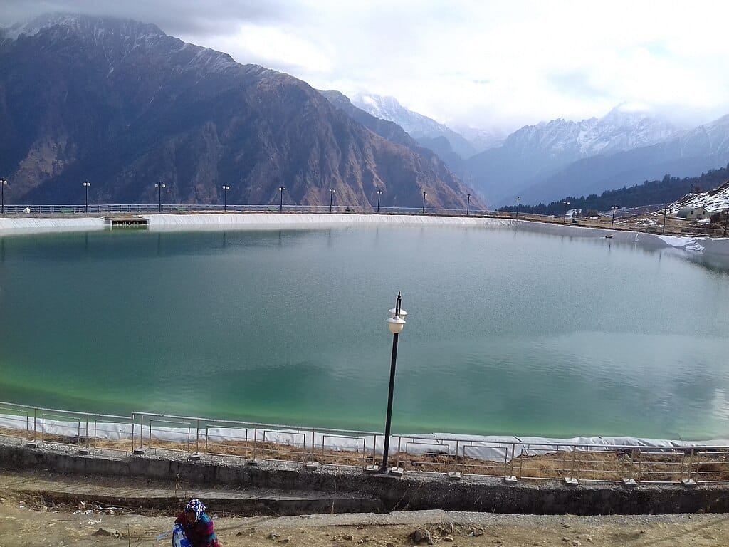
World’s Highest Artificial Snowmaking Lake (2,850 m)
At an altitude of approximately 2,850 meters (9,350 feet), Auli is home to one of the highest artificial man-made lakes in the world. Engineered by the Government of Uttarakhand to host the South Asian Winter Games, this vast reservoir stores clean mountain precipitation and meltwater.
The primary function of this lake is feeding the high-pressure TechnoAlpin snow guns positioned along the designated ski runs. When seasonal snowfall is delayed or irregular, these cannons draw water from the reservoir to generate fine artificial powder snow, ensuring dependable skiing surfaces for national and international championships.
Elevation Comparison: Auli vs. Major Himalayan Hill Stations
Review how Auli’s 2,800-meter altitude compares to other prominent mountain destinations and shrines across North India:
| Mountain Destination | State / Region | Elevation (Meters) | Elevation (Feet) | Winter Climate & Snow Profile |
|---|---|---|---|---|
| Tungnath Temple | Uttarakhand (Garhwal) | 3,680 m | 12,073 ft | Highest Shiva Temple; Heavy Alpine Snow |
| Badrinath Dham | Uttarakhand (Garhwal) | 3,133 m | 10,279 ft | Greater Himalayas on Alaknanda River |
| Auli Ski Slopes | Uttarakhand (Garhwal) | 2,800 m | 9,186 ft | Dry Powder Skiing; Regular Sub-Zero Freeze |
| Gulmarg (Meadow) | Jammu & Kashmir | 2,650 m | 8,694 ft | World-Class Powder Skiing & Gondola |
| Shimla Ridge | Himachal Pradesh | 2,276 m | 7,467 ft | Colonial Ridge; Transient Light Snowfall |
| Manali Town | Himachal Pradesh | 2,050 m | 6,726 ft | River Valley Staging Hub for Rohtang |
| Mussoorie (Mall Road) | Uttarakhand (Foothills) | 2,005 m | 6,578 ft | Occasional Brief Snow Flurries |
| Joshimath (Base Camp) | Uttarakhand (Alaknanda) | 1,890 m | 6,200 ft | Valley Foothill Transit Hub on NH-7 |
How Altitude Influences Auli’s Climate & Skiing Seasons
Sitting close to the 3,000-meter mark, Auli experiences a sub-alpine mountain climate, resulting in distinct seasonal phases:
- Peak Winter & Ski Season (Late December to February): The golden period for winter sports enthusiasts. Strong western disturbances bring regular heavy snowfall, blanketing the slopes in multiple feet of soft powder snow. Daytime temperatures hover between -2°C and 8°C, with nights plunging to -6°C to -10°C. The Garhwal Mandal Vikas Nigam (GMVN) operates professional skiing certificate courses during these months.
- Spring Meadow Thaw (March to May): The heavy snowpack gradually recedes, revealing emerald green grasslands bordered by blooming pink and red rhododendron woodlands. Temperatures range comfortably between 8°C and 18°C.
- Monsoon Greenery (July to August): The meadows turn lush green under frequent mountain showers, but road travel along the Rishikesh–Joshimath highway (NH-7) requires caution due to landslide vulnerabilities.
- Autumn Crystal Skies (September to November): Following the monsoons, atmospheric humidity drops dramatically. This is the finest season for clear trekking and photography, offering crisp views of the snow-clad peaks of Nanda Devi, Kamet, and Dunagiri.
Altitude Health & Acclimatization Tips (2,800 m)
Because atmospheric pressure and oxygen density at 2,800 meters are roughly 25% lower than at sea level, following basic acclimatization practices ensures a safe trip:
- Overnight at Joshimath (1,890 m): If arriving from the plains, spending your first night at Joshimath allows your body to adjust gradually before ascending to 2,800 meters.
- Hydrate Continuously: High-altitude alpine winds accelerate dehydration. Drink 3 to 4 liters of warm water, herbal teas, or soups daily to reduce the risk of altitude headaches.
- Layered Windproof Clothing: Temperatures drop rapidly when the sun dips behind the peaks. Wear moisture-wicking thermal innerwear, a fleece mid-layer, and a waterproof, windproof outer down jacket.
- UV Protection: The thin mountain atmosphere combined with sunlight reflecting off white snow increases UV radiation exposure. Carry high-grade SPF 50+ sunscreen and UV400 polarized sunglasses to prevent snow blindness.
Travel Routes & Connectivity to Auli
Travelers access Auli via the well-maintained Badrinath National Highway (NH-7) corridor:
- By Road via NH-7: The standard route runs from Rishikesh / Haridwar through Devprayag, Srinagar, Rudraprayag, Karnaprayag, and Chamoli to Joshimath (~250 km / 8 to 9 hours drive). From Joshimath, proceed either via the 16 km motorable link road or board the cable car.
- Nearest Airport: Jolly Grant Airport, Dehradun (DED) – located approximately 270 km from Joshimath.
- Nearest Railway Station: Rishikesh (YNRK) / Haridwar Railway Station (~250 km). Travelers connecting from Chandigarh can plan their road links from Sector 17 Chandigarh Bus Stand.
- Explore More Regional Mountain Guides: Discover nearby Himalayan peaks and engineering landmarks in our comprehensive guides to Chamoli Height From Sea Level, Yamunotri Height From Sea Level, Highest Mountain Peak in India, and the massive civil engineering feat at the Highest Dam in India (Tehri Dam).
Frequently Asked Questions (FAQs)
What is the exact auli height from sea level?
The central ski slopes and resort area of Auli sit at an altitude of approximately 2,800 meters (9,186 feet) above sea level, while the upper cable car terminal reaches 3,050 meters (10,006 feet).
Is Auli higher than Mussoorie, Shimla, and Nainital?
Yes. Auli (2,800 m) is significantly higher than Mussoorie (2,005 m), Nainital (2,084 m), and Shimla (2,276 m), which is why Auli experiences much heavier, longer-lasting natural powder snow throughout the winter.
How long is the Joshimath to Auli ropeway?
The Joshimath to Auli ropeway covers a track distance of 4.15 kilometers, climbing more than 1,110 vertical meters (3,640 feet) in approximately 20 to 22 minutes.
What are the best months for snow and skiing in Auli?
January and February are the prime months for snow sports, when the slopes are covered with deep natural powder snow and GMVN skiing certificate courses are in full operation.
Explore More Himalayan Elevation, Skiing & Mountain Pilgrimage Guides:
Badrinath Height From Sea Level | Chamoli Height From Sea Level | Tungnath Height From Sea Level | Yamunotri Height From Sea Level | Highest Mountain Peak in India | Highest Dam in India (Tehri Dam) | Sector 17 Chandigarh Bus Stand
Comments are closed.