
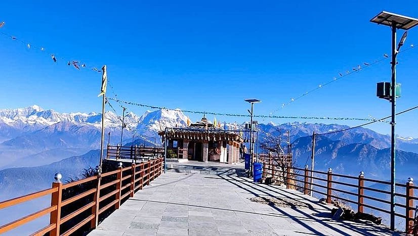
Rudraprayag Height From Sea Level – Altitude, Climate, Travel Guide & Things to Do
Rudraprayag Height From Sea Level: Altitude, Climate & Complete Travel Guide
Rudraprayag, in the Garhwal Himalayas of Uttarakhand, sits at the sacred confluence of the Alaknanda and Mandakini rivers — a key stop for pilgrims, trekkers, and travelers heading toward Kedarnath. Its elevation plays a real role in shaping the town’s climate, accessibility, and the kind of trip you can plan around it.
Rudraprayag Height From Sea Level: 895 Meters (2,936 Feet)
Rudraprayag sits at approximately 895 meters (2,936 feet) above sea level — a moderate elevation by Himalayan standards. It’s lower than high mountain towns like Chopta or Kedarnath, but well above the plains, placing it in a comfortable climate zone that’s cooler than lowland cities without the acclimatization concerns of higher-altitude destinations.
Where Is Rudraprayag & Why Its Elevation Matters
Rudraprayag lies in Rudraprayag district, carved from neighboring districts in 1997, at the sangam (confluence) of the Alaknanda and Mandakini rivers — a site of major religious and cultural significance. The town’s height from sea level shapes its weather patterns, the river flow and views along the confluence, the vegetation nearby, and accessibility both from the plains and toward higher Himalayan areas. Because it sits relatively low compared to true mountain towns, Rudraprayag gets mild to warm summers, pleasant springs and autumns, and cool winters — comfortable to visit through most of the year.
Climate at This Elevation
Summer (March–June): Comfortable to warm days, with temperatures reaching up to ~36°C at peak, though nights stay cool.
Monsoon (July–September): Moderate to heavy rainfall brings lush greenery, but roads can get slippery and landslides are possible in higher areas.
Winter (October–February): Cool, crisp weather with temperatures dropping close to freezing at night, along with occasional frost and fog.
Top Places to Visit In and Around Rudraprayag
Rudraprayag Sangam: The spiritual heart of the town — the confluence of the Alaknanda and Mandakini, where pilgrims bathe in the sacred waters.
Koteshwar Mahadev Temple: A Shiva temple near the riverbanks, known for its tranquil setting and river views.
Shiva & Chamunda Devi Temples: Historic temples with significant religious importance in the region.
Umra Narayan Temple: A quieter Vishnu temple set slightly away from the confluence.
Chopta & Bugyals: About 30–40 km away, this high-altitude meadow is ideal for trekking and camping, and serves as the base for the Tungnath–Chandrashila trek.
Nearby Pilgrimage Routes: Rudraprayag sits on the Char Dham Yatra route, branching toward Kedarnath, perched above 3,500 meters.
Best Time to Visit Rudraprayag
March–June: Pleasant weather, clear mountain views, and good conditions for riverfront walks and sightseeing.
September–November: Post-monsoon freshness, crisp air, and strong visibility — a solid window for casual travel.
Winter (December–February): Quiet and peaceful, but cold enough to limit long sightseeing days.
Monsoon (July–August): Lush green landscape, though heavy rain can disrupt roads and travel plans.
Given its river valley location, weather can shift quickly — always check local forecasts before planning any mountain drives from here.
How to Reach Rudraprayag
By Air: Jolly Grant Airport (Dehradun) is the nearest, about 160 km away, with taxis and buses available onward.
By Train: Rishikesh Railway Station (roughly 130–140 km) is the closest major railhead, connected by bus and taxi.
By Road: Rudraprayag is reachable via Rishikesh through Dehradun, from Haridwar, or as part of the Char Dham Yatra route, with frequent state buses, private taxis, and shared vehicles running the route.
Where to Stay in Rudraprayag
Rudraprayag offers accommodation ranging from budget stays to mid-range lodges. Options include GMVN Tourist Home (basic government-run lodging), local guesthouses and homestays for a more local experience, and riverside camps or small boutique stays for a different kind of mountain experience. For specific hotel names and current availability, it’s best to check directly with booking platforms or the local tourism office, since options can change.
Things to Do in Rudraprayag
Visit the Sangam: Witness the sacred river confluence — a genuine spiritual moment and a strong photography spot.
Explore the Temples: Spend time at Koteshwar Mahadev, Chamunda Devi, and the nearby Umra Narayan temple.
Nature Walks & Riverfront Strolls: Wander the banks of the Alaknanda and Mandakini for a quiet evening or a scenic sunset.
Camping & Picnics: Riverside picnics or camping near the forested areas around town, with mountain views throughout.
Adventure & Trekking: Many travelers use Rudraprayag as a base for treks to Deoria Tal, Chopta, and the Tungnath–Chandrashila trail.
Photography & Sightseeing: Between the river views and Himalayan backdrop, there’s plenty here for anyone with a camera.
Travel Tips & Precautions
- Roads can be narrow and steep — drive carefully, especially on unfamiliar mountain routes.
- Check weather forecasts during monsoon months before planning any road travel.
- Carry warm clothing for mornings and evenings, even outside winter.
- Stay hydrated and avoid rushing elevation changes if you’re continuing on toward Kedarnath or Chopta.
Frequently Asked Questions
What is Rudraprayag’s exact height from sea level?
Approximately 895 meters (2,936 feet) above sea level.
Is Rudraprayag higher or lower than Kedarnath?
Much lower — Kedarnath sits above 3,500 meters, while Rudraprayag is at around 895 meters, making it a far more accessible stop along the same pilgrimage route.
Does Rudraprayag’s altitude cause altitude sickness?
No — at 895 meters, it’s well below any altitude where sickness becomes a concern, making it comfortable for most travelers.
Can Rudraprayag be visited year-round?
Yes, though March–June and September–November offer the most pleasant conditions, while winter is cold and monsoon can disrupt road travel.
Is Rudraprayag a stop on the Char Dham Yatra?
Yes — it sits directly on the route, branching toward Kedarnath, making it a common stopping point for pilgrims.
Conclusion
At around 895 meters, Rudraprayag’s moderate elevation is exactly what makes it so accessible — cool enough to escape the plains’ heat, low enough to skip any real altitude concerns, and perfectly positioned at a sacred river confluence that anchors the whole town. Whether you’re here for the temples, the river views, or as a stop on the way to Kedarnath, the altitude is part of what makes it work.
For more travel guides like this, visit TopChandigarh.com.