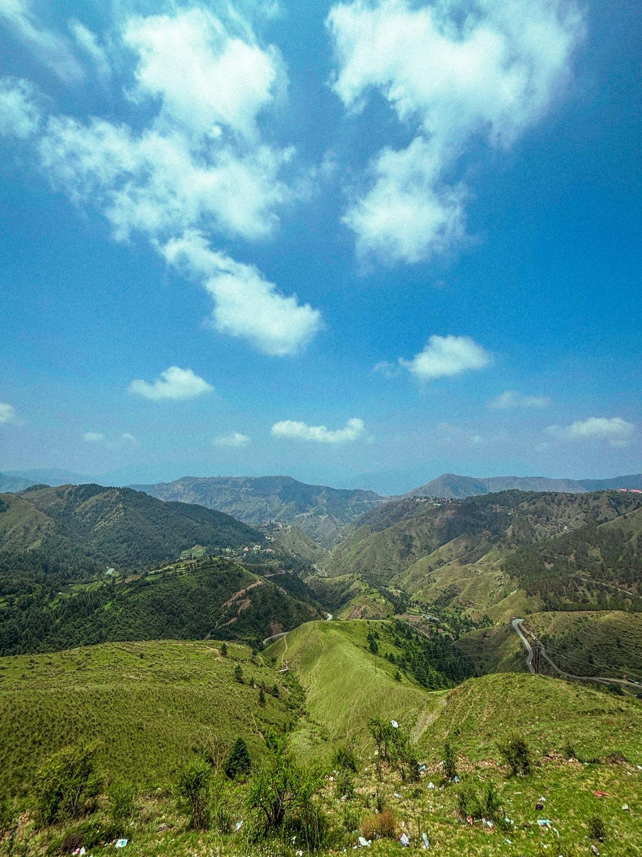
Chakrata Height From Sea Level (2026 Exact Elevation, Weather by Altitude, Tiger Falls & Travel Guide) – Nestled between the Tons and Yamuna rivers in the Jaunsar-Bawar tribal region of Dehradun district, Chakrata sits at an average altitude of approximately 2,118 meters (6,949 feet) above sea level. Originally founded in 1869 as a high-altitude British Indian Army cantonment by Colonel Hume of the 55th Regiment, Chakrata remains one of Uttarakhand’s most pristine, uncommercialized hill stations. Surrounded by virgin deodar, wild oak, and rhododendron forests, this tranquil mountain town offers panoramic views of the Western Garhwal Himalayas.
The subdivision spans varying elevations—from the deep river gorge at Tiger Falls (1,395 m) to the alpine ridgeline of Deoban (2,865 m / 9,400 ft), which offers views of over 50 snow-clad Himalayan peaks. In this definitive 2026 geographical guide, we examine Chakrata’s exact height in meters and feet, seasonal temperature patterns, winter snowfall expectations, sightseeing altitudes, cantonment entry rules, and route directions from Dehradun and Chandigarh.
Geographic Landmark / Sector
Elevation (Meters)
Elevation (Feet)
Topographical Role & Key Features
Deoban (Devban Forest Peak)
2,865 m
9,400 ft
Highest point in region; dense deodar forests & 55 Himalayan peak views
Budher Caves & Moila Danda
2,740 m
8,990 ft
Alpine meadow (bugyal) housing ancient underground limestone caves
Chilmiri Neck (Sunset Point)
2,160 m
7,086 ft
Plateau viewpoint offering views of Rohini and Swargarohini peaks
Topographical Zonation: From Foothills to Alpine Meadows
The Chakrata hill circuit spans a vertical range of over 2,300 meters, creating distinct environmental and ecological zones across Jaunsar-Bawar:
Sub-Tropical Foothills (Kalsi to Dakpathar, 500 m – 1,000 m): Marking the meeting point of the Shivalik hills and the Yamuna River basin, this belt features sub-tropical sal and deciduous foliage with warm summer temperatures.
Temperate Montane Forest (Chakrata Town & Cantonment, 2,000 m – 2,200 m): The town sits on a high mountain saddle cloaked in mature deodar (Cedrus deodara), blue pine, and banj oak trees. The high altitude ensures crisp mountain breezes and summer temperatures that rarely exceed 25°C.
High-Altitude Alpine Ridges (Deoban & Moila Top, 2,700 m – 2,865 m): Rising 700 vertical meters above the town, Deoban features dense deodar groves and high-altitude grasslands (Moila Danda). On clear mornings, visitors can view the Garhwal and Kinnaur skyline, including Bandarpunch (6,316 m), Srikantha, and the Chaukhamba massif. (Compare with nearby trekking elevations in our guide to Chandrashila Height From Sea Level).
How Chakrata’s 2,118-Meter Elevation Shapes Its Climate
Because Chakrata is situated more than 1,450 meters higher than Dehradun (640 m) and slightly higher than Mussoorie (2,005 m), it enjoys a temperate sub-alpine climate with pronounced seasonal shifts:
Season
Calendar Months
Day / Night Temperatures
Climatic Conditions & Packing Checklist
Spring / Early Summer
March to June
12°C to 25°C / 8°C to 14°C
Pleasant mountain sunshine, blooming rhododendrons; light woolens required
Monsoon Season
July to Mid-September
14°C to 20°C / 10°C to 15°C
Heavy rainfall, misty cloud cover; caution advised on Vikasnagar ghat roads
Regular snowfall blankets town; heavy thermal wear and boots essential
Winter Snowfall Patterns: What to Expect Above 2,000 Meters
Due to its 2,118-meter elevation and northern exposure, Chakrata receives substantial winter snowfall compared to other lower hill stations in Uttarakhand:
Peak Snow Window: Snow typically arrives in late December, continuing in spells through January and mid-February. Snowfall accumulation in the main cantonment ranges between 1 to 2 feet, while upper ridges at Deoban and Moila Danda often accumulate 3 to 5 feet of snowpack.
Road Accessibility: The mountain highway from Kalsi and Vikasnagar remains open most of the winter. During heavy blizzards, public works departments clear the road within 12 to 24 hours. Carrying warm footwear with good traction is recommended for icy patches.
Quiet Winter Appeal: Unlike crowded commercial hubs like Shimla or Mussoorie, Chakrata’s cantonment administration limits over-commercialization, offering visitors a peaceful winter escape.
Elevation Comparison: Chakrata vs. Major Himalayan Hill Stations
To understand Chakrata’s topographical standing, examine how its 2,118-meter elevation compares with other popular Himalayan destinations:
Chakrata’s vertical terrain supports a diverse range of natural attractions:
Tiger Falls (1,395 m): Plunging 50 meters down a moss-lined cliff into a clear mountain pool, Tiger Falls is one of the highest direct waterfalls in Uttarakhand. It can be reached via a scenic 5 km downhill forest trek from Chakrata or by road through Kanaser.
Chilmiri Neck (2,160 m): A flat mountain knoll located 4 km from the town center. It houses a military aviation facility and serves as an exceptional vantage point for sunsets, migratory birdwatching, and 360-degree views of the Bandarpoonch range.
Deoban Birding Sanctuary (2,865 m): An alpine wilderness dense with centuries-old deodar trees. Birders can spot the Himalayan monal, white-collared blackbird, and rufous-bellied woodpecker.
Budher Caves & Moila Danda (2,740 m): Located 30 km from town, a gentle 3 km hike leads to an expansive alpine meadow featuring underground karst limestone caves believed to have been explored by the Pandavas.
Cantonment Rules & Travel Permit Guidelines
Because Chakrata is an active cantonment housing specialized units of the Indian Army—including the headquarters of the elite Special Frontier Force (SFF)—it maintains strict access guidelines:
Indian Citizens: Indian nationals can travel freely throughout Chakrata, Tiger Falls, Deoban, and surrounding villages without inner-line permits. Standard government photo ID (Aadhaar Card, Voter ID, Passport) is required for hotel check-ins.
Foreign Nationals (Important Restriction): Due to military sensitivities, foreign passport holders (including OCI/PIO cardholders) are generally restricted from entering the inner cantonment zone without prior written permission from the Ministry of Home Affairs (MHA) or the District Magistrate of Dehradun. Foreign visitors are advised to check current entry guidelines before making travel plans.
Photography Restrictions: Photography and drone videography around military installations and cantonment gates are strictly prohibited.
How to Reach Chakrata from Dehradun & Chandigarh
Chakrata is well connected by paved mountain highways across the Garhwal foothills:
From Dehradun (~88 km / 3 Hours): Dehradun → Herbertpur → Vikasnagar → Kalsi (cross the Yamuna River) → Sahiya → Chakrata via NH-707 and the Chakrata State Highway.
From Chandigarh (~175 km / 4.5 to 5 Hours): Chandigarh → Panchkula → Naraingarh → Kala Amb → Nahan → Paonta Sahib → Herbertpur → Kalsi → Chakrata. (Check interstate transit links via Sector 17 Chandigarh Bus Stand).
Nearest Railway Station: Dehradun Railway Station (DDN) – ~88 km.
Nearest Airport: Jolly Grant Airport in Dehradun (DED) – ~115 km.
Chakrata sits at an average altitude of approximately 2,118 meters (6,949 feet) above sea level, while nearby viewpoints like Deoban reach up to 2,865 meters (9,400 feet).
Does it snow in Chakrata during winter?
Yes. Due to its elevation above 2,000 meters, Chakrata receives regular snowfall from late December through February, transforming the deodar forests into a quiet winter wonderland.
Is Chakrata higher than Mussoorie and Dehradun?
Yes. Chakrata (2,118 m) is higher than both Mussoorie (2,005 m) and Dehradun (640 m), resulting in cooler summer temperatures and heavier winter snow.
Are foreigners allowed to visit Chakrata?
Because Chakrata is a designated military cantonment housing the Special Frontier Force, foreign nationals face entry restrictions and generally require prior written permits from the Ministry of Home Affairs or Dehradun DM office.