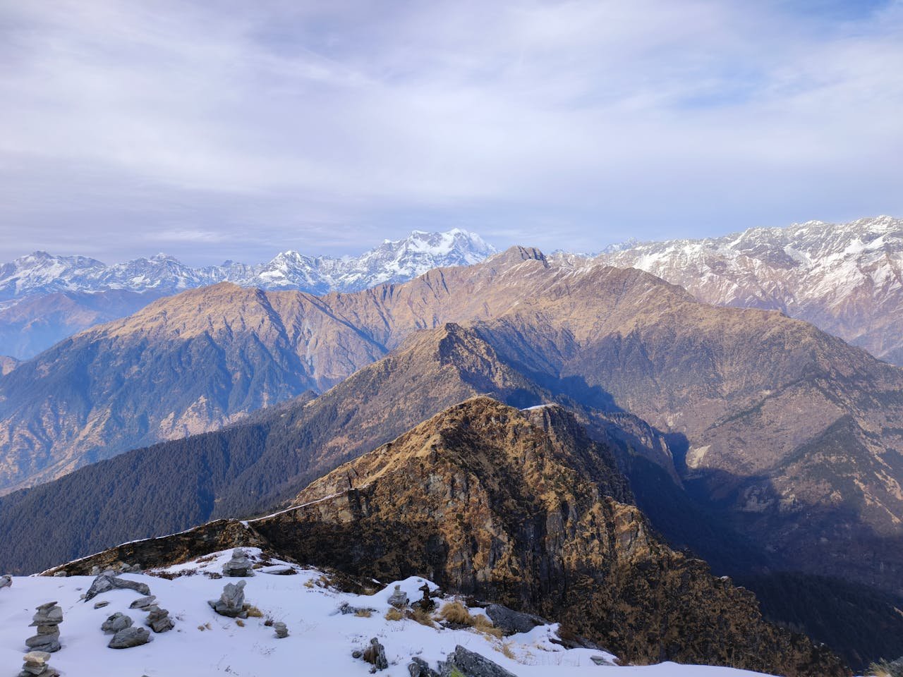
Tungnath Height From Sea Level (2026 Exact Elevation, Chopta Trek, Chandrashila Peak & Panch Kedar Guide) – Perched atop the Chandranath Parvat in the Rudraprayag district of Uttarakhand, Tungnath sits at an elevation of approximately 3,680 meters (12,073 feet) above sea level, holding the undisputed distinction of being the highest Shiva temple in the world. As the third and highest shrine of the sacred Panch Kedar circuit, Tungnath holds immense spiritual significance in Sanatana Dharma as the mythological site where the hands (bahu) of Lord Shiva materialized before the Pandavas.
Beyond its ancient Nagara-style stone architecture and religious reverence, Tungnath attracts trekkers and mountaineers for its accessibility, scenic alpine meadows (bugyals), and the adjoining ascent to Chandrashila Peak (4,000 meters / 13,123 feet), which offers a 360-degree panoramic view of Chaukhamba, Nanda Devi, and Trishul. In this definitive 2026 geographic reference guide, we examine Tungnath’s exact height in meters and feet, the 3.5 km Chopta trek gradient, Panch Kedar elevation comparisons, winter temple shifting rituals, and altitude safety protocols.
Topography: The Temple at 3,680 m vs. Chandrashila Summit (4,000 m)
When planning a journey to Tungnath, travelers should understand the two-tier topographical ascent:
Tungnath Temple Shrine (3,680 m / 12,073 ft): Constructed from dark Himalayan granite blocks, the temple sanctum houses a holy black stone lingam shaped like an arm (approx. 1 foot high). Believed to have been founded by the Pandava brothers and later renovated by Adi Shankaracharya, the shrine sits on a windswept mountain shoulder just above the alpine tree line.
Chandrashila Peak (4,000 m / 13,123 ft): Translating to “Moon Rock,” this summit lies just 1.5 kilometers beyond Tungnath Temple, climbing an additional 320 vertical meters along a steep rocky ridge. According to legend, Lord Rama meditated here after defeating Ravana. The summit houses a small Ganga temple and provides an unobstructed vantage point overlooking the western and eastern Garhwal Himalayas.
The Surrounding Himalayan Panorama: From this altitude, visitors can observe prominent Himalayan peaks including Chaukhamba (7,138 m), Nanda Devi (7,816 m), Trishul (7,120 m), Kedarnath Peak (6,940 m), Bandarpunch (6,316 m), and Kalanag (6,387 m). (Explore the country’s highest elevations in our guide to the Highest Mountain Peak in India).
Panch Kedar Elevation Hierarchy: Tungnath in Spiritual Context
In Hindu theology, Lord Shiva took the form of a celestial bull to evade the Pandavas. When Bhima attempted to hold him, the bull’s divine body dispersed across five sacred shrines in the Garhwal Himalayas, collectively venerated as the Panch Kedar:
Tungnath sits nearly 100 vertical meters higher than Kedarnath Dham and is also higher than both Yamunotri Dham (3,293 m) and Badrinath Dham (3,133 m), making it the highest consecrated temple in the Himalayas.
The Trek Route: Ascending from Chopta to Tungnath
The journey to Tungnath is one of the most accessible high-altitude pilgrimages in Uttarakhand, featuring a well-paved, clearly demarcated trail:
Trailhead at Chopta (2,680 m): All private vehicles, taxis, and state transport buses terminate at Chopta, which features mountain lodges, seasonal camps, and local dhabas along the Kund–Gopeshwar highway.
The 3.5-Kilometer Stone Trail: The trail climbs 1,000 vertical meters (3,280 feet) over a 3.5 km distance. The entire path is stone-paved with broad steps, safety railings, and resting benches. The trail features 11 major hairpin switchbacks that climb through rhododendron woodlands before opening onto high alpine meadows.
Trek Duration: An average hiker in moderate physical health completes the Chopta-to-Tungnath stretch in 2.5 to 3.5 hours. Continuing up to the Chandrashila summit takes an additional 45 to 60 minutes.
Pony & Porter Support: For elderly devotees, children, or travelers with joint concerns, government-registered ponies and mules are available for hire at the Chopta basecamp counter.
Elevation Comparison: Tungnath vs. Major Mountain Landmarks
Compare Tungnath’s 3,680-meter elevation with other prominent mountain destinations and high-altitude pilgrimage sites:
How Altitude Shapes Tungnath’s Climate, Snow & Temple Timings
Due to its high altitude, Tungnath experiences cold weather throughout the year, with a narrow window for regular temple worship:
Summer Season (May to June): Daytime temperatures stay comfortable between 10°C and 18°C, but drop sharply to 2°C to 6°C after sunset. The surrounding meadows bloom with red and pink rhododendrons (Buransh). This is the peak pilgrimage season.
Monsoon Warnings (July to August): The Garhwal belt receives heavy rain, resulting in slick stone paving along the switchbacks and occasional landslides on the Kund–Chopta highway. Always monitor regional weather warnings before ascending.
Autumn Clarity (September to October): Characterized by crisp mountain air, dry trails, and exceptional visibility for viewing distant Himalayan massifs. Night temperatures frequently drop below freezing (0°C to -4°C).
Winter Closure & Migration to Makkumath (November to April): Heavy snowfall buries the temple under 5 to 10 feet of snowpack. Following Diwali (Bhai Dooj), the symbolic Utsav Murti of Lord Tungnath is carried down in a ceremonial procession to its winter abode in Makkumath village (1,800 m) for regular daily worship until reopening in late spring.
Altitude Health & Acute Mountain Sickness (AMS) Precautions
Because the trek gains 1,000 vertical meters in under 4 kilometers, rapid ascent can trigger altitude symptoms:
Overnight Acclimatization at Chopta (2,680 m): Spend an evening resting and hydrating in Chopta or Sari village before attempting the climb to Tungnath (3,680 m) and Chandrashila (4,000 m).
Pace Your Ascent: Walk with a steady, measured rhythm. Taking short 60-second breaks at the designated rest shelters helps keep your heart rate stable as oxygen levels drop.
Maintain Hydration: Cold mountain air accelerates respiratory moisture loss. Drink 2 to 3 liters of warm water or electrolyte fluids, and avoid alcohol or smoking during your trek.
Thermal Outerwear: Wind speeds at the temple and Chandrashila ridge can be intense. Carry windproof jackets, warm woolen caps covering the ears, and thermal gloves even during summer afternoons.
How to Reach Tungnath: Highway Routes via Rishikesh & Haridwar
To reach the basecamp at Chopta, travelers drive through the scenic valleys of Garhwal:
Primary Route via Rishikesh: Rishikesh → Devprayag (Alaknanda-Bhagirathi confluence) → Srinagar → Rudraprayag → Agastyamuni → Kund → Ukhimath → Chopta (~205 km / approx. 7 to 8 hours drive).
Alternative Route via Tehri: Rishikesh → Chamba → New Tehri (visit the monumental Highest Dam in India (Tehri Dam)) → Tilwara → Kund → Chopta (~215 km).
Nearest Airport: Jolly Grant Airport, Dehradun (DED) – located approximately 220 km from Chopta.
Tungnath Temple is situated at an elevation of approximately 3,680 meters (12,073 feet) above sea level in the Rudraprayag district of Uttarakhand.
Is Tungnath higher than Kedarnath and Badrinath?
Yes. Tungnath (3,680 m) is higher than Kedarnath (3,583 m), Yamunotri (3,293 m), and Badrinath (3,133 m), holding the title of the highest Shiva temple in the world.
What is the height of Chandrashila Peak above Tungnath?
Chandrashila Peak rises to an altitude of 4,000 meters (13,123 feet), located 1.5 kilometers beyond Tungnath Temple and offering 360-degree views of the Garhwal Himalayas.
Where does the deity of Tungnath reside during winter?
During the winter months when heavy snow covers the temple, the deity is moved down to the historic Makkumath village (1,800 m) for regular daily worship.