Guwahati Height From Sea Level – Elevation, Geography, Climate & City Guide
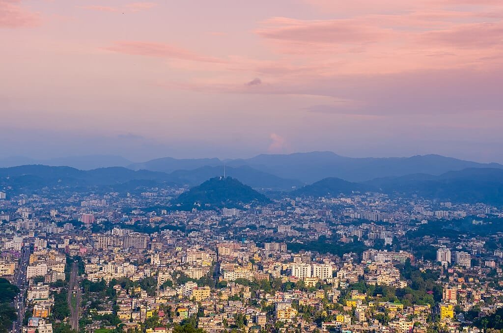
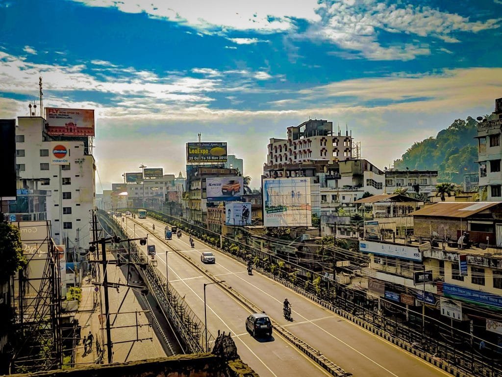
Guwahati Height From Sea Level – Resting on the southern banks of the mighty Brahmaputra River, Guwahati is the largest metropolitan city and economic nerve center of Assam and Northeast India. Serving as the primary gateway to the Seven Sister states, Guwahati features a unique topographical layout where expansive river floodplains meet rugged metamorphic hillocks that branch out from the Meghalaya plateau. The average height of Guwahati from sea level is approximately 55 meters (180 feet), categorizing it as a low-lying river valley metropolis. However, because the city’s urban expanse is punctuated by elevated granite inselbergs rising over 250 meters, its localized elevation profile varies significantly. In this complete 2026 geographic guide, we examine Guwahati’s exact altitude, hillock elevations, climate impacts, monsoon drainage dynamics, elevation comparisons, and travel insights.
Geographical Parameter
Elevation & Topographical Details
Average City Elevation (MSL)
55 meters (180 feet) above sea level
Elevation Range Across City
49 meters (Riverbed Plains) to 258 meters (Hill Ridges)
Highest Urban Point
Narakasur & Nilachal Hills (~248 m – 258 m)
River Basin System
Brahmaputra River (South Bank Valley)
Bordering High Ground
Shillong Plateau / Khasi Hills Foothills
Primary Eco-Drainage Basin
Deepor Beel Ramsar Wetland (~53 m MSL)
Climate Type (Köppen)
Humid Subtropical Climate (Cwa)
Altitude Sickness Risk (AMS)
Zero (Well below any physiological hypoxia threshold)
Topography: River Valleys vs. Elevated Hillocks (Inselbergs)
While Guwahati’s official baseline elevation is registered at 55 meters above sea level, the terrain is far from flat. The city is set in an amphitheater-shaped valley basin encircled by 18 designated forested hillocks (inselbergs) composed of ancient Precambrian granite:
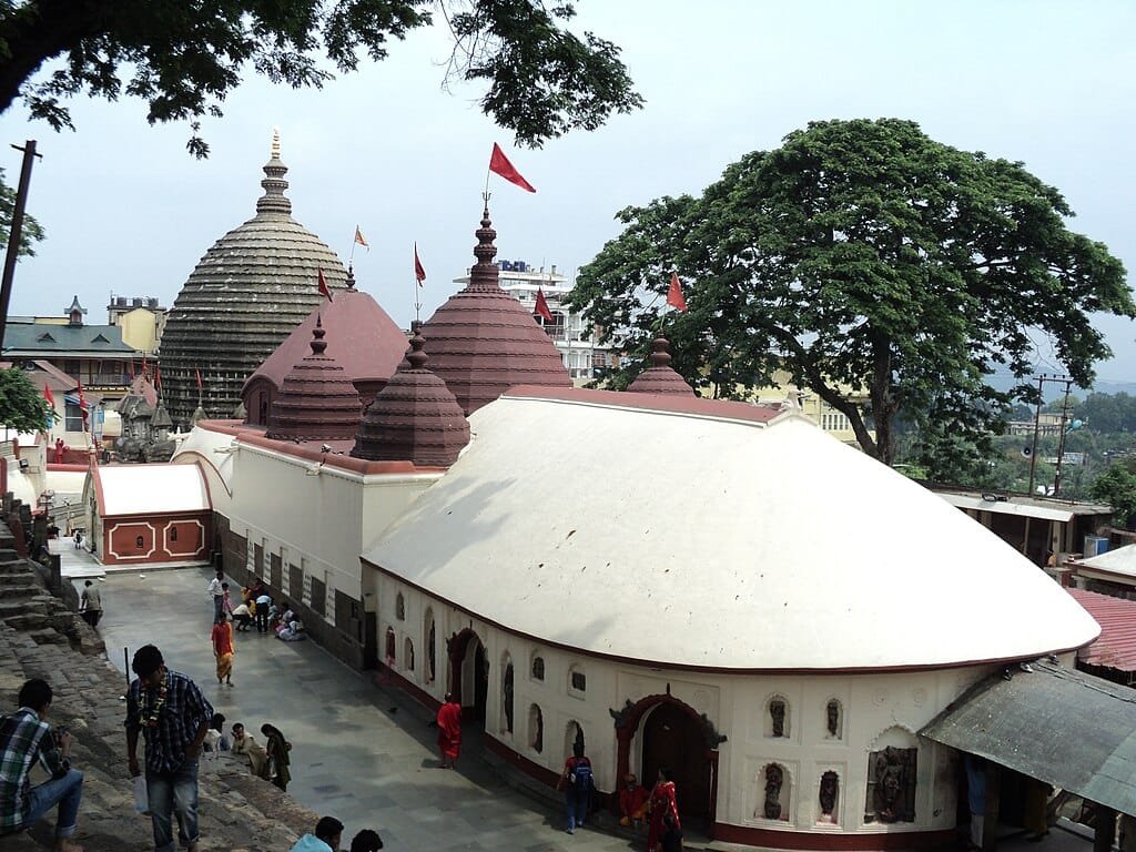
Nilachal Hill (~248 m / 814 ft): Located on the western flank overlooking the Brahmaputra, this sacred hill houses the historic Kamakhya Temple and stands roughly 190 meters higher than the surrounding riverbanks.
Chitrachal / Navagraha Hill (~217 m / 712 ft): Rising prominently in the city center, home to the ancient Navagraha (Nine Planets) astrological temple.
Sarania Hill (~200 m / 656 ft): A central ridge hosting the Kasturba Gandhi Ashram and the Gandhi Mandap memorial.
Deepor Beel Wetlands (~53 m / 174 ft): A low-elevation freshwater marshland located southwest of the city that functions as a natural drainage sponge, absorbing excess urban stormwater before releasing it toward the river.
How Altitude Affects Guwahati’s Climate & Weather
Sitting at a modest 55-meter elevation within the river trough of Lower Assam, Guwahati does not share the alpine climate of neighboring hill stations like Shillong or Tawang. Its microclimate is categorized as humid subtropical, characterized by high humidity, warm summers, and abundant precipitation:
Summer Dynamics (March to June): Temperatures typically fluctuate between 25°C and 35°C. Due to low altitude and moisture evaporation from the Brahmaputra, relative humidity consistently exceeds 75% to 85%, resulting in a high heat index.
Heavy Monsoon Influx (June to September): Monsoon winds channel directly through the funnel-shaped valley, triggering torrential seasonal rainfall averaging 1,700 mm to 2,200 mm annually. The moisture-laden air cools against the nearby hills, producing intense cloudbursts.
Crisp, Dry Winters (November to February): Winters are mild and pleasant. Temperatures range between 10°C and 25°C with dense morning fog rolling off the river, clearing by mid-day into sunny skies.
Elevation Comparison: Guwahati vs. Major Indian Cities
Comparing Guwahati’s altitude against other prominent Indian cities highlights its position as a lowland river corridor contrasting with high-altitude regional destinations:
Guwahati’s 55-meter low-lying posture creates significant civil engineering and drainage challenges during peak monsoons. When the Brahmaputra River swells above its high danger mark (~49.68 meters above MSL), the city’s natural gravitational drainage outlets (such as the Bharalu, Bahini, and Mora Bharalu channels) lose their outflow slope. As river water pressure pushes back, urban stormwater backs up into low-lying residential sectors like Zoo Road, Christian Basti, and Anil Nagar, necessitating automated sluice gates and heavy-duty storm pumping stations.
Tourism & Travel Highlights Influenced by Geography
Despite its lowland foundation, Guwahati’s dramatic interaction with the Brahmaputra creates unforgettable sightseeing avenues:
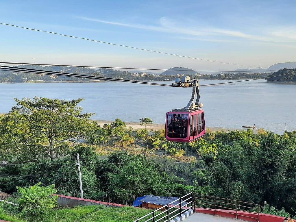
Guwahati Passenger Ropeway: India’s longest river ropeway (~1.8 km) glides across the Brahmaputra from Panbazar to North Guwahati, offering panoramic views of Umananda Island—the world’s smallest inhabited river island.
Kamakhya Temple Pilgrimage: Ascending Nilachal Hill provides expansive vistas of the sprawling city nestled beside the sweeping river curve.
Sunset River Cruises: Luxury cruise vessels and ferries depart from Fancy Bazar and Machkhowa ghats, providing twilight views over the shimmering waters.
Deepor Beel Birdwatching: A haven for migratory waterfowls, storks, and wild Asian elephants descending from the Rani-Garbhanga reserve forest.
Frequently Asked Questions (FAQs)
What is the exact Guwahati height from sea level?
The average elevation of Guwahati is 55 meters (180 feet) above sea level, though its inner-city hillocks like Nilachal Hill rise up to 248 meters (814 feet).
Is Guwahati a hill station?
No. Guwahati is a river valley city located in the plains of Lower Assam along the Brahmaputra. While it is dotted with forested hillocks, true hill stations like Shillong (1,525 m) are situated roughly 100 km south in Meghalaya.
Does Guwahati experience altitude sickness?
No. At 55 meters above sea level, atmospheric pressure and oxygen saturation are identical to coastal plains, posing zero risk of Acute Mountain Sickness (AMS) for travelers of any age.

Comments are closed.