
Gangtok Height From Sea Level
Gangtok Height From Sea Level (2026 Elevation, Mountain Ridges & Climate Guide) – Perched along a dramatic southwest-facing mountain ridge in the Eastern Himalayas, Gangtok, the capital city of Sikkim, sits at an average elevation of 1,650 meters (5,410 feet) above sea level. Renowned for its clean, pedestrianized MG Marg, ancient Tibetan Buddhist monasteries (such as Enchey and Rumtek), the Deorali aerial ropeway, and panoramic vistas of the towering Mount Kanchenjunga (8,586 m / 28,169 ft), Gangtok’s tiered topography creates a temperate mountain climate.
Because the municipal city stretches over stepped hillsides flanking the Roro Chu and Ranikhola river basins, elevations vary from 1,400 meters in Lower Deorali up to 2,195 meters (7,200 feet) at Hanuman Tok. In this complete 2026 geographic reference guide, we explore Gangtok’s exact height in meters and feet, zone-wise neighborhood elevations, the Teesta River approach, weather patterns, and crucial altitude acclimatization guidelines for Nathu La and Gurudongmar Lake.
| Geographic Parameter | Official Measurement & Elevation Details |
|---|---|
| City Center Altitude (MG Marg) | 1,650 meters (5,410 feet) above sea level |
| Municipal Elevation Range | 1,400 m – 2,195 m (4,593 ft – 7,201 ft) |
| Highest Local Ridge Point (Hanuman Tok) | 2,195 meters (7,201 feet) |
| Lowest Valley Gateway (Ranipool) | ~950 meters (3,116 feet) |
| Mountain Range | Eastern Himalayas (Shivalik & Outer Himalayan Zone) |
| Prominent Visible Summit | Mount Kanchenjunga (8,586 m – World’s 3rd Highest Peak) |
| State & Country | Sikkim, North East India |
| Risk of Altitude Sickness (AMS) | Zero (Well below the 2,400 m medical risk threshold) |
Topography Explained: Tier-Wise Neighborhood Elevations in Gangtok
Unlike flat plateau cities, Gangtok is built along a series of terraced steps rising sharply from river canyons up to cloud-draped mountain crests:
- Ranipool & Lower Suburbs (950 m – 1,200 m): The subtropical gateway zone along the Ranikhola riverbed connecting incoming traffic from Siliguri and Pakyong Airport.
- Deorali & Namgyal Institute of Tibetology (1,450 m / 4,757 ft): The lower transport terminal and cultural precinct, serving as the lower boarding base for the bi-cable Gangtok Ropeway.
- MG Marg & Main Commercial Bazaar (1,650 m / 5,410 ft): The cobblestone, vehicle-free tourist promenade that houses hotels, handicraft showrooms, and cafes.
- The Ridge & Raj Bhavan (1,800 m / 5,905 ft): An elevated residential and bureaucratic spine lined with pine trees, flower gardens, and the historic White Hall.
- Tashi View Point (1,850 m / 6,070 ft): Located 8 km north of the city center, offering sunrise perspectives of Kanchenjunga and Mount Siniolchu.
- Ganesh Tok (1,980 m / 6,496 ft): A circular viewpoint pavilion providing sweeping aerial views over the entire Gangtok bowl.
- Hanuman Tok (2,195 m / 7,201 ft): Maintained by the Indian Army along the upper ridgeline, this temple site represents the highest municipal elevation in greater Gangtok.
Elevation Comparison: Gangtok vs. Sikkim Circuit & Regional Hill Stations
Gangtok serves as the primary gateway connecting the warm plains of Bengal and Assam with the high-altitude frontier passes of the Tibetan plateau:
| Destination / High Pass | Elevation (Meters) | Elevation (Feet) | Altitude Tier & Significance |
|---|---|---|---|
| Siliguri (Plains Hub) | 122 m | 400 ft | North Bengal Transit Foothills |
| Guwahati | 55 m | 180 ft | Brahmaputra Valley Gateway |
| Gangtok (City Center) | 1,650 m | 5,410 ft | Mid-Altitude Capital Base |
| Darjeeling | 2,045 m | 6,709 ft | Colonial Ridge, Tea Gardens |
| Pelling (West Sikkim) | 2,150 m | 7,050 ft | Kanchenjunga Facing Plateau |
| Lachung (North Sikkim) | 2,700 m | 8,860 ft | Yumthang Valley Basecamp |
| Lachen (North Sikkim) | 2,750 m | 9,020 ft | Gurudongmar Staging Village |
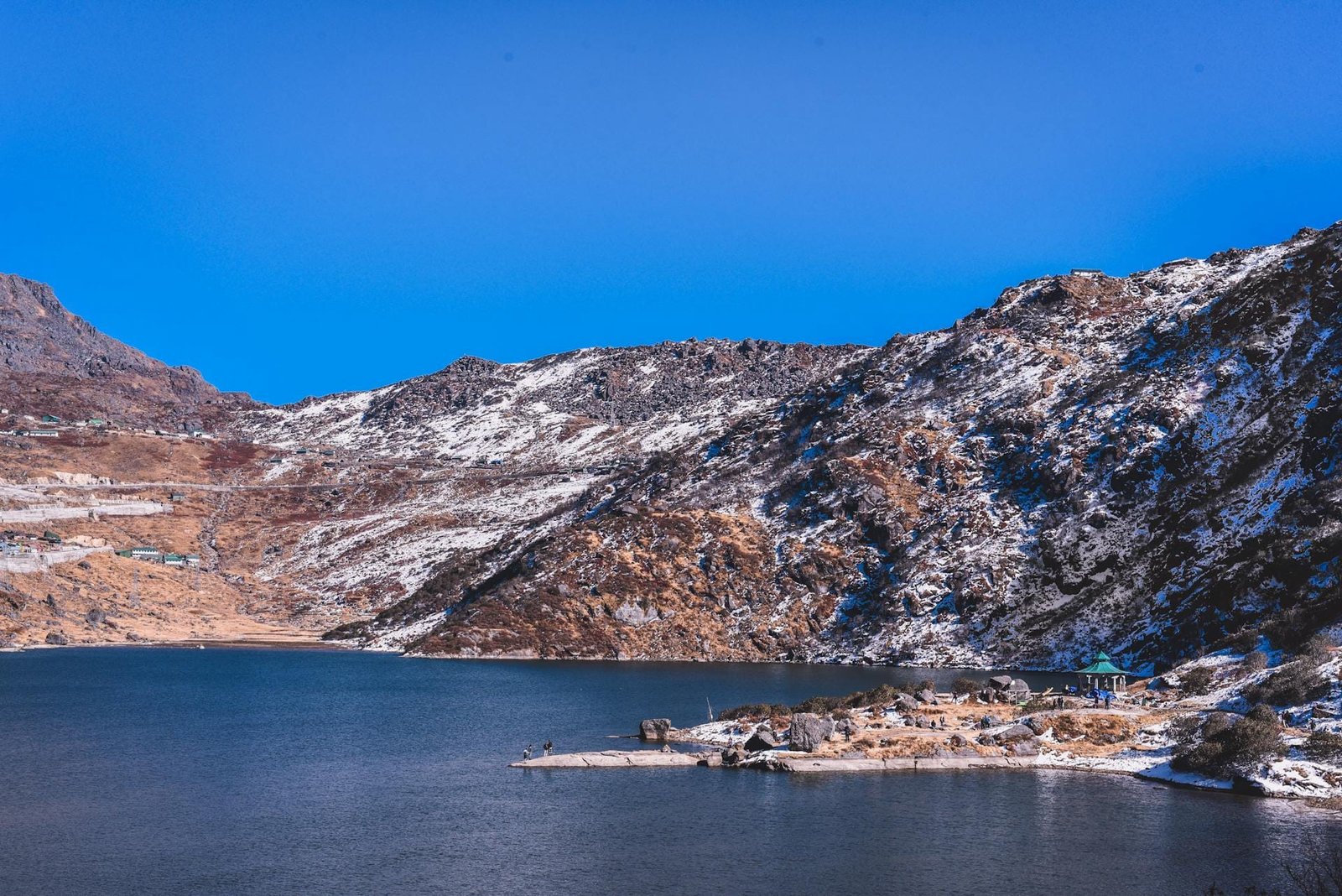
| Tsomgo (Changu) Lake | 3,753 m | 12,313 ft | Sacred Glacial Lake (East Sikkim) |
| Nathu La Pass | 4,310 m | 14,140 ft | Indo-China Border Trading Pass |
| Gurudongmar Lake | 5,430 m | 17,800 ft | High-Altitude Sacred Arctic Lake |
| Mount Everest (Summit) | 8,848.86 m | 29,031.7 ft | Highest Summit on Earth |
How Altitude Shapes Gangtok’s Climate & Weather Patterns
Sitting at 1,650 meters, Gangtok enjoys a subtropical highland climate (Köppen: Cwb), shielded from extreme tropical heat while remaining mild enough to prevent severe winter freezes:
- Spring & Summer (March to June): Daytime temperatures stay pleasant between 14°C and 22°C. Wild rhododendrons, magnolias, and over 500 species of indigenous orchids bloom across the hillsides, making this peak tourism season.
- Heavy Monsoonal Deluge (July to September): Gangtok receives massive annual precipitation (~3,500 to 3,800 mm). Moist monsoon currents strike the steep Himalayan escarpment, creating thick fog. Road travel along NH-10 requires monitoring for seasonal rockfalls and river swelling along the Teesta.
- Autumn Clarity (October to November): The best window for Himalayan sightseeing. Post-monsoon breezes clear the atmosphere, providing crisp blue skies and sharp morning views of Kanchenjunga and Mount Pandim.
- Winter Weather & Snowfall Realities (December to February): Temperatures hover between 4°C and 14°C, occasionally dipping to 2°C on January nights. Snowfall in Gangtok city center is extremely rare due to its 1,650 m elevation; however, heavy snow is guaranteed just 35 to 40 km uphill at Tsomgo Lake and Nathu La.
Altitude Acclimatization: Using Gangtok as a Staging Hub
While an elevation of 1,650 meters carries zero risk of Acute Mountain Sickness (AMS), Gangtok plays a vital role as an acclimatization stopover:
- The Golden 24-to-48-Hour Rule: Travelers heading to East Sikkim (Nathu La at 4,310 m) or North Sikkim (Gurudongmar Lake at 5,430 m) should spend at least two nights in Gangtok. Ascending directly from the plains of Siliguri (122 m) to 4,000+ meters in a single day can trigger severe altitude sickness, pulmonary edema, and acute nausea.
- Permits & Formalities: Protected Area Permits (PAP) for Nathu La, Tsomgo Lake, Lachung, and Lachen are issued through the Tourism & Civil Aviation Department and Sikkim Police checkposts in Gangtok via registered local tour operators. Carry valid government photo IDs and passport-size photographs.
- Layered Clothing: While light woolens or jackets suffice for walking along MG Marg, transitioning to higher passes requires windproof thermal inner layers, fleece jackets, and insulated gloves.
How to Reach Gangtok: Highway & Transit Routes
Reaching the Himalayan capital involves ascending from the North Bengal plains into the Teesta River gorge:
- By Road via NH-10: The standard route starts from Siliguri/NJP, passing through Sevoke (Coronation Bridge), Kalijhora, Teesta Bazaar, Rangpo (Sikkim border entry checkpost), and Singtam to Gangtok (~115 km, approx. 4 to 5 hours drive).
- Nearest Airports: Pakyong Airport (PYG) (~30 km from Gangtok) is Sikkim’s dedicated high-altitude airport, offering select regional flights. Bagdogra International Airport (IXB) (~125 km) in West Bengal operates frequent commercial connections to all major Indian metro hubs.
- Nearest Railway Station: New Jalpaiguri Junction (NJP) and Siliguri Junction (~120 km), connecting directly to New Delhi, Kolkata, and Guwahati. (The ongoing Sivok–Rangpo railway line will soon bring train connectivity directly to the Sikkim border). For long-distance connections departing from Punjab and Haryana, see our guide to Sector 17 Chandigarh Bus Stand.
- Mountain Geography Circuit: Explore more Himalayan elevation benchmarks across India in our guides to Shimla Height From Sea Level and Auli Height From Sea Level.
Frequently Asked Questions (FAQs)
What is the exact Gangtok height from sea level?
The city center of Gangtok (centered around MG Marg) is situated at an elevation of 1,650 meters (5,410 feet) above sea level, with municipal neighborhoods ranging from 1,400 m to 2,195 m.
Does Gangtok city receive snowfall during winter?
Snowfall in Gangtok city center is very rare due to its moderate 1,650-meter elevation. However, heavy snowfall occurs regularly between December and March at nearby high destinations like Tsomgo Lake (3,753 m) and Nathu La Pass (4,310 m), located just 35 to 50 km away.
Is Gangtok higher than Darjeeling?
No. Darjeeling (2,045 m / 6,709 ft) is situated nearly 395 vertical meters higher than Gangtok (1,650 m / 5,410 ft), making Darjeeling noticeably cooler during winter months.
What is the highest point in Gangtok?
The highest viewpoint within greater Gangtok is Hanuman Tok, situated on the upper mountain ridgeline at an elevation of 2,195 meters (7,201 feet).
Explore More Regional Mountain Elevation & City Guides:
Siliguri Height From Sea Level | Guwahati Height From Sea Level | Everest Height From Sea Level | Shimla Height From Sea Level | Auli Height From Sea Level
Comments are closed.