
Height of Dharamshala
Height of Dharamshala – Dharamshala, one of Himachal Pradesh’s most culturally rich and scenic destinations, attracts travellers from around the world. Known for its Tibetan influence, monasteries, mountain views and spiritual ambience, this hill station offers a perfect mix of nature and culture. But before planning a trip, many travellers search for one particular detail — the height of Dharamshala from sea level.
Understanding Dharamshala’s elevation is important because it affects its weather, climate, accessibility, and overall travel experience. In this detailed guide, we explain Dharamshala’s exact altitude, elevation variations, weather patterns, and provide travel tips that will help you plan your trip more comfortably and efficiently.
What is the Height of Dharamshala from Sea Level?
The height of Dharamshala from sea level is approximately 1,457 meters (4,780 feet).
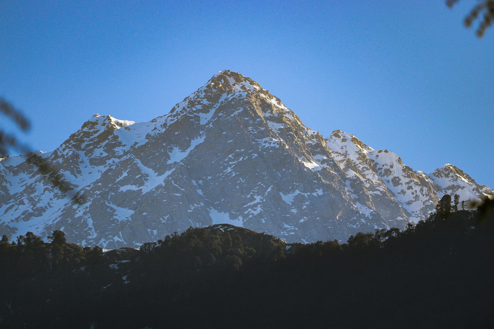
It is located in the foothills of the Dhauladhar mountain range, which is part of the majestic Himalayas.
Dharamshala is divided into Lower Dharamshala (the main town) and Upper Dharamshala, which includes the popular region of McLeodganj—the residence of His Holiness the Dalai Lama.
McLeodganj is situated at a higher altitude than the main city, giving visitors cooler weather and stunning mountain views.
Dharamshala Height, Altitude & Elevation – Quick Table
| Parameter | Details |
|---|---|
| Location | Himachal Pradesh, India |
| Height of Dharamshala | 1,457 m (4,780 ft) |
| Elevation of McLeodganj | 2,082 m (6,831 ft) |
| Highest Nearby Point | Triund – 2,828 m (9,278 ft) |
| Dharamshala Temperature (Summer) | 18°C to 35°C |
| Dharamshala Temperature (Winter) | 0°C to 14°C |
| Best Time to Visit | March–June & September–December |
This table gives a clear overview of Dharamshala’s altitude and elevation differences, making it easy for travellers to understand the overall terrain and climate.
How Dharamshala’s Altitude Influences its Weather
Dharamshala’s elevation plays a major role in shaping its weather throughout the year. Here’s a season-wise explanation:
1. Summer (March – June)
-
Temperature ranges between 18°C and 35°C
-
Cool mornings and evenings
-
Clear mountain views
-
Best season for sightseeing and trekking
2. Monsoon (July – September)
-
Heavy to moderate rainfall
-
Known as one of the wettest regions in India
-
Lush green landscapes everywhere
-
Trekking is less ideal due to slippery terrain
3. Winter (October – February)
-
Temperature ranges between 0°C and 14°C
-
Higher areas may receive snow
-
Crisp air, beautiful mountain views
-
Perfect for those who love chilly weather
Since Dharamshala sits at a significantly higher altitude than the plains, the temperature always remains cooler, making it a refreshing escape from cities like Chandigarh, Delhi, Jalandhar, and Amritsar.
Altitude Variations Within Dharamshala
One of the most interesting aspects of Dharamshala is its altitude difference within a very short distance.
1. Lower Dharamshala – Main Town
-
Average height: 1,457 meters
-
Houses markets, district offices, and residential areas
2. Upper Dharamshala – McLeodganj
-
Height: 2,082 meters
-
Much cooler climate
-
Home to Tibetan monasteries, cafés, and the Dalai Lama Temple
3. Dharamkot & Bhagsu
-
Height: approx. 2,100 meters
-
Popular for yoga retreats, hostels, and backpacker stays
4. Triund
-
Height: 2,828 meters
-
Famous trekking destination
-
Offers panoramic views of the Dhauladhar range
This gradual altitude increase is what makes Dharamshala such a diverse travel spot — from spiritual monasteries to adventure trekking routes.
Why Knowing Dharamshala’s Altitude Matters
Many travellers overlook altitude as a factor, but it directly affects:
1. Weather Expectations
Carrying the right clothing is easier when you know the elevation.
2. Travel Comfort
Some people may feel mild discomfort due to elevation changes, especially when travelling from the plains.
3. Trekking Preparation
Treks like Triund and Kareri Lake require preparation more suited to high-altitude locations.
4. Accommodation Choices
Higher areas like Upper Dharamshala offer cooler temperatures and mountain views.
Travel Tips for Visiting Dharamshala’s High Altitude Areas
To make your trip smoother, here are some altitude-friendly tips:
✔ Stay Hydrated
High altitudes can cause dehydration faster.
✔ Take Short Breaks While Climbing
Whether hiking or exploring McLeodganj, avoid rushing.
✔ Dress in Layers
Weather shifts quickly based on height.
✔ Plan Daytime Travel
Mountain roads are safer during daylight.
✔ Carry Essential Medicines
Especially for cold, headache, and stomach issues.
Nearby High-Altitude Destinations Around Dharamshala
| Place | Height From Sea Level |
|---|---|
| McLeodganj | 2,082 m (6,831 ft) |
| Triund | 2,828 m (9,278 ft) |
| Dharamkot | 2,100 m (6,889 ft) |
| Bhagsunag | 1,770 m (5,807 ft) |
These nearby destinations complement Dharamshala’s altitude and make the region perfect for trekking, photography, and nature exploration.
The Beauty of Dharamshala’s Elevation
The hill station’s altitude not only brings pleasant weather but also enhances its scenic beauty. The snow-capped Dhauladhar peaks appear stunning from McLeodganj and Triund, creating postcard-like landscapes throughout the year. This elevation gives Dharamshala its peaceful charm, making it a perfect getaway for nature lovers, spiritual seekers, photographers, and adventure enthusiasts.
If you love exploring hill stations and nearby destinations, topchandigarh.com is an excellent platform to discover new places. This blog offers detailed guides on popular travel spots around Chandigarh, including Dharamshala, Dalhousie, Shimla, Kasauli, Manali, Kasol and more. From travel distances and elevation details to must-visit places and practical tips, topchandigarh.com provides well-researched information to help travellers plan effortless and memorable trips.