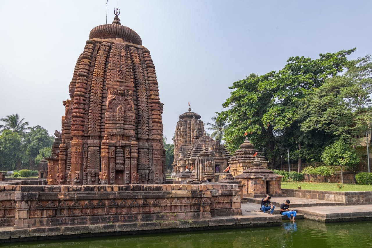
Mukteshwar Height From Sea Level (2026 Exact Elevation, Snowfall, Himalayan Views & Kumaon Travel Guide) – Perched atop a scenic ridge in the Nainital district of Uttarakhand, Mukteshwar sits at an elevation of 2,286 meters (7,500 feet) above sea level. Renowned across Northern India as a serene, uncrowded alternative to bustling hill resorts like Nainital and Mussoorie, Mukteshwar derives its name from the 350-year-old Shiva temple, Mukteshwar Dham, situated at the town’s highest summit. Towering above the surrounding valleys of Kumaon, this high-altitude haven provides an unobstructed 180-degree panoramic vista of the Great Himalayan peaks—including Nanda Devi (7,816 m), Trishul (7,120 m), Nanda Ghunti, and the Panchachuli range.
Surrounded by dense canopies of Himalayan oak, blue pine, and deodar forests alongside terraced fruit orchards of apples, plums, and apricots, the town’s altitude creates a cool temperate climate throughout the year. In this comprehensive 2026 geographic reference and travel guide, we examine Mukteshwar’s exact height in meters and feet, landmark viewpoints like Chauli Ki Jali, winter snowfall windows, road trip driving routes from Delhi and Chandigarh, and essential high-altitude travel tips.
Geographic Landmark / Parameter
Elevation (Meters)
Elevation (Feet)
Topographical & Scenic Significance
Mukteshwar Ridge & Town Centre
2,286 m
7,500 ft
Official municipal benchmark; ridgeline dividing Kumaon valleys
Mukteshwar Dham (Shiva Temple Peak)
2,312 m
7,585 ft
Highest geographic point in Mukteshwar; 350-year-old stone temple
Chauli Ki Jali (Cliff Edge Viewpoint)
2,240 m
7,349 ft
Natural rock lattice over vertical 1,000-meter drop into the South Gola Valley
IVRI Campus (Colonial Heritage Reserve)
2,280 m
7,480 ft
Historic Indian Veterinary Research Institute established in 1893
Sitla & Peora (Orchard Hamlets)
1,800 m – 1,950 m
5,905 ft – 6,397 ft
Tranquil eco-villages known for colonial bungalows and apple orchards
Bhalu Gaad Waterfall (Valley Basin)
1,650 m
5,413 ft
60-foot natural cascading waterfall nestled within deep pine ravines
Bhimtal (Base Lake Town)
1,370 m
4,495 ft
Major scenic lake transit hub en route to Mukteshwar
Kathgodam (Railway Foothill Gateway)
554 m
1,818 ft
Primary railhead at the base of the Kumaon Shivalik hills
Why 2,286-Meter Elevation Gives Mukteshwar a Unique Advantage
While many travelers default to visiting Nainital, Mukteshwar’s geographic positioning offers decisive advantages over neighboring Kumaon destinations:
Substantially Higher Than Nainital: Sitting at 2,286 meters, Mukteshwar is over 200 meters higher than Nainital town (2,084 m) and more than 600 meters higher than Almora (1,638 m). This elevation difference makes Mukteshwar 3°C to 5°C cooler, providing crisp mountain air free from vehicular smog.
The 180-Degree Himalayan Wall: Because Mukteshwar is perched along an isolated high ridge without immediate obstructing peaks to its north, it provides one of the widest, most direct viewing angles of the Greater Himalayas in Uttarakhand. On clear mornings between October and March, peaks such as Nanda Devi (7,816 m) and Trishul stand out sharply against the azure horizon.
Abundant Winter Snowfall: The town regularly receives moderate to heavy snowfall during January and February, turning its pine and oak forests into a winter wonderland without the massive traffic gridlocks seen in major commercial hill stations.
Climate & Weather Profile Across the Four Seasons
Mukteshwar’s altitude governs its temperate highland climate, ensuring distinct seasonal charms throughout the year:
Season
Calendar Months
Temperature Range
Weather Experience & Packing Advice
Summer (Pleasant Escape)
March to June
12°C to 24°C
Crisp mornings, warm sunny afternoons, and cool evenings. Light woolens or jackets needed for night strolls.
Monsoon (Lush Greenery)
July to August
15°C to 20°C
Moderate to heavy rainfall; misty clouds float through the valleys. Waterfalls like Bhalu Gaad flow at full volume.
Autumn (Crystal Clear Skies)
September to November
8°C to 18°C
The best season for unobstructed Himalayan snow views, astrophotography, and fruit picking. Light to medium woolens.
Winter (Chilly & Snowbound)
December to February
-3°C to 10°C
Sub-zero nighttime temperatures, dense frost, and periodic snowfall. Heavy down jackets, thermal innerwear, and woolens required.
Elevation Comparison: Mukteshwar vs. Other Hill Stations
To put Mukteshwar’s 2,286-meter altitude into geographic perspective, compare it with other prominent hill stations across the Himalayas and Peninsular India:
Top Sightseeing Attractions Shaped by Mukteshwar’s Ridge Height
Each major landmark in Mukteshwar highlights a unique facet of its high-altitude topography:
Mukteshwar Dham Temple (2,312 m): Sitting at the highest crest of the town, this stone temple dedicated to Lord Shiva offers spiritual peace and unmatched vantage points over the northern snowfields. Legends hold that Lord Shiva granted immortality (Moksha) to a demon here.
Chauli Ki Jali (2,240 m): Located right behind the Mukteshwar temple, this rocky outcrop features natural holes in vertical stone slabs protruding over an abyss. According to local folklore, barren women crossing the lattice rock were blessed with fertility. Today, it serves as a thrilling spot for rock climbing, rappelling, and dramatic valley photography.
Historic IVRI Campus: Established by the British in 1893 as the Imperial Bacteriological Laboratory, this sprawling research institute was chosen specifically for Mukteshwar’s cold mountain climate, which helped preserve serum cultures before modern refrigeration. Its colonial stone architecture and preserved oak forests remain an educational highlight.
Fruit Orchards of Ramgarh & Mukteshwar: Often called the “Fruit Bowl of Kumaon,” the sunlit hillsides surrounding Mukteshwar are terraced with apple, peach, plum, and apricot trees that blossom in pink and white hues during spring (March–April) and bear fruit through July.
Bhalu Gaad Waterfall (1,650 m): A scenic 2-kilometer forest trek through streams and pine groves leads to this natural waterfall plunging into a turquoise plunge pool, ideal for daytime picnics and birdwatching.
How to Reach Mukteshwar: Road Routes & Ghat Driving Distances
Climbing to 2,286 meters is a scenic, well-paved mountain drive connecting the plains of Delhi NCR and Punjab with the Kumaon hills:
From Delhi NCR (~340 km / 7.5 to 8.5 Hours): Drive via NH 9 past Hapur, Moradabad, Rampur, and Bilaspur to Haldwani. From Haldwani, ascend through the gentle curves of the Kathgodam–Bhimtal road, continue past Bhowali and Ramgarh, and follow the scenic ridge highway to Mukteshwar.
From Chandigarh (~460 km / 9.5 to 10.5 Hours): Drive via Ambala, Saharanpur, Haridwar, Kashipur, and Haldwani before beginning the hill ascent. (Travelers planning intercity connections can verify regional bus timings via Sector 17 Chandigarh Bus Stand).
Nearest Railway Station: Kathgodam Railway Station (KGM) is situated approximately 62 km away (approx. 2 to 2.5 hours by taxi), with daily express trains (such as the Kathgodam Shatabdi and Ranikhet Express) connecting directly from New Delhi.
Nearest Airport: Pantnagar Airport (PGH) is located about 95 km away (approx. 3.5 hours drive), offering scheduled regional flights from Delhi and Dehradun.
High-Altitude Travel Tips for Visiting Mukteshwar
Ensure a comfortable, safe mountain holiday by keeping these practical travel precautions in mind:
No Acute Altitude Sickness: At 2,286 meters, Mukteshwar sits just below the clinical threshold (2,500 m) where acute mountain sickness (AMS) typically occurs. Most travelers, including senior citizens and young children, adjust effortlessly. However, staying well-hydrated helps prevent mild headaches during the initial ascent from the plains.
Carry Multi-Layered Woolens: Because ridge winds can cause sudden temperature drops of 6°C to 8°C after sunset even during May and June, always carry a windcheater jacket and fleece sweater.
Careful Winter Driving: If visiting during peak winter (late December to January) when snowfall occurs, carry snow chains or travel in four-wheel-drive vehicles to navigate frozen black ice along shady curves between Bhatelia and Mukteshwar.
Frequently Asked Questions (FAQs)
What is the exact Mukteshwar Height From Sea Level?
Mukteshwar is situated at an elevation of approximately 2,286 meters (7,500 feet) above sea level, while its highest summit at the Mukteshwar Dham temple reaches 2,312 meters (7,585 feet).
Does it snow in Mukteshwar?
Yes. Due to its high elevation of 2,286 meters, Mukteshwar regularly receives snowfall during the peak winter months of late December, January, and early February, with temperatures frequently dropping below freezing.
Which is higher: Nainital or Mukteshwar?
Mukteshwar (2,286 m / 7,500 ft) is higher than Nainital (2,084 m / 6,837 ft) by approximately 202 meters, giving it cooler weather, fewer crowds, and clearer views of the Himalayan peaks.
Which Himalayan peaks are visible from Mukteshwar?
Mukteshwar offers spectacular views of several majestic Himalayan massifs, including Nanda Devi, Trishul, Nanda Ghunti, Kamet, and the Panchachuli peaks, especially on clear autumn and winter mornings.