
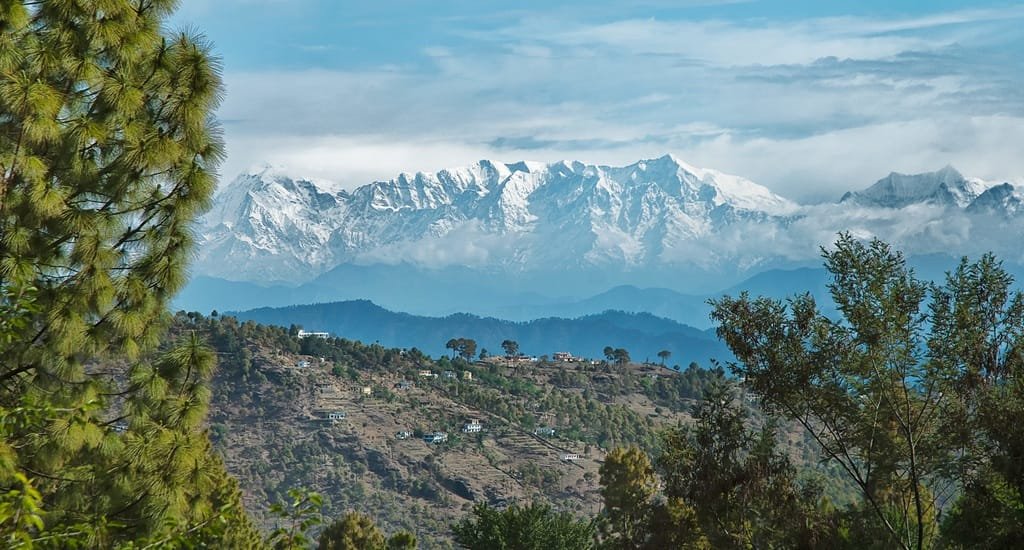
Top 5 Highest Mountain Peak in India
Highest Mountain Peak in India (2026 Geography Ranking, Elevations in Feet & Meters, UPSC Facts & Peaks Guide) – Rising along the rooftop of the world where the ongoing tectonic collision between the Indian and Eurasian plates thrusts the Greater Himalayas and Trans-Himalayan Karakoram ranges skyward, India encompasses some of the most formidable alpine massifs on Earth. One of the most frequently asked questions in physical geography and competitive examinations (UPSC Civil Services, SSC CGL, NDA, and State PSCs) is: Which is the highest mountain peak in India?
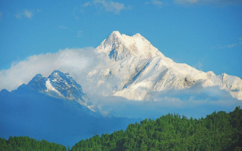
Officially recognized under sovereign Indian administrative control, Kangchenjunga rises to an elevation of 8,586 meters (28,169 feet) above sea level on the border of Sikkim and eastern Nepal, making it the highest mountain peak in India and the third-highest summit on Earth. Furthermore, Nanda Devi (7,816 m / 25,643 ft) in Uttarakhand stands as the highest mountain peak situated entirely within Indian territory without sharing an international boundary. In this definitive 2026 geographic reference guide, we examine the Top 5 highest mountain peaks in India, exact elevations in meters and feet, geographical coordinates, climbing histories, and the crucial distinction between K2, Kangchenjunga, and Nanda Devi.
| Rank | Mountain Peak | Elevation (Meters) | Elevation (Feet) | Mountain Range & Zone | State / Union Territory | Geographic & Territorial Status |
|---|---|---|---|---|---|---|
| 1 | Kangchenjunga | 8,586 m | 28,169 ft | Great Himalayas (Eastern) | Sikkim (India–Nepal Border) | Highest peak under Indian administration; 3rd highest on Earth |
| 2 | Nanda Devi | 7,816 m | 25,643 ft | Garhwal Himalayas | Chamoli, Uttarakhand | Highest mountain peak situated entirely within India; 23rd on Earth |
| 3 | Kamet | 7,756 m | 25,446 ft | Zaskar / Garhwal Range | Chamoli, Uttarakhand | Second highest entirely in Uttarakhand; 29th highest on Earth |
| 4 | Saltoro Kangri | 7,742 m | 25,400 ft | Karakoram (Saltoro Ridge) | Ladakh (Siachen Glacier Basin) | 31st highest peak in the world; strategic frontier summit along AGPL |
| 5 | Saser Kangri I | 7,672 m | 25,171 ft | Karakoram (Saser Muztagh) | Ladakh (Nubra Valley Region) | 35th highest peak in the world; eastern Karakoram sentinel |
The Geography Dilemma Explained: K2 vs. Kangchenjunga vs. Nanda Devi
Students, researchers, and travelers frequently encounter conflicting statements in reference books and online portals regarding India’s tallest peak. To resolve this ambiguity, three distinct cartographic parameters must be understood:
- Kangchenjunga (8,586 m / 28,169 ft): The official and internationally accepted answer for the highest peak in India under active sovereign administration. Located on the western border of Sikkim and eastern Nepal, its eastern face lies wholly within the North Sikkim district of India.
- K2 / Mount Godwin-Austen (8,611 m / 28,251 ft): Under India’s constitutional map, the entire former princely state of Jammu & Kashmir and Ladakh forms an integral part of the nation, making K2 in the Karakoram range India’s tallest point de jure (by legal right). However, because K2 currently lies in Pakistan-administered Gilgit-Baltistan along the border with China’s Xinjiang region, it is not under de facto (operational) Indian administrative governance.
- Nanda Devi (7,816 m / 25,643 ft): The definitive answer when answering: Which is the highest mountain peak located completely within Indian territory? Unlike Kangchenjunga (shared with Nepal) or K2, Nanda Devi’s base, surrounding peaks, glacier systems, and summit ridge lie entirely within Uttarakhand.
Top 5 Highest Mountain Peaks in India (Detailed Profiles)
1. Kangchenjunga (8,586 m / 28,169 ft) – The Sovereign Summit
Deriving its Tibetan name from Kang-chen-zod-nga—translating to the “Five Treasures of the Great Snow”—Kangchenjunga encompasses five distinct high peaks representing the five sacred storehouses of God (gold, silver, gems, grain, and sacred books). Sacred to both Buddhists and Hindus in Sikkim, local custom requires mountaineering expeditions to stop a few feet short of the actual summit to keep the peak uncontaminated.
- Geographical Coordinates: 27°42′12″ N Latitude, 88°08′51″ E Longitude.
- First Successful Ascent: May 25, 1955, by British climbers Joe Brown and George Band via the southwest face.
- Vantage Points: Clear views of the Kangchenjunga massif are visible from Gangtok (1,650 m), Tashi Viewpoint, and Tiger Hill in Darjeeling. Compare global heights in our overview of Mount Everest Height From Sea Level.
2. Nanda Devi (7,816 m / 25,643 ft) – The Bliss-Giving Goddess of Garhwal

Revered as the patron goddess of the Garhwal and Kumaon Himalayas, Nanda Devi is a steep two-peaked pyramid citadel rising dramatically above the Rishi Ganga gorge in Chamoli district. The mountain comprises two main summits: Nanda Devi Main (7,816 m) and Nanda Devi East (Sunanda Devi, 7,434 m), connected by a razor-sharp 2-kilometer ridge.
- The Nanda Devi Sanctuary: Enclosed by an impenetrable ring of 12 peaks exceeding 6,400 meters, this pristine ecological basin was inscribed as a UNESCO World Heritage Site in 1988. Since 1983, the core sanctuary has remained completely closed to all civilian trekking and commercial mountaineering to protect fragile high-altitude alpine biodiversity.
- Viewing Vantage Points: Spectacular vistas of Nanda Devi are visible from Auli Ski Resort (2,800 m) and Gorson Bugyal.
3. Kamet (7,756 m / 25,446 ft) – Giant of the Zaskar Range
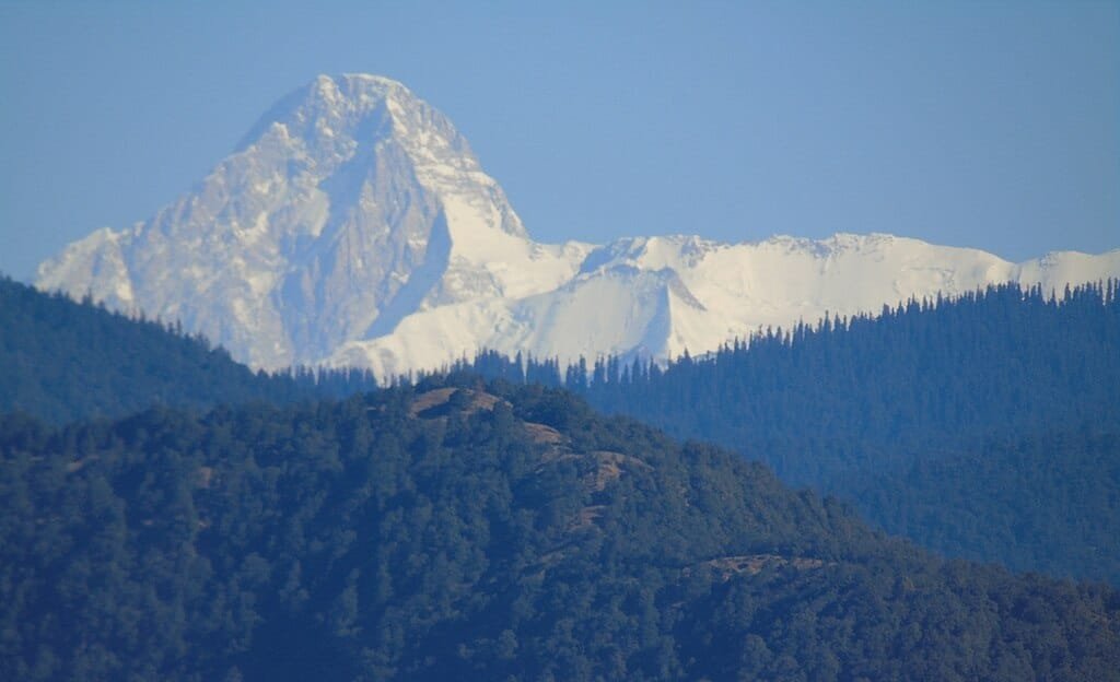
Positioned in northern Chamoli close to the border of Tibet, Kamet resembles a massive obelisk flanked by twin peaks (Mukut Parvat and Abi Gamin). Because of its position north of the main Himalayan spine in the rain-shadow zone, Kamet is swept by freezing Tibetan winds, yet remains clear of dense monsoon cloud cover.
- Historic Expedition: In 1931, British mountaineer Frank Smythe successfully summited Kamet, making it the first peak over 25,000 feet climbed by humans. While descending through Bhyundar Valley, Smythe stumbled upon a high-altitude meadow carpeted with alpine flora, famously naming it the Valley of Flowers.
- Nearby Pilgrimage Hub: Located north of the holy shrine of Badrinath Dham. (Compare regional base altitudes in our guide to Chakrata Height From Sea Level).
4. Saltoro Kangri (7,742 m / 25,400 ft) – Sentinel of Siachen

Situated in the Saltoro Range of the Trans-Himalayan Karakoram system, Saltoro Kangri (Saltoro Kangri I) is the 31st highest mountain peak in the world. Perched immediately west of the world’s longest non-polar glacier—the Siachen Glacier—this peak commands deep glaciated valleys along the Actual Ground Position Line (AGPL) dividing Indian and Pakistani defense positions in Ladakh.
- Climbing History: First climbed in 1962 by a joint Japanese-Pakistani team; subsequent ascents by Indian Army mountaineering teams followed Operation Meghdoot in 1984. Due to military security and avalanche terrain, commercial climbing is strictly restricted.
5. Saser Kangri I (7,672 m / 25,171 ft) – Monarch of the Eastern Karakoram
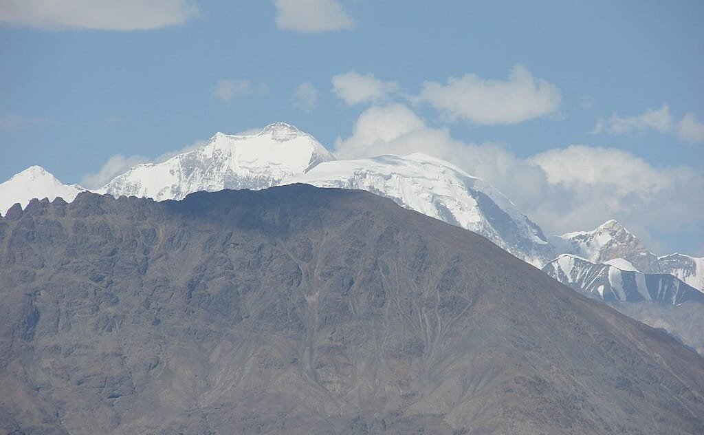
Dominating the Saser Muztagh sub-range in the Union Territory of Ladakh, Saser Kangri I (Yellow Mountain) is the 35th highest independent summit on the globe. Towering above the upper Shyok and Nubra river valleys, Saser Kangri acts as an eastern anchor of the Karakoram, separated from the Great Karakoram spine by the historic Saser La caravan trading pass into Central Asia.
- Mountaineering Challenge: First summited in 1973 by an expedition of the Indo-Tibetan Border Police (ITBP) via its formidable western approaches through the North Shukpa Kunchang glacier. (Explore high-altitude cold deserts in our guide to Leh Height From Sea Level).
Geographic Importance of India’s Tallest Mountains
These massive summits serve critical climatic, environmental, and cultural functions across the subcontinent:
- Climate Regulation & Monsoon Barrier: The immense elevation of the Great Himalayan and Karakoram ranges blocks dry, sub-zero continental winds from Central Asia from entering North India during winter, while simultaneously trapping the Indian summer monsoon clouds to precipitate life-giving rainfall across the Gangetic and Brahmaputra plains.
- The Water Towers of Asia: Glaciers descending from these peaks—including Zemu (Kangchenjunga), Rishi (Nanda Devi), and Siachen (Karakoram)—feed perennial river systems like the Ganga, Yamuna, Teesta, and Indus, providing fresh drinking water and irrigation to over 500 million people.
- Biodiversity Reservoirs: These massifs harbor protected biosphere reserves housing endangered fauna such as snow leopards, Himalayan musk deer, red pandas, blue sheep (bharal), and monal pheasants.
- Peninsular Mountain Contrast: While the northern ranges exceed 7,000 to 8,000 meters, Peninsular India features its own historic peaks; explore the southern summits in our guide to the Highest Peak in South India (Anamudi).
Frequently Asked Questions (FAQs)
Which is the highest mountain peak in India?
Kangchenjunga (8,586 meters / 28,169 feet), located on the border of Sikkim and Nepal, is officially recognized as the highest mountain peak in India under sovereign administrative control and the third-highest peak in the world.
Which is the highest mountain peak completely within India?
Nanda Devi (7,816 meters / 25,643 feet), located in the Chamoli district of Uttarakhand, is the highest mountain peak situated entirely within Indian territory, with no shared international border.
Why is K2 not considered the official highest peak of India in practical geography?
While India maintains a legitimate sovereign claim over K2 (8,611 m) as part of the union territory of Jammu & Kashmir and Ladakh, the peak currently lies in Pakistan-administered Gilgit-Baltistan along the border with China. Therefore, Kangchenjunga is the highest peak in territory actively governed by India.
What is the correct answer for competitive exams (UPSC / SSC)?
For government exams, Kangchenjunga is the standard correct answer for the highest peak in India under effective administrative control. If the question asks for the highest peak situated entirely within India, the correct answer is Nanda Devi.
Explore More National Geography, Elevation & Mountain Guides:
Highest Peak in South India (Anamudi) | Chamoli Height From Sea Level | Gangtok Height From Sea Level | Auli Height From Sea Level | Badrinath Height From Sea Level | Leh Height From Sea Level | Chakrata Height From Sea Level
Comments are closed.