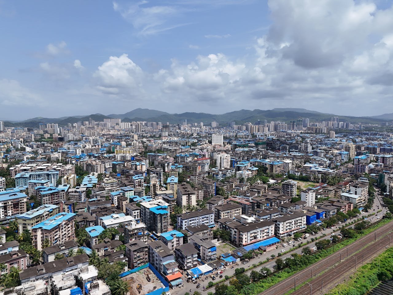
Mumbai Height From Sea Level (2026 Exact Elevation, Coastal Geography, Flooding & High Tides) – Situated along the Konkan coast of Maharashtra bordering the Arabian Sea, Mumbai sits at an average elevation of approximately 14 meters (46 feet) above sea level. As India’s premier financial capital and one of the most densely populated coastal megacities on Earth, Mumbai presents a unique geological paradox: while vast swathes of its reclaimed financial and residential districts lie barely 2 to 8 meters above mean sea level, northern tracts within the Sanjay Gandhi National Park on Salsette Island elevate dramatically to 450 meters (1,476 feet).
In this definitive 2026 geographic reference guide, we examine Mumbai’s exact elevation in meters and feet, the history of the original Seven Islands, how low altitude dictates monsoon flooding and Mithi River drainage, elevation comparisons across major Indian metropolises, and climate adaptation strategies.
Topographical Breakdown: The Seven Islands & Coastal Reclaimed Plains
To understand why Mumbai’s elevation is so low, one must examine its geological and colonial history. Modern Mumbai was not originally a contiguous landmass; it was an archipelago consisting of seven distinct volcanic basalt islands—Isle of Bombay, Colaba, Old Woman’s Island (Little Colaba), Mazagaon, Parel, Worli, and Mahim:
The Hornby Vellard & Reclamation Era: Beginning in the late 18th century under the British East India Company, low-lying tidal salt marshes and tidal creeks separating the islands were gradually filled in with rock ballast and soil. This engineering joined the seven islands into a single peninsula.
Sub-Sea Level Bowls: Because large portions of south and central Mumbai (including lower Parel, Hindmata, Dadar T.T., and Grant Road) represent reclaimed mangrove beds, they sit in natural low-lying saucer-shaped depressions barely 2 to 4 meters above normal sea level.
Gilbert Hill Monolith (61 m): Located in suburban Andheri, this sheer 200-foot column of black basalt rock represents a 66-million-year-old volcanic plug from the Mesozoic Era, serving as one of the city’s rarest natural geological towers.
Sanjay Gandhi National Park (450 m): Spanning the northern suburbs, this 87 sq. km. protected tropical forest houses the Kanheri Caves and forms the natural water catchment basin for Vihar and Tulsi lakes, containing Mumbai’s highest point at 450 meters above sea level.
Elevation Comparison: Mumbai vs. Major Indian Cities & Hill Stations
Comparing Mumbai’s elevation to inland commercial hubs and mountain destinations illustrates the contrast between peninsular plateaus and sea-level cities:
How Altitude Dictates Monsoons, High Tides & Urban Flooding
Mumbai’s low elevation directly influences its susceptibility to severe urban waterlogging during the Southwest Monsoon (June to September):
The Spring High Tide Confluence: During peak monsoon months, Arabian Sea high tides frequently rise between 4.5 and 4.9 meters. When heavy downpours (often exceeding 100 to 200 mm in 24 hours) coincide with high tide, sea floodgates must be shut to prevent seawater from surging into the city. This halts gravity drainage from storm-water outfalls, trapping stormwater inside urban lowlands.
The Mithi River Drain: Originating from the overflow of Vihar and Powai lakes, the 17.8 km Mithi River winds through dense residential and industrial belts before emptying into Mahim Creek. Siltation and narrow discharge channels reduce its carrying capacity, resulting in flooding across Kurla, Kalina, and the Bandra-Kurla Complex (BKC).
Modern Pumping Stations: To counter low gravity flow, the Brihanmumbai Municipal Corporation (BMC) operates heavy-duty stormwater pumping stations (such as those at Love Grove Worli, Haji Ali, Cleaveand Bunder, Britannia, and Gazdarband) designed to pump out millions of liters of floodwater per hour directly into the sea during high tides.
Climate & Daily Life at Sea Level
Living at 14 meters altitude along a warm tropical sea creates specific weather patterns year-round:
Persistent Atmospheric Humidity: Due to continuous maritime evaporation from the Arabian Sea, relative humidity remains elevated between 65% and 85% throughout the year, keeping perceived temperatures higher during the summer months (March to May).
Equable Temperatures: Maritime winds moderate extremes; temperatures rarely drop below 16°C in winter (December to February) or climb above 36°C in summer, preventing the continental heatwaves and cold snaps typical of northern inland cities.
Coastal Land & Sea Breezes: Daily atmospheric pressure differentials between the heated mainland and the cooler Arabian Sea generate welcome evening sea breezes along iconic promenades like Marine Drive, Bandra Bandstand, Carter Road, and Juhu Beach.
Infrastructure Engineering: Low coastal elevation has required massive infrastructure projects—including the Mumbai Coastal Road Project (MCRP), the Mumbai Trans Harbour Link (Atal Setu) across Thane Creek, and the underground Mumbai Metro Line 3—engineered with flood barriers, cathodic corrosion protection against saline sea spray, and elevated sea-wall berms.
Intercity Connectivity: Reaching Mumbai From North India
Despite low coastal elevation, Mumbai serves as the primary maritime, financial, and aviation gateway of India:
Aviation Access: Chhatrapati Shivaji Maharaj International Airport (BOM) operates two cross-runways situated approximately 11 meters above sea level in suburban Santacruz/Vile Parle.
Rail Connectivity: Historic architectural terminus stations—including Chhatrapati Shivaji Maharaj Terminus (CSMT) and Mumbai Central (MMCT)—connect directly to the northern plains via western trunk railway routes.
Transit from North India: Travelers coordinating road or interstate connections from Chandigarh and Punjab can review schedules at Sector 17 Chandigarh Bus Stand.
Frequently Asked Questions (FAQs)
What is the exact Mumbai Height From Sea Level?
The city of Mumbai has an average elevation of 14 meters (46 feet) above sea level, with coastal and reclaimed areas sitting between 2 and 8 meters.
What is the highest point in Mumbai?
The highest natural elevation within Mumbai’s municipal limits is located in the northern hills of Sanjay Gandhi National Park (Salsette Island) at approximately 450 meters (1,476 feet) above sea level.
Why does Mumbai face severe flooding during monsoons?
Mumbai’s vulnerability to flooding stems from its low elevation (many reclaimed neighborhoods sit at 2 to 4 meters), high-tide sea water levels (rising over 4.5 meters), heavy tropical cloudbursts, and limited natural discharge capacity along the Mithi River.
Which areas of Mumbai are lowest in elevation?
Reclaimed lowlands in central and south Mumbai—including Hindmata (Dadar), Lower Parel, Kurla, Milan Subway (Santacruz), and King’s Circle—sit in natural depressions barely 2 to 5 meters above sea level.