Ooty Height From Sea Level (2026 Exact Elevation, Doddabetta Peak, Weather & Nilgiris Travel Guide) – Perched high in the Nilgiri Hills of the Western Ghats in western Tamil Nadu, Ooty (officially Udhagamandalam) sits at an average elevation of 2,240 meters (7,350 feet) above sea level. Originally serving as the summer capital of the Madras Presidency during the British Raj, the “Queen of Hill Stations” stands well above South India’s coastal and Deccan plains.
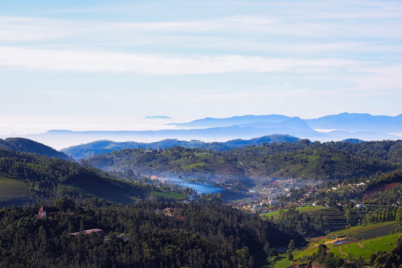
The Nilgiris plateau spans dramatic vertical terrain—ranging from the peaceful waters of Ooty Lake at 2,220 meters to the windswept summit of Doddabetta Peak at 2,637 meters (8,652 feet), the highest vantage point in the Nilgiri range. This substantial elevation gifts Ooty with an invigorating sub-tropical highland climate, mist-cloaked pine ridges, rolling tea plantations, and cool temperatures year-round. In this definitive 2026 geographical and travel guide, we examine Ooty’s exact height in meters and feet, landmark elevation waypoints, seasonal weather shifts, the UNESCO Nilgiri Mountain Railway ascent, and essential travel tips.
Topographical Zonation: From Foothills to Doddabetta Peak
The Nilgiri massif forms a junction where the Eastern Ghats meet the Western Ghats, rising sharply from the surrounding lowlands. As you ascend into the Ooty highlands, the landscape transitions through distinct ecological zones:
Foothill Deciduous Forest (Mettupalayam to Kallar, 300 m – 600 m): Warm, tropical deciduous woodlands populated by teak, bamboo, and wild elephants at the foot of the Nilgiri escarpment.
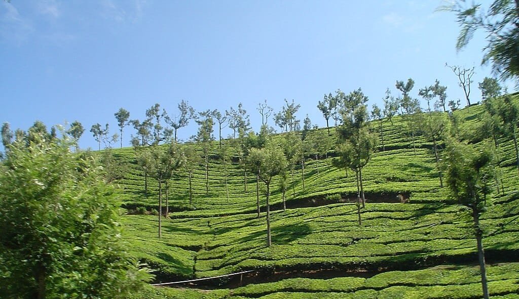
Sub-Montane Tea Slopes (Coonoor to Kotagiri, 1,600 m – 1,900 m): As elevation rises above 1,500 meters, temperatures drop significantly. This mist-drenched belt is dominated by terraced Camellia sinensis (tea) bushes, orange groves, and eucalyptus plantations. (Compare with another popular tea hub in our guide to Munnar Height From Sea Level).
High Montane Shola-Grassland Mosaic (Ooty to Doddabetta, 2,200 m – 2,637 m): The highest plateau tier is defined by undulating montane grasslands interspersed with sheltered evergreen shola forest patches. Indigenous tree species like Rhododendron arboreum nilagiricum thrive alongside crystal-clear glacial streams.
How Ooty’s 2,240-Meter Elevation Shapes Its Unique Climate
Because Ooty sits 2,240 meters above sea level, it avoids the tropical heat of the southern plains (such as Coimbatore at 411 m or Chennai at 6 m). Even during peak summer, daytime highs rarely exceed 22°C, while winter nights frequently dip near the freezing mark:
Season
Calendar Months
Temperature Range
Weather Experience & Packing Guide
Summer (Peak Season)
March to June
10°C to 22°C
Pleasant, sunny days; cool mountain breeze. Light woolens and jackets required for evenings.
Southwest Monsoon
July to September
11°C to 18°C
Heavy continuous showers, dense fog, and lush green moss. Waterproof jackets and umbrellas essential.
Post-Monsoon (Autumn)
October to November
9°C to 19°C
Crisp skies, scenic valley visibility, and mist-covered lakes. Medium woolens recommended.
Winter (Frost Season)
December to February
3°C to 16°C (Occasional 0°C)
Chilly mornings with ground frost across open meadows; heavy woolens and thermals required.
Elevation Comparison: Ooty vs. Major Indian Hill Stations
To understand Ooty’s place among India’s premier mountain destinations, compare its 2,240-meter altitude with other major hill stations across South and North India:
Top Sightseeing Attractions Influenced by Altitude
Ooty’s high-altitude setting shapes each of its most popular sightseeing destinations:
Doddabetta Peak (2,637 m): Located 9 km from Ooty town, this peak offers a popular viewpoint over the Nilgiris. The Tamil Nadu Tourism Development Corporation (TTDC) maintains an octagonal Telescope House here, offering 360-degree views of the Chamundi Hills and the Coimbatore plains on clear days.
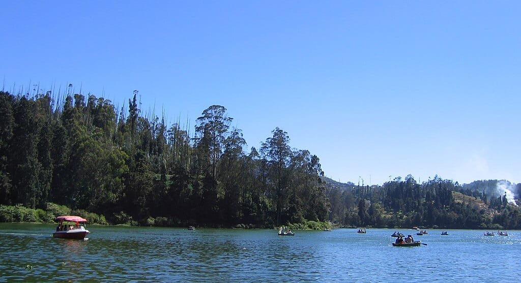
Ooty Lake (2,220 m): An artificial lake spanning 65 acres, constructed by John Sullivan in 1824 by damming mountain mountain streams. Visitors can rent rowboats, motorboats, and pedal boats framed by tall blue gum (eucalyptus) trees.
Government Botanical Garden (2,250 m): Established in 1848 by British botanist William Graham McIvor, this garden spans 55 terraced acres across the lower slopes of Doddabetta Peak. It features over a thousand exotic temperate plant species, lush fern houses, and a 20-million-year-old fossilized tree trunk.
Pykara Lake & Waterfalls (2,130 m): Situated 21 km from town on the Ooty–Mysore road, Pykara is considered sacred by the indigenous Toda community. The river flows through quiet shola forests before plunging down two stepped cascades into a serene reservoir.
Avalanche & Emerald Lakes (2,150 m – 2,180 m): Located in the Upper Bhavani region roughly 25 km south of Ooty, these high-altitude lakes offer scenic, uncommercialized nature retreats, bordered by dense pine woodlands, tea gardens, and trout hatcheries.
Ascending to 2,240 Meters: Nilgiri Mountain Railway (UNESCO World Heritage)
The journey up to Ooty’s high elevation is an attraction in itself, most famously experienced via the Nilgiri Mountain Railway (NMR):
Engineering Marvel (Abt Rack-and-Pinion System): Completed in 1908 and designated a UNESCO World Heritage Site in 2005, the 46-km meter-gauge railway climbs from Mettupalayam (326 m) to Ooty (2,240 m). The train tackles an extreme average gradient of 1 in 12.5 using an alternate-biting rack rail system powered by historic steam locomotives.
Scenic Route Waypoints: The 4.5-hour uphill journey passes through 16 tunnels, 250 bridges, and steep mountain curves, with stops at Kallar, Adderley, Hillgrove, Runnymede, Coonoor, Wellington, Aravankadu, and Lovedale before arriving at Udhagamandalam station.
Road Access via Ghat Roads: Travelers driving from Bangalore or Mysore climb through Bandipur and Mudumalai Tiger Reserves via the Kalhatty Ghat road (featuring 36 hairpin bends) or via Gudalur. Travelers arriving from Coimbatore ascend via the smooth four-lane highway through Mettupalayam and Coonoor along NH-181. (Commuters connecting via northern road transit can reference our guide to Sector 17 Chandigarh Bus Stand).
Health, Acclimatization & Travel Tips at High Altitude
At 2,240 meters (7,350 feet), Ooty provides crisp mountain air without the risks of severe altitude sickness associated with high Himalayan elevations:
No Risk of Acute Mountain Sickness (AMS): Medical altitude sickness generally only occurs above 2,500 to 2,800 meters. Ooty’s elevation is safe for senior citizens, toddlers, and individuals with cardiovascular conditions.
Skin Protection & UV Radiation: UV radiation increases by roughly 10% to 12% for every 1,000 meters of elevation gain. Carry broad-spectrum sunscreen (SPF 30+) and sunglasses to protect against high-altitude solar glare, especially while visiting open peaks like Doddabetta.
Layered Clothing Year-Round: While daytime temperatures can be comfortable in cotton clothing, evening temperatures drop rapidly. Always pack a windproof fleece, woolen caps for children, and comfortable walking shoes for hilly pathways.
Frequently Asked Questions (FAQs)
What is the exact Ooty Height From Sea Level?
Ooty (Udhagamandalam) sits at an average altitude of approximately 2,240 meters (7,350 feet) above sea level, while nearby Doddabetta Peak reaches up to 2,637 meters (8,652 feet).
Is Ooty higher than Kodaikanal and Munnar?
Yes. Ooty (2,240 m) is higher than both Kodaikanal (2,133 m) and Munnar (1,532 m), making it one of the highest major hill station settlements in South India.
Does it ever snow in Ooty?
No, Ooty does not experience snowfall due to its tropical latitude in South India. However, during peak winter nights in December and January, temperatures can drop close to 0°C, producing thick morning ground frost across valleys and golf links.
What is the nearest airport to Ooty?
The nearest airport is Coimbatore International Airport (CJB), located approximately 88 km away, taking around 3 to 3.5 hours by road via NH-181.


Comments are closed.