Mahabaleshwar Height From Sea Level (2026 Exact Elevation, Wilson Point, Weather & Western Ghats Travel Guide) – Perched atop the Sahyadri mountain range in the Satara district of Maharashtra, Mahabaleshwar sits at an average elevation of 1,353 meters (4,439 feet) above sea level. Celebrated as the premier hill retreat of Western India and the historic summer capital of the Bombay Presidency during the British era, this elevated laterite plateau towers dramatically above the Konkan coastal plains. The plateau spans diverse vertical topography—ranging from the serene waters of Venna Lake at 1,320 meters to the windswept summit of Wilson Point (Sunrise Point) rising to 1,439 meters (4,721 feet), the highest geographic point in the region.
This substantial altitude provides Mahabaleshwar with a cool sub-tropical highland climate, heavy monsoon downpours that feed five sacred rivers, and the ideal microclimate for cultivating over 85% of India’s commercial strawberries. In this comprehensive 2026 geographic and travel guide, we examine Mahabaleshwar’s exact elevation in meters and feet, landmark vantage points, seasonal climate patterns, driving routes from Mumbai and Pune, and practical travel advice.
Geographic Landmark / Parameter
Elevation (Meters)
Elevation (Feet)
Topographical Role & Significance
Wilson Point (Sunrise Point)
1,439 m
4,721 ft
Highest elevation summit in Mahabaleshwar; 360-degree sunrise panorama
Arthur’s Seat (Queen of Points)
1,470 m (Ridge Peak)
4,822 ft
Dramatic cliff drop overlooking the Savitri River basin and Konkan valley
Mahabaleshwar Town Centre (Market)
1,353 m
4,439 ft
Official municipal datum; central commercial and hotel core
Old Mahabaleshwar (Panchganga)
1,372 m
4,501 ft
Sacred origin spring of Krishna, Koyna, Venna, Savitri & Gayatri rivers
Kate’s Point & Needle Hole Rock
1,290 m
4,232 ft
Natural rock arch formation overlooking Balakwadi and Dhom reservoirs
Venna Lake & Boating Pier
1,320 m
4,330 ft
Scenic high-altitude freshwater lake constructed by the Raja of Satara
Mahabaleshwar’s dramatic geography is shaped by the Western Ghats (Sahyadris), a UNESCO World Heritage biodiversity hotspot. The plateau rises precipitously from the Konkan lowlands on the west while sloping gently toward the Deccan plateau on the east:
The High Tableland Plateau (1,300 m to 1,440 m): The town of Mahabaleshwar and neighboring Panchgani rest on massive basaltic lava flows formed millions of years ago by the Deccan Traps volcanism. Heavy tropical weathering has left a thick crust of porous, iron-rich red laterite soil, creating the foundation for the region’s strawberry and berry farming.
The Konkan Coastal Escarpment: Along viewpoints like Arthur’s Seat, Elphinstone Point, and Lodwick Point, vertical cliffs plunge over 800 meters into the Savitri and Koyna river valleys below, generating updrafts that allow light objects thrown from the cliffs to float back upward.
The Five Holy Rivers Origin (Panchganga): Situated at 1,372 meters in Old Mahabaleshwar, the ancient stone Panchganga Temple houses a natural spring issuing from the mouth of a sculpted cow (Gomukh), reverently believed to represent the confluence of five sacred rivers: the Krishna, Venna, Koyna, Savitri, and Gayatri.
How 1,353-Meter Altitude Shapes Mahabaleshwar’s Climate
Due to its high altitude, Mahabaleshwar remains significantly cooler than the surrounding Maharashtra plains year-round, escaping the humid heat of Mumbai and the dry heat of Pune:
Season
Calendar Months
Typical Temperatures
Atmospheric Experience & Highlights
Summer (Sightseeing Peak)
March to June
16°C to 30°C
Pleasant daytime breezes, clear mountain skies; annual Strawberry Festival held in April–May.
Monsoon (The Deluge)
July to September
15°C to 20°C
Intense orographic rainfall (5,500+ mm); roaring waterfalls like Lingmala and Dhobi Falls.
Post-Monsoon (Lush Greenery)
October to November
13°C to 26°C
Crisp skies, vibrant green valleys, full lakes, and optimal visibility across viewpoints.
Winter (Chilly Retreat)
December to February
10°C to 24°C (Occasional 8°C)
Chilly mornings with fog rolling across Venna Lake; perfect for romantic weekend getaways.
The Strawberry Capital: Why Elevation Matters for Berry Farming
Mahabaleshwar accounts for roughly 85% of India’s total strawberry harvest, alongside raspberries, mulberries, and blueberries. This agricultural success is directly tied to its unique elevation:
Temperature Equilibrium: Strawberry crops require warm, sunny days (20°C to 25°C) paired with cold nights (8°C to 12°C) during winter and early spring to trigger heavy sugar synthesis and flowering. The 1,353-meter plateau provides this exact balance.
Red Lateritic Soil Drainage: The porous volcanic laterite soil on the high plateau sheds excessive standing water rapidly while retaining moisture, protecting root systems from rot.
Agritourism: Visitors between December and April can tour commercial strawberry farms along the Mahabaleshwar–Panchgani road, sample fresh strawberries with whipped cream at Mapro Garden, and pick berries directly from the fields.
Elevation Comparison: Mahabaleshwar vs. Other Hill Stations
To understand Mahabaleshwar’s topographic standing, compare its 1,353-meter altitude against popular Sahyadri, Western Ghats, and Northern Himalayan hill stations:
Top High-Altitude Sightseeing Viewpoints in Mahabaleshwar
Each major viewpoint highlights a unique perspective of the Sahyadri plateau:
Wilson Point (1,439 m): The highest plateau in the region, featuring three spacious masonry observation towers. Named after Sir Leslie Wilson, Governor of Bombay, it provides panoramic views of sunrise over the surrounding valleys.
Arthur’s Seat (1,470 m Ridge): Known as the “Queen of Points,” this cliff formation honors Sir Arthur Malet. The viewpoint overlooks the dramatic Savitri gorge on the right and the deep green Brahma-Arayna valley on the left.
Kate’s Point & Needle Hole (1,290 m): Famous for its natural rock formation that features a distinct gap resembling a needle eye, with scenic vistas over the Balakwadi reservoir.
Venna Lake (1,320 m): A 28-acre lake constructed in 1842, offering pedal and row boating framed by eucalyptus and pine trees along its shores.
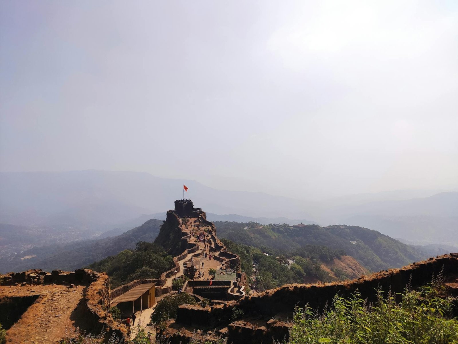
Pratapgad Fort (1,080 m): Situated 22 km from town on an isolated mountain spur, this 17th-century fortress was the site of the historic Battle of Pratapgad between Chhatrapati Shivaji Maharaj and Afzal Khan. (Exploring other historical getaways? Read our travel guide to Offbeat Places Near Bangalore).
How to Reach Mahabaleshwar: Ghat Routes & Distances
Ascending to 1,353 meters is an accessible and scenic road journey from the major urban hubs of Maharashtra:
From Pune (~120 km / 2.5 to 3 Hours): Take NH 48 (Pune–Bengaluru Highway) past Shirwal and Shirwal Ghat to Surur, turn toward Wai, and ascend through the winding curves of Pasarni Ghat into Panchgani and Mahabaleshwar.
From Mumbai (~240 km / 5 to 5.5 Hours): Drive via the Mumbai–Pune Expressway, bypass Pune on NH 48, and follow the route via Wai; alternatively, take the scenic coastal route along NH 66 through Mangaon and climb via the steep Poladpur Ghat past Pratapgad.
Nearest Airport & Railhead: The nearest major international airport is Pune International Airport (PNQ) (~125 km), while the closest railway station with broad connectivity is Satara (58 km) or Pune Junction (120 km). (Commuters linking across northern transit hubs can reference our guide to Sector 17 Chandigarh Bus Stand).
Travel Tips for Visiting at 1,353 Meters Elevation
Make the most of your trip with these practical high-altitude travel tips:
No Altitude Sickness (AMS): Because Mahabaleshwar sits at 1,353 meters—well below the 2,500-meter threshold where acute altitude sickness begins—travelers of all ages, including young children and seniors, can visit without needing acclimatization days.
Pack Light Woolens for Evenings: Even during summer months, evening winds blowing across the plateau can cause temperatures to drop to 16°C. Carry a light jacket, cardigan, or shawl for night strolls around the town market.
Monsoon Precautions: If traveling between July and September, equip your vehicle with fresh wiper blades and reliable tyres to navigate dense mountain fog and heavy rainfall along Pasarni Ghat.
Frequently Asked Questions (FAQs)
What is the exact Mahabaleshwar Height From Sea Level?
Mahabaleshwar sits at an average altitude of approximately 1,353 meters (4,439 feet) above sea level, while its highest geographic summit at Wilson Point reaches 1,439 meters (4,721 feet).
Which is higher: Mahabaleshwar or Panchgani?
Mahabaleshwar (1,353 m) is slightly higher than Panchgani (1,334 m) by roughly 19 meters, giving it slightly cooler temperatures and denser forest cover.
Why is Mahabaleshwar called the Strawberry Capital of India?
Its high elevation of 1,353 meters delivers cool night temperatures and well-drained volcanic laterite soils that create the ideal microclimate for growing strawberries, accounting for roughly 85% of India’s commercial production.
Does it ever snow in Mahabaleshwar?
No, Mahabaleshwar does not experience snowfall due to its tropical latitude in peninsular India. However, during peak winter nights in December and January, temperatures occasionally drop to 8°C with morning valley mists.