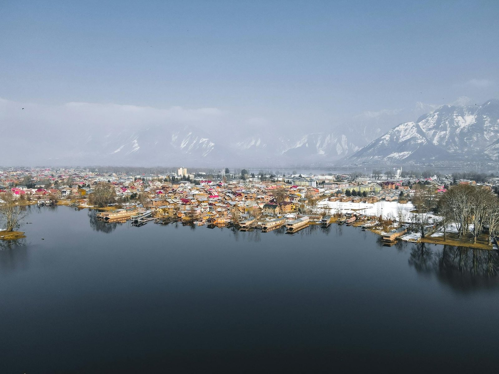
Srinagar Height From Sea Level (2026 Exact Elevation, Weather, Dal Lake & Kashmir Travel Guide) – Nestled in the heart of the Kashmir Valley along the meandering banks of the Jhelum River, Srinagar sits at an average elevation of 1,585 meters (5,200 feet) above sea level. Celebrated worldwide as the “Venice of the East” and the summer capital of Jammu & Kashmir, Srinagar serves as the primary gateway to the high-altitude landscapes of the Western Himalayas. The city’s geography is framed by dramatic vertical relief: from the calm waters of Dal Lake at 1,582 meters and the sacred vantage of Shankaracharya Hill rising to 1,850 meters (6,070 feet) to the imposing Zabarwan Mountain Range anchored by Mahadev Peak at nearly 3,966 meters.
This moderate altitude gives Srinagar a temperate highland climate marked by pleasant summers, vibrant golden chinar foliage in autumn, and snow-draped landscapes during winter. In this comprehensive 2026 geographic reference guide, we examine Srinagar’s exact height in meters and feet, zone-wise hill altitudes, four-season climate patterns, altitude safety for tourists, and essential road trip tips.
Geographic Landmark / Parameter
Elevation (Meters)
Elevation (Feet)
Topographical Role & Significance
Srinagar Municipal City Datum
1,585 m
5,200 ft
Official municipal valley floor benchmark
Dal Lake (Water Surface Level)
1,582 m
5,190 ft
World-famous lake with floating gardens and historic wooden houseboats
Srinagar’s distinct geography is shaped by its location within an intermontane valley basin carved by tectonic movements and ancient lake sedimentations (known locally as karewas):
The Valley Trough (1,580 m to 1,600 m): Srinagar lies nestled in an elliptical bowl bounded by the Pir Panjal Range to the southwest and the Greater Himalayas to the northeast. This geographic setting buffers the city from the extreme winter winds of the Tibetan plateau while creating a natural drainage channel for the Jhelum River.
The Zabarwan Foothills: Along the eastern fringe of Dal Lake, the topography rises steeply into the Zabarwan hills. Here, historic Mughal gardens like Shalimar Bagh, Nishat Bagh, and Chashme Shahi utilize natural mountain springs descending from the heights to power terraced fountains and cascading water chutes without mechanical pumps.
Urban Hillocks: Isolated summits like Shankaracharya Hill and Hari Parbat provide natural vantage points rising 75 to 265 meters above the valley floor, offering complete views across the old city’s wooden architecture and surrounding waterways.
How 1,585-Meter Elevation Shapes Srinagar’s Climate
Because Srinagar sits at 1,585 meters, its weather is classified as a Mediterranean-influenced humid subtropical to temperate highland climate, characterized by four distinct seasons:
Season
Calendar Months
Typical Temperatures
Atmospheric Experience & Highlights
Spring (Bloom & Renewal)
March to April
8°C to 20°C
Pleasant afternoon breezes; millions of tulips bloom at the Zabarwan foothills garden.
Summer (Sightseeing Peak)
May to August
15°C to 30°C
Warm, sunny days with cool evenings; ideal for shikara cruises and houseboat stays.
Autumn / Harud (Golden Season)
September to November
4°C to 22°C
Crisp skies and minimal rainfall; leaves of majestic Chinar trees turn fiery crimson and amber.
Winter / Chillai Kalan (Snow Season)
December to February
-6°C to 10°C
Sub-zero nighttime chills; moderate snowfall covers roofs and Dal Lake edges partially freeze.
Elevation Comparison: Srinagar vs. Regional & National Hill Stations
To understand Srinagar’s altitude in perspective, compare its 1,585-meter valley height against nearby mountain resorts in Jammu & Kashmir and other prominent hill destinations:
Health & Acclimatization: Does Srinagar Cause Altitude Sickness?
One of the most frequent health concerns among prospective travelers is whether visiting Srinagar causes Acute Mountain Sickness (AMS):
No Altitude Sickness in Srinagar City: Medical guidelines define high altitude as beginning at 2,500 meters (8,200 feet). Because Srinagar sits at 1,585 meters, atmospheric oxygen levels remain close to normal. Senior citizens, young toddlers, and visitors with hypertension or mild cardiac conditions can comfortably visit without acclimatization days.
Day Excursion Precautions (Gulmarg & Sonmarg): When taking day trips from Srinagar to higher meadows, the altitude jump becomes significant:
Gulmarg Gondola Phase 2: Reaches 3,980 meters (13,057 feet) near Apharwat Peak, where oxygen levels drop to around 65% of sea level. Take slow steps and stay hydrated.
Transit to Ladakh via Zoji La: Crossing Zoji La pass (3,528 m) toward Kargil and Leh requires gradual acclimatization. (Plan your Trans-Himalayan route using our guide to Leh Height From Sea Level and compare peaks in Highest Mountain Peak in India).
How to Reach Srinagar: Air, Rail & Highway Connectivity
Reaching Srinagar’s 1,585-meter valley floor is accessible via multiple transportation networks:
By Air: Sheikh ul-Alam International Airport (SXR) is situated approximately 12 km from Dal Lake, operating frequent domestic flights from New Delhi, Mumbai, Chandigarh, and Bengaluru.
By Rail: The landmark Udhampur–Srinagar–Baramulla Rail Link (USBRL) connects the Kashmir Valley directly to the national railway grid via the Chenab Bridge, terminating at Nowgam Srinagar Railway Station.
By Road (NH-44): The four-lane expressway connects Jammu to Srinagar across the Pir Panjal range via the Dr. Syama Prasad Mookerjee Tunnel (Chenani-Nashri) and the Banihal Qazigund Road Tunnel (Navyug Tunnel), reducing travel time to 6–7 hours. (Commuters connecting via northern bus transit hubs can check timetables in our guide to Sector 17 Chandigarh Bus Stand).
Frequently Asked Questions (FAQs)
What is the exact Srinagar Height From Sea Level?
Srinagar is situated at an average elevation of approximately 1,585 meters (5,200 feet) above sea level, while Dal Lake rests at about 1,582 meters.
Does it snow in Srinagar during winter?
Yes. Due to its 1,585-meter altitude and northern latitude, Srinagar experiences snowfall between late December and mid-February, particularly during the 40-day core winter period known as Chillai Kalan.
Is Srinagar higher than Gulmarg and Pahalgam?
No. Srinagar (1,585 m) is lower than both Pahalgam (2,200 m) and Gulmarg (2,650 m), making it the warm base valley from which travelers venture into higher alpine destinations.
Do tourists need oxygen cylinders in Srinagar?
No. At 1,585 meters, oxygen levels are normal and safe for travelers of all ages. Supplementary oxygen is only needed for travelers with chronic pulmonary disorders ascending to high mountain passes like Apharwat Peak or Zoji La.