Kedarnath Height From Sea Level – Perched near the head of the Mandakini River in the Rudraprayag district of Uttarakhand, the sacred shrine of Kedarnath is one of the twelve Jyotirlingas of Lord Shiva and the most revered destination of the Char Dham and Panch Kedar pilgrimage circuits. Located at an elevation of 3,583 meters (11,755 feet) above sea level, Kedarnath is surrounded by towering snow-clad peaks, glacial moraines, and challenging alpine weather. Understanding Kedarnath’s exact altitude, atmospheric pressure, and the steep elevation gain from Gaurikund is essential for planning a safe, spiritually fulfilling trek. In this complete 2026 guide, we examine Kedarnath’s elevation profile, oxygen levels, acclimatization rules, Char Dham height comparisons, and safety guidelines.
Trek Elevation Profile: From Gaurikund to Kedarnath Dham
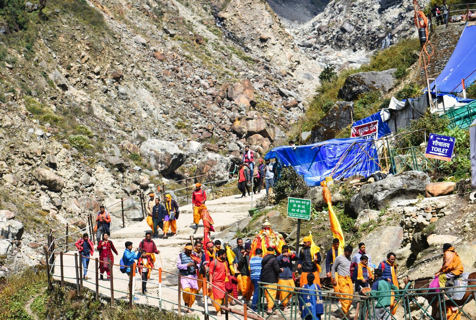
The trek to Kedarnath is physically demanding because it requires ascending approximately 1,600 vertical meters over a 16 km paved mountain trail. As you gain height, the atmospheric density drops progressively:
Gaurikund (Base Point): 1,982 m (6,502 ft) – The last motorable roadhead where pilgrims register permits, hire ponies/palkis, and begin on foot.
Jungle Chatti: ~2,400 m (7,874 ft) | 4 km from Gaurikund – Gradual uphill trail passing mountain tea stalls and basic medical aid booths.
Bheembali: ~2,700 m (8,858 ft) | 6 km from Gaurikund – Midway halt with tented accommodation, free drinking water, and panoramic views of the cascading Mandakini gorge.
Lincholi (New Route): ~3,150 m (10,335 ft) | 11 km from Gaurikund – Alpine zone begins; air becomes noticeably thinner, and temperatures drop sharply.
Kedarnath Base Camp: ~3,500 m (11,480 ft) | 15 km from Gaurikund – GMVN tourist huts, helipads, and oxygen emergency points.
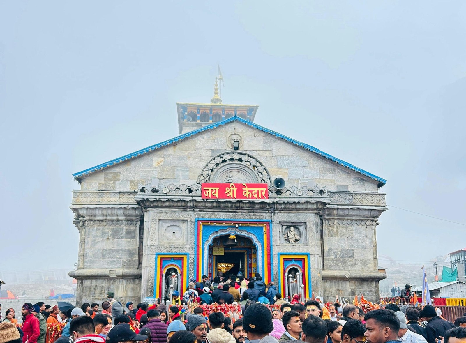
Kedarnath Temple: 3,583 m (11,755 ft) | 16 km point – Destination of the pilgrimage, surrounded by the towering Kedar Massif.
How Altitude Affects Oxygen Levels & Acute Mountain Sickness (AMS)
At 3,583 meters (11,755 feet), the atmospheric pressure is roughly one-third lower than at sea level. While the air still contains 21% oxygen, the reduced barometric pressure causes each breath to deliver fewer oxygen molecules to your bloodstream. Key health considerations include:
Blood Oxygen Saturation (SpO2): In low plains, normal resting SpO2 ranges between 95% and 99%. At Kedarnath’s altitude, healthy individuals often experience oxygen levels dropping to 80% to 88% until acclimatized.
Symptoms of Altitude Sickness: Throbbing headache, lightheadedness, nausea, breathlessness on slight exertion, loss of appetite, and insomnia.
Acclimatization Rules: Never rush directly from Rishikesh or Haridwar to the Kedarnath trek in a single day. Spend at least one night acclimatizing at intermediate altitudes like Guptkashi (1,319 m) or Sonprayag (1,829 m) before undertaking the climb.
Hydration is Key: Drink 3 to 4 liters of water, electoral (ORS), or warm lemon-honey water throughout the trek to assist blood oxygenation.
Elevation Comparison: Kedarnath vs. Other Himalayan Shrines
Kedarnath is the highest among the Chota Char Dham shrines of Uttarakhand, requiring greater physical conditioning than Badrinath or Gangotri:
Pilgrimage Shrine
State / Region
Height in Meters
Height in Feet
Road Accessibility
Amarnath Cave
Jammu & Kashmir
3,888 m
12,756 ft
Trek / Helicopter only
Tungnath Temple (Highest Shiva Temple)
Uttarakhand
3,680 m
12,073 ft
3.5 km Trek from Chopta
Kedarnath Temple
Uttarakhand
3,583 m
11,755 ft
16 km Trek / Helicopter
Gangotri Temple
Uttarakhand
3,415 m
11,204 ft
Fully Motorable by Road
Yamunotri Temple
Uttarakhand
3,293 m
10,804 ft
6 km Trek from Janki Chatti
Badrinath Temple
Uttarakhand
3,133 m
10,279 ft
Fully Motorable by Road
Vaishno Devi Temple
Jammu & Kashmir
1,585 m
5,200 ft
12 km Paved Trek / Battery Car
High-Altitude Attractions Near Kedarnath
If you are properly acclimatized and have extra time, several sacred high-altitude landmarks surround the temple valley:
Bhairavnath Temple (~3,650 m / 11,975 ft): Perched on a steep ridge 1 km east of Kedarnath. Dedicated to Lord Bhairav, the fierce guardian deity of the valley during winter snows.
Chorabari Tal / Gandhi Sarovar (~3,900 m / 12,795 ft): A pristine glacial lake situated 3 km uphill from Kedarnath at the foot of Kedar Dome, where Mahatma Gandhi’s ashes were immersed in 1948.
Vasuki Tal (~4,135 m / 13,566 ft): An advanced high-altitude alpine lake known for rare Brahma Kamal flowers, located roughly 8 km across technical moraine trails.
Helicopter Alternatives for High-Altitude Travel
For senior citizens, young children, or pilgrims with cardiovascular or respiratory concerns, official helicopter shuttle services bypass the 16 km climb:
Operating Helipads: Guptkashi, Phata, and Sersi.
Flight Duration: Approximately 5 to 9 minutes each way.
Official Booking: Authorized government bookings are strictly managed through the IRCTC HeliYatra portal (heliyatra.irctc.co.in). Always verify tickets against fraudulent third-party booking agents.
Frequently Asked Questions (FAQs)
What is the exact height of Kedarnath from sea level?
Kedarnath Temple is situated at an elevation of 3,583 meters (11,755 feet) above sea level in the Garhwal Himalayas of Uttarakhand.
Is oxygen low at Kedarnath?
Yes. Due to lower atmospheric pressure at 11,755 feet, available oxygen levels feel significantly lower than in plain areas. Normal blood oxygen levels can dip below 85%, making slow walking, hydration, and acclimatization essential.
Which is higher: Kedarnath or Badrinath?
Kedarnath (3,583 m / 11,755 ft) is significantly higher than Badrinath (3,133 m / 10,279 ft). Additionally, while Badrinath is accessible directly by vehicle, reaching Kedarnath requires a 16 km uphill mountain trek or helicopter flight.


Comments are closed.