
Yamunotri Height From Sea Level – Altitude, Geography & Travel Guide
Yamunotri Height From Sea Level (2026 Exact Elevation, Janki Chatti Trek, Surya Kund & Char Dham Guide) – Perched dramatically against the sheer granite cliffs of the western Garhwal Himalayas in Uttarakhand’s Uttarkashi district, Yamunotri Temple sits at an altitude of approximately 3,293 meters (10,804 feet) above sea level. Revered as the seat of Goddess Yamuna and the sacred first destination on the traditional Chhota Char Dham Yatra, Yamunotri represents a profound union of spiritual devotion, challenging alpine trekking, and boiling geothermal phenomena.
While pilgrims worship at the temple along the banks of the young river, the true hydrological source of the sacred Yamuna River lies further up the rugged Kalind Mountain at the Champasar Glacier and Saptarishi Kund, elevated at 4,421 meters (14,505 feet). In this definitive 2026 geographic and pilgrimage reference guide, we examine Yamunotri’s exact height in meters and feet, the 6 km Janki Chatti trek gradient, the boiling waters of Surya Kund (88°C), Char Dham elevation comparisons, seasonal weather, and altitude safety tips.
| Geographic / Pilgrimage Landmark | Height in Meters (MSL) | Height in Feet (MSL) | Topographical Significance & Role |
|---|---|---|---|
| Yamunotri Temple Shrine | 3,291 m – 3,293 m | 10,797 ft – 10,804 ft | Seat of Goddess Yamuna / First stop of Char Dham circuit |
| Janki Chatti (Trek Basecamp) | 2,650 m | 8,694 ft | Motorable road terminus, pony stands & base lodges |
| Kharsali Village (Winter Abode) | 2,675 m | 8,776 ft | Winter seat of Goddess Yamuna & passenger helipad |
| Surya Kund Geothermal Spring | 3,290 m | 10,794 ft | Natural boiling hydrothermal spring (88°C to 90°C) |
| Champasar Glacier (Actual Source) | 4,421 m | 14,505 ft | Glacial origin and physical birth of the Yamuna River |
| Saptarishi Kund (Glacial Lake) | 4,421 m | 14,505 ft | High-altitude alpine cirque lake & mountaineering trail |
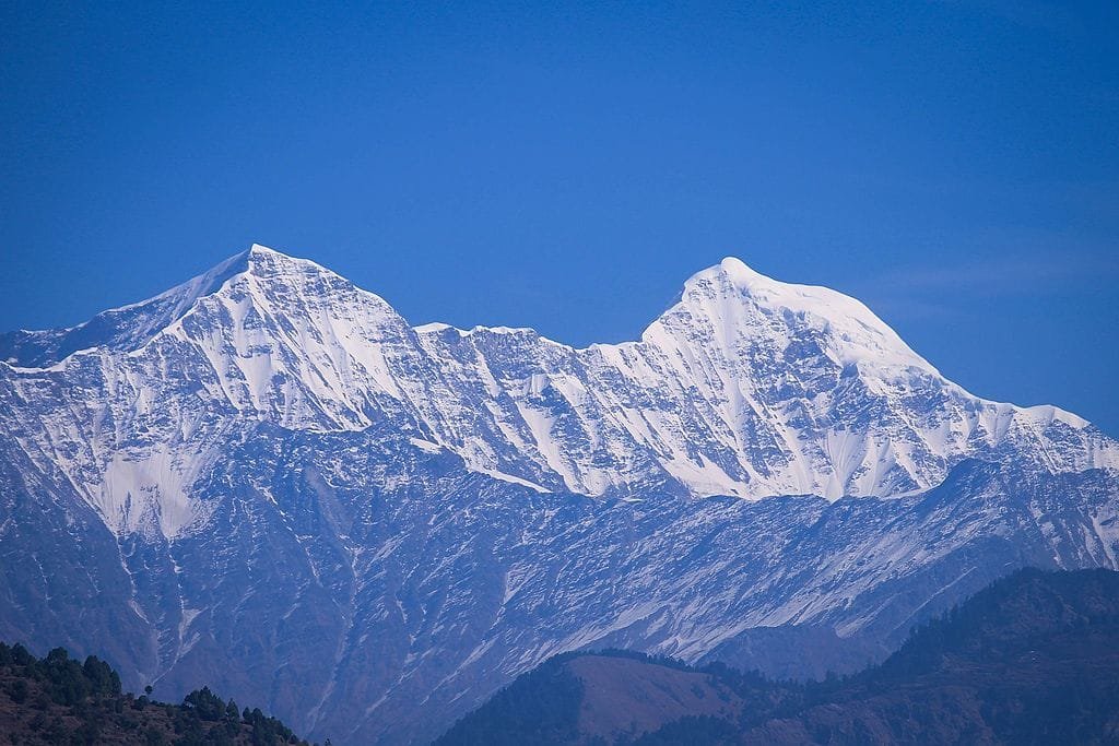
| Bandarpunch Massif (Summit) | 6,316 m | 20,722 ft | Glacier-clad peak towering directly over the shrine |
Topography: The Temple Shrine vs. The Glacial Source
When studying the elevation of Yamunotri, pilgrims and geography enthusiasts must distinguish between the consecrated temple shrine where darshan takes place and the actual glacial birth of the river:
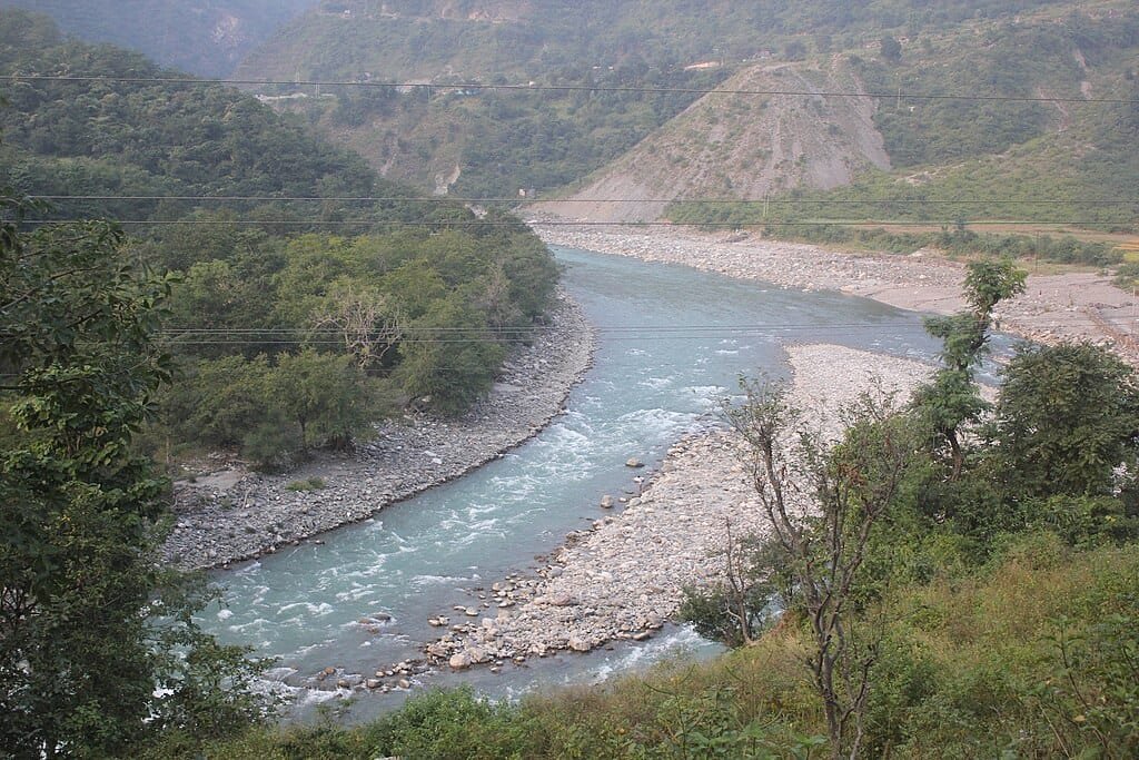
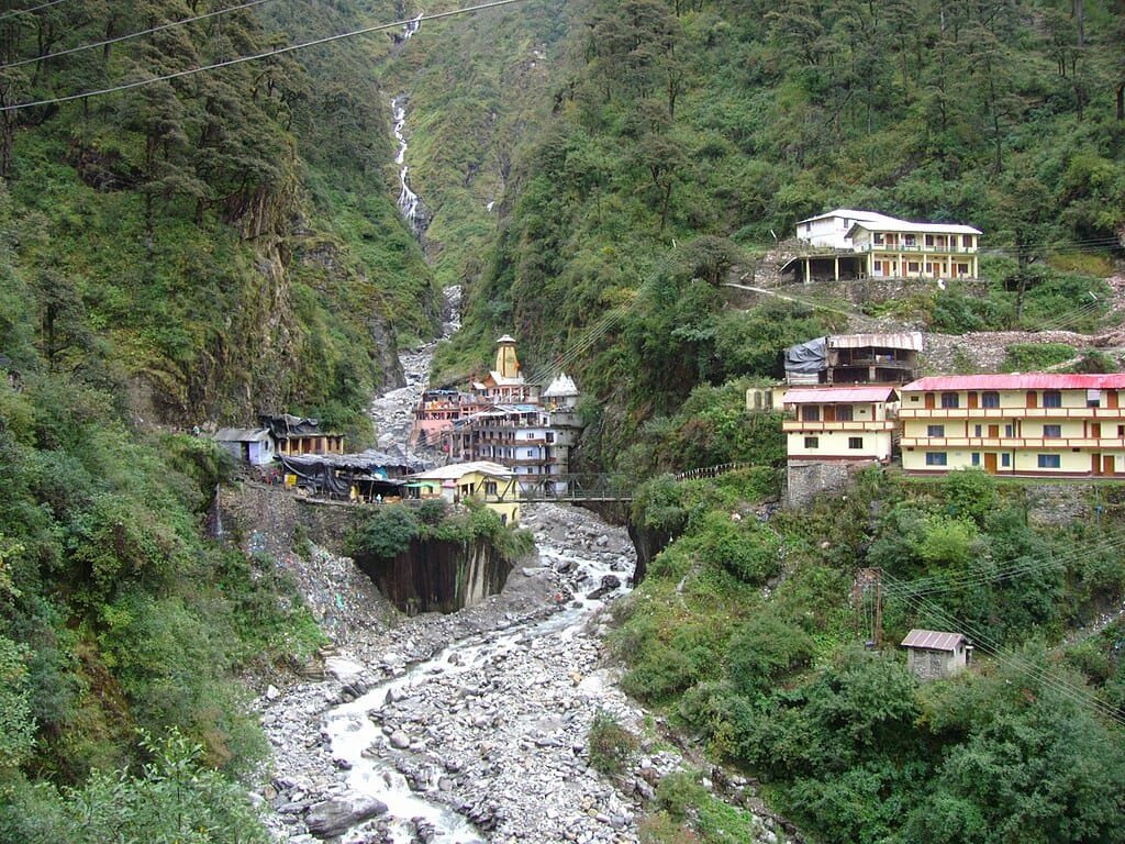
- Yamunotri Temple Shrine (3,293 m / 10,804 ft): Situated on the left bank of the nascent Yamuna River, the main temple was originally constructed by Maharaja Pratap Shah of Tehri Garhwal. The sanctum sanctorum houses a revered black marble idol of Goddess Yamuna. This marks the culmination point for standard Char Dham yatra pilgrims.
- Champasar Glacier & Saptarishi Kund (4,421 m / 14,505 ft): The true physical origin of the river lies approximately 1,128 vertical meters above the temple at the base of Kalind Parvat. Reaching this glacial lake requires a demanding 10-to-12 km expedition through scree fields, steep knife-edge ridges, and moraine ice, accessible only to experienced mountaineers accompanied by certified local guides.
- The Bandarpunch Massif (6,316 m / 20,722 ft): Translating to “Monkey’s Tail” (associated with Lord Hanuman in the Ramayana), this glaciated massif feeds both the Yamuna and Ganga river basins and provides the backdrop for the shrine.
The Trek Route: Ascending from Janki Chatti to Yamunotri
Unlike Gangotri and Badrinath, which are accessible directly by motorable highways, reaching Yamunotri requires an uphill foot trek from the valley floor:
- The Trailhead at Janki Chatti (2,650 m): All private cars, tourist buses, and shared taxis terminate at Janki Chatti, which features hotels, guest houses, and administrative check-posts.
- The 6-Kilometer Trail Gradient: The trek ascends 643 vertical meters (2,110 feet) over a 6 km distance. The entire path is stone-paved and protected with steel safety railings, following the roaring Yamuna gorge via Phool Chatti and Bhairon Ghati. An average hiker takes 3 to 4.5 hours to reach the temple on foot.
- Transit Alternatives: Government-regulated ponies, mules, dandis (palanquins carried by four porters), and pithus (baskets carried on porters’ backs) are readily available for booking at the official Janki Chatti terminal.
- Helicopter & Ropeway Connectivity: VIP helicopter charter services operate to the Kharsali Helipad (~2,675 m). Additionally, the upcoming Janki Chatti to Yamunotri Passenger Ropeway project is engineered to bridge the vertical climb in approximately 15 minutes.
Geothermal Marvels: Surya Kund and Gauri Kund
Despite being surrounded by snow-covered Himalayan peaks and freezing glacier waters, the immediate surroundings of Yamunotri Temple are marked by intense hydrothermal activity:
- Surya Kund (Thermal Spring): Named after the Sun God (Surya Dev, father of Goddess Yamuna in Hindu cosmology), this boiling geothermal vent bubbles up at temperatures of 88°C to 90°C (190°F to 194°F). Pilgrims pack raw rice, potatoes, and lentils into small muslin cloth pouches (potlis) and immerse them in the thermal spring; the food cooks thoroughly within minutes and is carried home as sanctified prasad.
- Divya Shila: A dark rock pillar positioned adjacent to Surya Kund that devotees traditionally revere and worship before entering the main temple.
- Gauri Kund: A designated bathing tank where boiling thermal water mixes with cold mountain runoff, allowing pilgrims to take a purifying holy dip in comfortably warm water before offering prayers.
Char Dham Elevation Comparison (Yamunotri in Perspective)
To understand the high-altitude challenges of the Uttarakhand pilgrimage circuit, review the comparative heights of all four sacred shrines:
| Pilgrimage Shrine | Elevation (Meters) | Elevation (Feet) | District | Traditional Yatra Order |
|---|---|---|---|---|
| Tungnath Temple | 3,680 m | 12,073 ft | Rudraprayag | Highest Shiva Shrine (Panch Kedar) |
| Kedarnath Dham | 3,583 m | 11,755 ft | Rudraprayag | Third Shrine (Highest of the Char Dham) |
| Yamunotri Dham | 3,293 m | 10,804 ft | Uttarkashi | First Shrine (Traditional Starting Point) |
| Badrinath Dham | 3,133 m | 10,279 ft | Chamoli | Fourth & Final Shrine |
| Gangotri Dham | 3,100 m | 10,170 ft | Uttarkashi | Second Shrine (Motorable Roadhead) |
| Auli Ski Slopes | 2,800 m | 9,186 ft | Chamoli | Premier Himalayan Ski Resort |
Yamunotri is traditionally the first shrine visited on the Char Dham circuit because the river Yamuna is considered the elder sister of the Ganga. At nearly 3,300 meters, it serves as the pilgrim’s initial introduction to high-altitude Himalayan terrain.
Climate, Seasons & Temple Opening Schedule
- Opening & Closing Windows: The portals of Yamunotri Temple open annually on the auspicious day of Akshaya Tritiya (late April or early May) and close on Bhai Dooj (October/November) following Diwali. During the harsh winter months when heavy snow covers the shrine, the symbolic deity is moved to the nearby village of Kharsali for daily winter worship.
- Summer Pilgrimage (May to June): Daytime temperatures range between 10°C and 18°C, with nights cooling down to 4°C to 8°C. This is the peak yatra season, offering stable trail conditions.
- Monsoon Warnings (July to August): The mountain roads of Uttarkashi receive heavy rain, creating risks of rockfalls and landslides along the Dharasu–Barkot–Janki Chatti highway. Check Uttarakhand State Disaster Management Authority (USDMA) bulletins before traveling.
- Post-Monsoon Autumn (September to October): Crisp mountain air, clear views of Bandarpunch, and manageable crowds make autumn an ideal time for seasoned travelers.
Altitude Sickness (AMS) & Health Guidelines (3,293 m)
Because the trek crosses the 3,000-meter threshold, Acute Mountain Sickness (AMS) can affect pilgrims who ascend too rapidly from the plains:
- Staged Ascent: Break your drive with an overnight rest at Barkot (~1,220 m) or Janki Chatti (~2,650 m) before starting the 6 km climb to Yamunotri.
- Hydration is Key: Cold, dry mountain winds speed up dehydration, which can trigger altitude headaches. Drink 3 to 4 liters of warm water, oral rehydration salts (ORS), and soups daily.
- Pace Your Climb: Walk at a steady, rhythmic pace. If you experience dizziness, throbbing headaches, or breathlessness while resting, stop at the covered shelters along the route and allow your heart rate to normalize.
Travel Routes & How to Reach Yamunotri
To reach the basecamp at Janki Chatti, pilgrims travel through scenic Garhwal highway routes:
- Route via Dehradun / Mussoorie: Dehradun → Mussoorie → Damta → Naugaon → Barkot → Hanuman Chatti → Janki Chatti (~220 km, approx. 7 to 8 hours drive).
- Route via Rishikesh & Tehri: Rishikesh → Chamba → New Tehri (visit the monumental Highest Dam in India (Tehri Dam)) → Dharasu Bend → Barkot → Janki Chatti (~235 km).
- Nearest Airport: Jolly Grant Airport, Dehradun (DED) – located approximately 210 km from Janki Chatti.
- Nearest Railway Station: Dehradun Railway Station (~175 km) or Rishikesh / Haridwar (~220 km). Travelers starting from Chandigarh can plan their road links from Sector 17 Chandigarh Bus Stand.
Frequently Asked Questions (FAQs)
What is the exact yamunotri height from sea level?
Yamunotri Temple is located at an altitude of 3,293 meters (10,804 feet) above sea level in the Uttarkashi district of Uttarakhand.
What is the distance and difficulty of the trek from Janki Chatti to Yamunotri?
The trek is 6 kilometers long, ascending 643 vertical meters from Janki Chatti (2,650 m) to Yamunotri (3,293 m). It is moderately challenging, featuring continuous paved uphill gradients that take 3 to 4.5 hours on foot.
Is Yamunotri higher than Gangotri and Badrinath?
Yes. Yamunotri (3,293 m) is higher than both Badrinath (3,133 m) and Gangotri (3,100 m). Among the four Char Dham shrines, only Kedarnath (3,583 m) sits at a higher elevation.
Where is the actual source of the Yamuna River located?
The true physical source of the Yamuna River is the Champasar Glacier near Saptarishi Kund on Kalind Mountain, located at an altitude of approximately 4,421 meters (14,505 feet), about 1,128 vertical meters above the temple complex.
Explore More Himalayan Elevation, Skiing & Pilgrimage Guides:
Kedarnath Height From Sea Level | Badrinath Height From Sea Level | Chamoli Height From Sea Level | Tungnath Height From Sea Level | Auli Height From Sea Level | Highest Dam in India (Tehri Dam) | Sector 17 Chandigarh Bus Stand