
Highest Rainfall in India – Top 7 Facts You Must Know
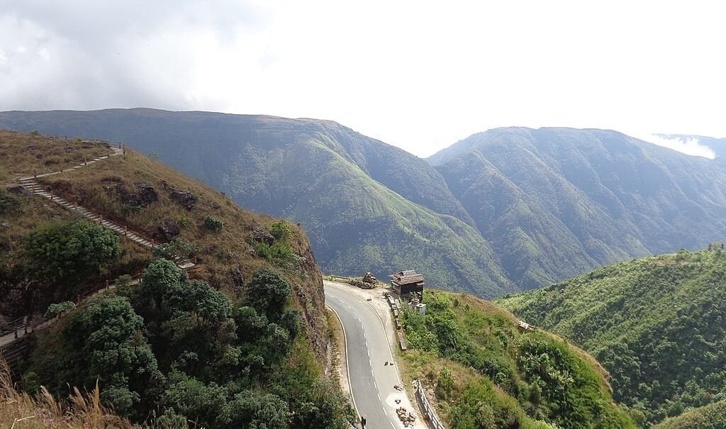
Highest Rainfall in India (2026 Climate Rankings, Mawsynram vs Cherrapunji & Orographic Science) – From the arid sands of the Thar Desert to the mist-cloaked escarpments of the North-Eastern highlands, India encompasses some of the most dynamic meteorological extremes on the planet. Among these precipitation records, the state of Meghalaya (meaning “Abode of Clouds”) holds the global benchmark. The small village of Mawsynram, nestled in the East Khasi Hills of Meghalaya, receives the highest annual rainfall in India and the world, averaging an extraordinary 11,872 millimeters (467.4 inches) of rain each year.
Closely following is its historic twin, Cherrapunji (Sohra), which holds undisputed world records for the wettest single year and calendar month ever documented. In this comprehensive physical geography guide, we examine why Mawsynram and Cherrapunji receive unprecedented deluges, the Top 7 rainiest places in India (including Western Ghats hotspots like Agumbe and Amboli), orographic funneling mechanics, and living root bridge bio-engineering.
| Meteorological Record Category | Location & State | Average Annual Rainfall (mm / in) | Global / National Significance |
|---|---|---|---|
| Highest Annual Rainfall in India & World | Mawsynram, East Khasi Hills, Meghalaya | ~11,872 mm (467.4 inches) | Guinness World Record for wettest inhabited place on Earth |
| Second Wettest Place in India | Cherrapunji (Sohra), Meghalaya | ~11,430 – 11,777 mm (450+ inches) | Historic record-holder for single-year and single-month rainfall |
| Highest Single-Year Rainfall in History | Cherrapunji (August 1860 – July 1861) | 26,467 mm (1,042 inches) | Greatest recorded 12-month precipitation ever observed on Earth |
| Highest Single-Month Rainfall in History | Cherrapunji (July 1861) | 9,296 mm (366 inches) | Wettest calendar month ever recorded in meteorological history |
| Wettest Place in South India | Agumbe & Hulikal, Shivamogga, Karnataka | ~7,000 – 7,620 mm (275+ inches) | Known as the “Cherrapunji of the South” (Western Ghats rainforest) |
| Wettest Place in Maharashtra | Amboli, Sindhudurg District | ~7,500 mm (295 inches) | South Konkan hill station receiving intense Arabian Sea monsoons |
| Lowest Rainfall in India (Contrast) | Rupli / Jaisalmer (Rajasthan) & Leh (Ladakh) | <100 mm (under 4 inches) | Arid desert and cold mountain rain-shadow zones |
1. Mawsynram: The Wettest Inhabited Place on Planet Earth
Situated roughly 15 kilometers west of Cherrapunji at an elevation of 1,400 meters (4,593 feet) in the East Khasi Hills, Mawsynram is officially certified by climatologists and the Guinness Book of World Records as the wettest spot on Earth. While coastal plains experience seasonal showers, Mawsynram endures continuous cloudbursts where the sky rarely clears for weeks during peak monsoon. On June 17, 2022, Mawsynram set a historic 24-hour record by logging an incredible 1,003.2 mm (39.5 inches) of rain in a single day.
- Living with Relentless Rain: The local Khasi community relies on traditional full-body rain shields known as Knups—turtle-shell-shaped gear woven from bamboo strips, wild reeds, and waterproof leaves—which allow tea planters and farmers to work hands-free in heavy downpours.
- Mawjymbuin Cave: A famous natural geological landmark in Mawsynram containing a massive 4-meter-high stalagmite naturally shaped like a Shiva Lingam, continually bathed by mineral-rich water dripping from the cave ceiling.
2. Cherrapunji (Sohra): The Historic Monsoon Capital
Known in the native Khasi language as Sohra (which the British pronounced as Churra and later Cherrapunji), this plateau town rests on the southern cliff edge of the Meghalaya plateau at an altitude of 1,484 meters (4,869 feet), dropping sharply into the floodplains of Sylhet in Bangladesh. Although Mawsynram edges slightly higher in modern 30-year rainfall averages, Cherrapunji holds the most dramatic single-event records in global climate history:
- The Unbroken 1860–1861 Deluge: Over a single 12-month period from August 1, 1860, to July 31, 1861, Cherrapunji recorded 26,467 mm (1,042 inches) of precipitation—enough water to submerge a two-story building.
- The Inundation of July 1861: In that single month, Sohra logged 9,296 mm (366 inches) of rainfall.
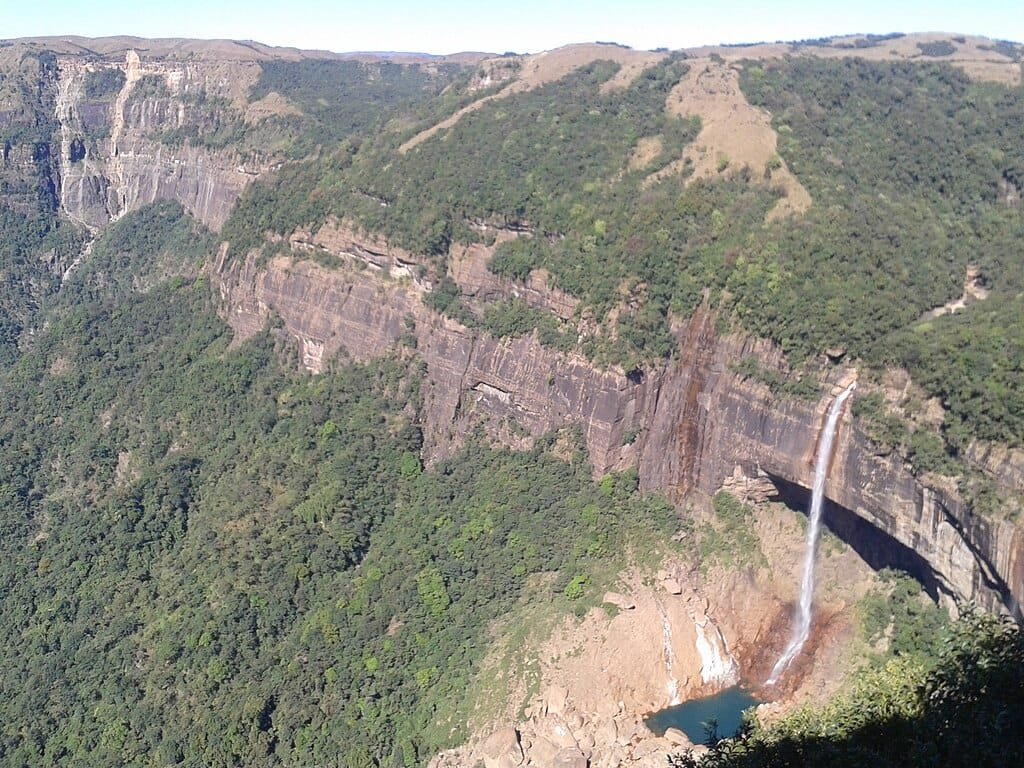
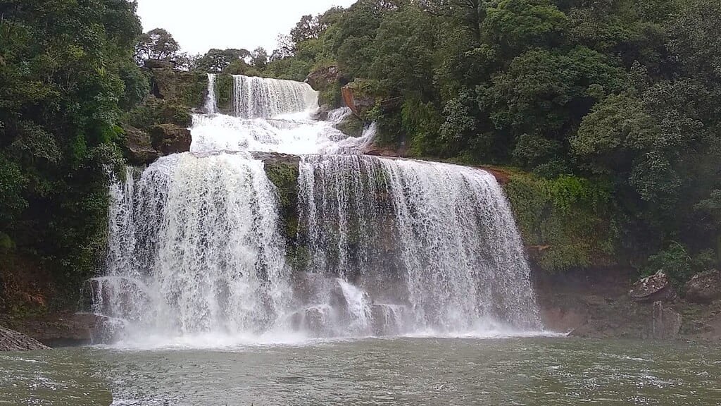
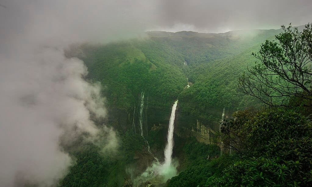
- Roaring Waterfalls: The plateau’s sheer limestone canyons create some of Asia’s most spectacular waterfalls, including Nohkalikai Falls (340 m drop), Seven Sisters (Nohsngithiang) Falls, and Dainthlen Falls.
Monsoon Science: Why Does Meghalaya Receive So Much Rainfall?
The monumental rainfall over the Meghalaya plateau is the result of a classic meteorological phenomenon known as orographic uplift amplified by geographical funneling:
- Unobstructed Moisture Highway: During the southwest monsoon season, the Bay of Bengal branch sweeps north across thousands of kilometers of ocean, picking up maximum moisture before traveling across the flat delta plains of Bangladesh without meeting any topographical barrier.
- The Great Orographic Wall: After traveling over flat terrain, these moisture-laden clouds suddenly collide with the vertical sandstone and limestone cliff walls of the Meghalaya plateau, which rise abruptly from near sea level to over 1,400 meters.
- The Khasi Funneling Trap: The Garo, Khasi, and Jaintia Hills form an amphitheater-like valley funnel facing south. Prevailing southwesterly winds force clouds deep into this tapering gorge. With no eastern or northern escape routes, the trapped maritime air is forced rapidly upward into the cooler upper troposphere.
- Adiabatic Condensation: As the air ascends, it expands and cools rapidly (adiabatic lapse rate). This causes near-instant condensation, releasing massive volumes of moisture directly over Mawsynram and Cherrapunji.
Top 7 Rainiest Places in India (Ranked by Annual Precipitation)
While the Khasi Hills dominate the top ranks, the windward western slopes of the Western Ghats form an equally impressive rain belt along the Arabian Sea coast:
| Rank | Destination / Town | State & Mountain Range | Avg. Annual Rainfall | Key Geographic Highlight |
|---|---|---|---|---|
| 1 | Mawsynram | Meghalaya (Khasi Hills) | ~11,872 mm | Undisputed rainiest inhabited place on Earth |
| 2 | Cherrapunji (Sohra) | Meghalaya (Khasi Hills) | ~11,430 – 11,777 mm | Historic world records for single-year and single-month rain |
| 3 | Agumbe | Karnataka (Western Ghats) | ~7,620 mm | “Cherrapunji of the South”; king cobra research sanctuary |
| 4 | Hulikal | Karnataka (Western Ghats) | ~7,500+ mm | Shivamogga district; frequently rivals Agumbe during peak monsoons |
| 5 | Amboli | Maharashtra (Sahyadri Range) | ~7,500 mm | Wettest hill station in Maharashtra; lush waterfalls and mist |
| 6 | Mahabaleshwar | Maharashtra (Western Ghats) | ~5,600 mm | Elevated strawberry plateau receiving heavy orographic downpours |
| 7 | Neriamangalam | Kerala (Ernakulam District) | ~4,200 mm | Known as the “Cherrapunji of Kerala”; gateway to the Munnar hills |
Bio-Engineering Marvel: The Living Root Bridges (Jingkieng Jri)
Because relentless monsoon floods frequently swept away traditional wooden bridges and rusted steel footpaths, the indigenous Khasi and Jaintia tribes devised a brilliant bio-engineering solution centuries ago: Living Root Bridges (Jingkieng Jri).
- Living Architecture: By directing the pliable aerial secondary roots of the Ficus elastica (Indian rubber tree) through hollowed betel-nut tree trunks across roaring jungle gorges, roots gradually anchor into opposite banks.
- Generational Strength: Unlike concrete structures that deteriorate in acidic rainfall, living root bridges grow stronger and more resilient over decades as the root systems thicken and interlock. Some double-decker root bridges in Nongriat village are estimated to be over 200 years old, supporting 50+ travelers simultaneously.
Best Time to Visit India’s Rainiest Destinations
Planning a trip to Meghalaya or the Western Ghats requires matching your travel goals with seasonal shifts:
- For Waterfall & Cloud Chasers (July to September): Experience the raw majesty of monsoon rivers, thundering waterfalls, and fast-moving cloud banks. Rain gear, waterproof bags, and leech protection are mandatory.
- For Trekking & Sightseeing (October to February): Post-monsoon skies clear into brilliant sunshine with daytime temperatures around 15°C to 20°C. Waterfalls retain healthy volumes, while the Umngot River in Dawki becomes completely transparent.
- Pre-Monsoon Exploration (March to May): Pleasant spring days suited for spelunking in Meghalaya’s limestone cave networks (like Krem Liat Prah and Mawsmai Cave).
Frequently Asked Questions (FAQs)
Which place in India receives the highest annual rainfall?
Mawsynram, located in the East Khasi Hills of Meghalaya, receives the highest annual rainfall in India and the world, averaging approximately 11,872 millimeters (467.4 inches) every year.
Why does Mawsynram receive more rain than Cherrapunji?
Although situated only 15 kilometers apart on the same plateau, Mawsynram sits directly inside a narrower, deeper valley trough that channels incoming clouds more tightly, forcing slightly higher condensation.
Which place receives the highest rainfall in South India?
Agumbe and Hulikal in the Shivamogga district of Karnataka receive the highest rainfall in South India, recording annual averages between 7,000 mm and 7,620 mm.
Which place in India receives the lowest rainfall?
Rupli near Jaisalmer in the Thar Desert (Rajasthan) and Leh in Ladakh record the lowest rainfall in India, often averaging under 100 millimeters annually due to continental rain-shadow effects.
Explore More National Geography, Mountains & Elevation Guides:
Highest Mountain Peak in India | Highest Peak in South India (Anamudi) | Highest Dam in India (Tehri Dam) | Wayanad Height From Sea Level | Madikeri Height From Sea Level | Gangtok Height From Sea Level