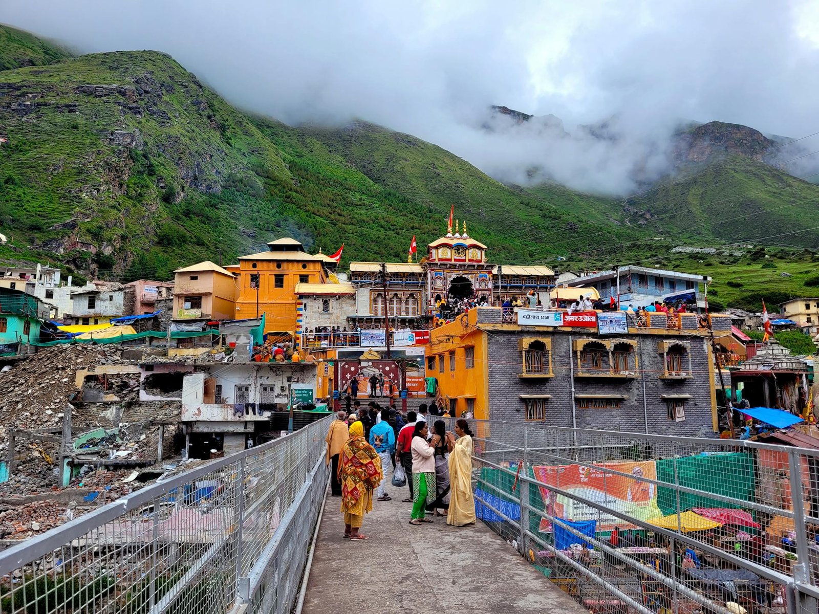
Badrinath Height From Sea Level (2026 Elevation, Route Map & Char Dham Guide) – Perched between the twin mountain ranges of Nar and Narayana along the rushing glacial waters of the Alaknanda River, Badrinath Dham is situated at an official elevation of 3,133 meters (10,279 feet) above sea level (with the surrounding valley plateau extending up to 3,300 meters / 10,827 feet). Located in the Chamoli district of Uttarakhand, Badrinath is the premier pilgrimage destination of the sacred Char Dham Yatra and one of the 108 holy Divya Desams dedicated to Lord Vishnu.
Framed by the pyramid-shaped, snow-capped summit of Neelkanth Peak, this high-altitude sanctuary attracts millions of pilgrims and mountain lovers every season. In this comprehensive 2026 travel and geography guide, we examine Badrinath’s exact height in meters and feet, town-by-town route elevations along NH-7, Tapt Kund hot springs, Mana Village landmarks, seasonal climate variations, and altitude sickness (AMS) precautions.
Geographical Parameter
Official Elevation & Location Details
Badrinath Temple Elevation
3,133 meters (10,279 feet) above sea level
Surrounding Valley Range
3,100 m – 3,300 m (10,170 ft – 10,827 ft)
Prominent Backdrop Peak (Neelkanth)
6,597 meters (21,644 feet)
Mountain Range
Garhwal Himalayas (Central Himalayan Zone)
Sacred River
Alaknanda River (Major tributary forming the Ganga)
While official Survey of India cartographic benchmarks record the main sanctum sanctorum of Badrinath Temple at 3,133 meters (10,279 feet), common travel literature often rounds the wider valley settlement to 3,300 meters (10,827 feet). The town sits in a high glacial U-shaped valley framed by dramatic topography:
Nar and Narayana Mountains: The valley is sheltered by Nar Parvat (5,831 m) to the east and Narayana Parvat (5,965 m) to the west, revered in Hindu scriptures as the eternal meditating manifestations of Arjuna and Lord Krishna.
Neelkanth Peak (6,597 m / 21,644 ft): Towering immediately behind the temple, the dramatic conical peak of Neelkanth (often hailed as the “Garhwal Queen”) catches the first rays of morning sunlight, creating a golden halo over the shrine.
Alaknanda River Gorges: Emerging from the Satopanth and Bhagirath Kharak glaciers further upstream, the Alaknanda flows directly below the temple steps, dividing the town into two banks connected by pedestrian suspension bridges.
Unlike Kedarnath and Yamunotri which require strenuous multi-kilometer uphill treks on foot or pony, Badrinath is fully motorable right up to the temple perimeter parking lot. This makes it accessible for pilgrims of all ages despite its high altitude of over 10,200 feet.
Elevation Profile Along National Highway 7 (Rishikesh to Badrinath)
Ascending to Badrinath via the All-Weather Char Dham Highway (NH-7) involves a gradual 295-kilometer climb from the foothills through the sacred river confluences (Panch Prayag):
Transit Point / Town
Distance from Rishikesh
Elevation in Meters
Elevation in Feet
Rishikesh
0 km (Base)
372 m
1,220 ft
Devprayag (Alaknanda meets Bhagirathi)
~70 km
475 m
1,558 ft
Srinagar Garhwal
~105 km
560 m
1,837 ft
Rudraprayag (Alaknanda meets Mandakini)
~140 km
610 m
2,001 ft
Karnaprayag (Alaknanda meets Pindar)
~172 km
780 m
2,559 ft
Chamoli Town / Gopeshwar
~205 km
960 m – 1,450 m
3,150 ft – 4,757 ft
Joshimath (Jyotirmath)
~250 km
1,890 m
6,200 ft
Govindghat (Valley of Flowers diversion)
~270 km
1,828 m
5,997 ft
Pandukeshwar (Yog Dhyan Badri)
~275 km
1,920 m
6,299 ft
Badrinath Dham
~295 km
3,133 m
10,279 ft
Climate & Weather Driven by High Altitude
Due to its 3,133-meter sub-alpine altitude, Badrinath remains cool during the warmest summer months and severely freezing in winter:
Summer Season (May to June): Daytime temperatures range between 8°C and 18°C, offering crisp and pleasant conditions. However, post-sunset temperatures rapidly plunge to 3°C–6°C, requiring heavy woolens even in June.
Monsoon Deluge (July to August): The upper Alaknanda basin receives heavy rainfall. Hill roads between Joshimath and Badrinath (especially near Lambagar and Hanuman Chatti) are susceptible to mudslides and shooting stones. Travelers should always check state disaster management alerts.
Autumn Window (September to October): Post-monsoon skies clear up completely, delivering sharp views of snow-capped peaks and daytime temperatures around 10°C to 15°C before the seasonal freeze sets in.
Winter Closure (November to April): Temperatures drop well below zero, reaching -10°C to -15°C with heavy snow covering the temple town under several feet of snow. The shrine officially closes around Diwali, and the ceremonial idol of Lord Badri Vishal is transported down to the winter seat at the Narsingh Temple in Joshimath.
High-Altitude Attractions Near Badrinath
Exploring Badrinath beyond the primary temple compound reveals several iconic geographic and cultural sites:
Tapt Kund (3,130 m): A natural geothermal spring located immediately below the temple entrance on the banks of the Alaknanda. Despite ambient air temperatures near freezing, this sulfur-rich thermal spring stays at a consistent 45°C to 55°C, where pilgrims take a holy bath before entering the sanctum.
Mana Village (3,200 m / 10,498 ft): Located just 3 km north of Badrinath, Mana is officially designated as “India’s First Village” on the border with Tibet. It is inhabited by the indigenous Bhotia community.
Bheem Pul & Saraswati River Gorge: A natural stone boulder bridge in Mana Village spanning the Saraswati River as it roars through a narrow rock canyon before merging into the Alaknanda at Keshav Prayag.
Vyas Gufa & Ganesh Gufa: Ancient rock-cut caves in Mana where Maharishi Ved Vyas is believed to have composed the epic Mahabharata with Lord Ganesha serving as the scribe.
Vasudhara Falls (3,700 m – 4,000 m / 12,200 ft): An alpine waterfall situated a 5-kilometer hike from Mana Village, where glacial water cascades from a 400-foot cliff face against the backdrop of Chaukhamba and Satopanth peaks.
Because Badrinath sits above the 3,000-meter threshold, the atmospheric pressure and oxygen partial pressure are lower than on the plains:
Do Not Rush the Drive: Avoid traveling directly from Rishikesh or Haridwar to Badrinath in a single day. Make an overnight acclimatization halt at Joshimath (1,890 m) or Pandukeshwar (1,920 m) to allow your respiratory system to adjust.
Hydrate Continuously: Cold mountain air dries out mucous membranes and accelerates dehydration. Consume at least 3 to 4 liters of warm water, ginger tea, or electrolyte drinks daily.
Recognize AMS Warning Signs: Mild headaches, lightheadedness, nausea, loss of appetite, and restless sleep are common initial symptoms of Acute Mountain Sickness. Rest quietly, avoid physical overexertion on your arrival afternoon, and keep portable oxygen canisters on hand for elderly relatives.
How to Reach Badrinath
By Road: Fully connected via National Highway 7 (NH-7) from Rishikesh through Devprayag, Srinagar, Rudraprayag, Karnaprayag, Chamoli, and Joshimath.
Helicopter Services: Regular commercial Char Dham helicopter packages fly daily during the open season from Dehradun’s Sahastradhara Helipad directly to the Badrinath Helipad located 1 km from the temple.
Nearest Airport: Jolly Grant Airport, Dehradun (DED) – ~310 km.
Nearest Railway Station: Rishikesh / Yog Nagari Rishikesh (~295 km), with the ongoing Rishikesh–Karnaprayag rail project set to significantly shorten road travel times. If taking buses from Chandigarh, review routes at Sector 17 Chandigarh Bus Stand.
What is the exact Badrinath Height From Sea Level?
The main Badrinath Temple is located at an altitude of 3,133 meters (10,279 feet) above sea level, while the surrounding valley settlement extends to approximately 3,300 meters (10,827 feet).
Is Badrinath higher than Kedarnath and Yamunotri?
No. Kedarnath (3,583 m) and Yamunotri (3,293 m) are both higher than Badrinath (3,133 m). Gangotri (3,100 m) is the only shrine in the Char Dham circuit located slightly lower than Badrinath.
Do you have to trek to reach Badrinath Temple?
No trekking is required. Unlike Kedarnath or Yamunotri, Badrinath is fully motorable via National Highway 7, with vehicles parking just a few hundred meters from the temple entrance.
What is the water temperature of Tapt Kund in Badrinath?
The natural geothermal hot spring at Tapt Kund maintains a continuous temperature of approximately 45°C to 55°C (113°F to 131°F) year-round, regardless of freezing outdoor mountain weather.


Comments are closed.