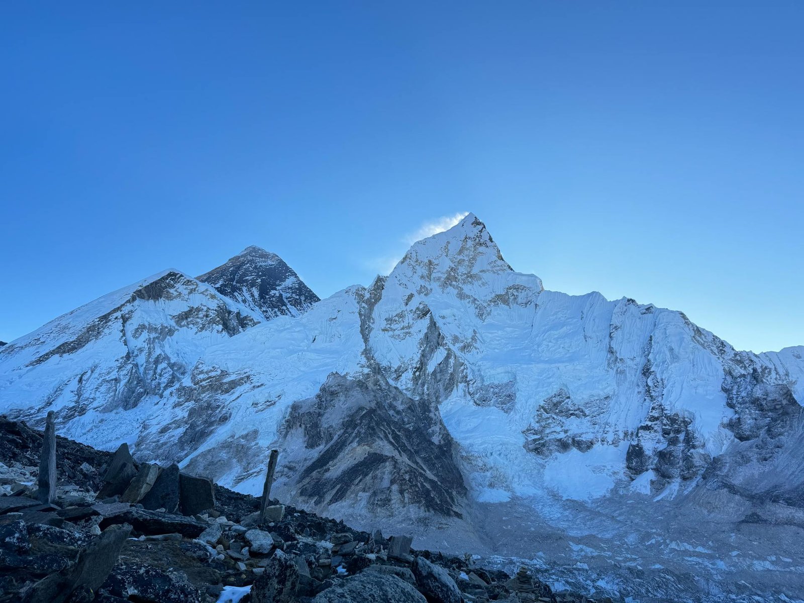
Mount Everest Height From Sea Level (2026 Official Elevation, Geodetic Remeasurement, Death Zone & Trekking Guide) – Soaring above the Mahalangur Himal sub-range on the border between Nepal and the Tibet Autonomous Region of China, Mount Everest (Sagarmatha in Nepali, Chomolungma in Tibetan) stands at an official elevation of 8,848.86 meters (29,031.7 feet) above sea level. Formally ratified in a historic bilateral announcement by the governments of Nepal and China in December 2020, this geodetic measurement resolved decades of international scientific debate regarding rock-head height versus summit snowpack depth.
As the highest geographical point on Earth, Everest’s extreme altitude creates one of the most hostile environments on the planet—marked by hurricane-force jet stream winds exceeding 160 km/h, temperatures plummeting to -60°C, and atmospheric pressure at the summit falling to just one-third of sea level. In this definitive 2026 geographical reference guide, we examine Mount Everest’s exact height in meters and feet, the 2020 GNSS satellite survey, tectonic plate uplift dynamics, the 8,000-meter Death Zone physiology, Everest Base Camp (EBC) elevation profiles, and climbing routes.
How Mount Everest’s Height Was Measured: The 2020 Geodetic Survey
Everest’s elevation has been calculated using increasingly sophisticated surveying methods over the past 170 years:
Great Trigonometrical Survey (1852–1856): British surveyors led by Sir George Everest and mathematician Radhanath Sikdar established that “Peak XV” was the highest mountain in the world, initially calculating its height at exactly 29,002 feet (8,839.8 m) using ground-based theodolite stations situated over 150 km away in the plains of Bihar.
Survey of India (1954): Using advanced multi-station triangulation, the Survey of India refined the elevation to 8,848 meters (29,029 feet), a benchmark that stood as the globally accepted reference for more than six decades.
The 2020 Bilateral Survey (8,848.86 m): Following the devastating 7.8-magnitude Gorkha earthquake in 2015, geologists suspected shifts in Himalayan crustal elevation. Survey teams from Nepal (2019) and China (2020) summitted Everest with advanced Global Navigation Satellite System (GNSS) receivers, radar antennas, and gravimeters. By combining satellite triangulation with precise gravimetric modeling of the marine geoid (the actual mean sea level surface extended under the continents), both nations officially ratified the updated height of 8,848.86 meters (29,031.7 feet), adding 0.86 meters (approx. 2.8 feet) to the historic 1954 benchmark.
Snowpack vs. Rock Height: Ground-penetrating radar deployed during the survey revealed that the summit consists of a limestone rock dome capped by roughly 3 to 4 meters of permanent compacted snow and ice.
Tectonic Geology: Why Everest Continues to Grow
Mount Everest is not an inert mass of stone; it is an active geological structure formed by powerful continental collision:
The Continental Collision: Approximately 50 million years ago, the northward-drifting Indian tectonic plate collided with the Eurasian continental plate. Because both landmasses consist of buoyant continental crust, neither could subduct easily into the mantle, forcing the marine sediments of the ancient Tethys Ocean upward to create the Himalayas.
Marine Fossils at the Summit: The upper pyramid of Everest—known as the Qomolangma Formation—is composed of Ordovician marine limestone dating back over 450 million years. Climbers regularly discover fossilized marine trilobites, crinoids, and ancient sea shells just below the 8,848-meter summit ridge.
Annual Uplift vs. Glacial Denudation: The Indian Plate continues to push northward beneath the Tibetan Plateau at a rate of 4 to 5 centimeters per year. This crustal shortening lifts Mount Everest by roughly 4 to 8 millimeters annually, while wind scour, freeze-thaw rock fracturing, and gravity-driven avalanches continuously erode the mountain, maintaining a dynamic equilibrium.
Altitude Zonation: Waypoints from Lukla to the Summit (8,848.86 m)
Climbing Mount Everest via the classic South Col Route in Nepal involves traversing distinct physiological and ecological elevation tiers:
Expedition Waypoint
Altitude (Meters)
Altitude (Feet)
Physiological & Climbing Environment
Lukla Airport (Tenzing-Hillary)
2,860 m
9,383 ft
Trek starting point; mountain airstrip in the Dudh Kosi valley
Spiritual Buddhist center with iconic views of Ama Dablam & Everest
Dingboche Village
4,410 m
14,468 ft
High alpine settlement above the tree line; secondary acclimatization base
Gorak Shep
5,164 m
16,942 ft
Final frozen lodge outpost situated below the Kala Patthar ridge
Everest Base Camp (EBC)
5,364 m
17,598 ft
Expedition tent city established atop the dynamic Khumbu Icefall moraine
Camp I (Valley of Silence Entry)
6,065 m
19,900 ft
Upper rim above the hazardous, crevasse-riddled Khumbu Icefall
Camp II (Advanced Base Camp)
6,400 m
21,000 ft
Spacious camp in the Western Cwm; staging hub for summit rotations
Camp III (Lhotse Face)
7,200 m
23,622 ft
Tents carved into a 40-degree sheer blue-ice wall; oxygen use begins
Camp IV (South Col)
7,920 m
25,984 ft
Windswept rocky col separating Everest and Lhotse; gateway to Death Zone
The Balcony
8,400 m
27,559 ft
Small resting platform on the southeast ridge; switch to fresh oxygen bottles
The Hillary Step
8,790 m
28,838 ft
Historic 12-meter near-vertical rock face below the summit ridge
Mount Everest Summit
8,848.86 m
29,031.7 ft
Highest point on planet Earth; 360-degree curve of the horizon
Atmospheric Physics: The “Death Zone” Above 8,000 Meters
In high-altitude mountaineering, any terrain situated above 8,000 meters (26,247 feet) is formally designated as the Death Zone:
Severe Atmospheric Hypoxia: Although the atmospheric composition of air remains roughly 21% oxygen at all altitudes, barometric pressure at Everest’s summit drops from 1,013 millibars (at sea level) to approximately 337 millibars. With each inhalation, a climber draws in only one-third of the oxygen molecules available at the coast.
The Human Survival Clock: Above 8,000 meters, human cells consume oxygen faster than the bloodstream can replenish it, even while resting. The body enters progressive multi-organ decline. Climbers cannot survive in the Death Zone for more than 48 to 72 hours without succumbing to High Altitude Cerebral Edema (HACE), High Altitude Pulmonary Edema (HAPE), or fatal exhaustion.
Supplementary Oxygen Systems: Over 97% of successful mountaineers utilize closed-circuit or continuous-flow supplementary oxygen masks starting from Camp III (7,200 m) or the South Col (7,920 m), regulating flow rates to simulate an effective altitude of approximately 6,500 to 7,000 meters.
Elevation Comparison: Mount Everest vs. The World’s Highest Peaks
Compare Mount Everest’s 8,848.86-meter elevation against other iconic 8,000-meter giants and regional Himalayan summits:
Due to its extreme elevation penetrating the upper troposphere, Mount Everest directly intercepts the high-altitude subtropical jet stream:
Spring Climbing Window (May): The primary mountaineering window opens for approximately 7 to 14 days in mid-to-late May. During this brief interlude, the approaching Indian summer monsoon shifts the jet stream northward into Tibet, creating calm conditions on the summit with wind speeds temporarily dropping below 40 km/h.
Autumn Climbing Season (September to October): Characterized by crisp skies following the retreat of the summer monsoon. While colder than May, summit bids are occasionally mounted, though post-monsoon snow accumulation elevates avalanche hazards on the Lhotse Face.
Harsh Winter (December to February): Winter summit attempts are exceptionally rare. Sustained jet stream winds frequently exceed 160 to 200 km/h, accompanied by windchill temperatures plunging below -60°C, tearing exposed tents off the South Col and scouring the upper ridges down to bare black rock.
Visiting the Everest Region: Treks & Flight Options
While scaling the 8,848-meter summit requires years of technical alpine mountaineering experience and substantial expedition budgets, experiencing Mount Everest in person is accessible via non-technical trekking routes:
Everest Base Camp Trek (5,364 m): A world-famous 12 to 14-day teahouse trek starting from Lukla through the Khumbu Valley. Hikers climb to Kala Patthar (5,550 m) for direct views of Everest’s black western face and the Khumbu icefall.
Gokyo Lakes & Cho La Pass: An alternative high-altitude route taking trekkers through turquoise glacial tarns and climbing Gokyo Ri (5,357 m) for a sweeping vista of four 8,000-meter peaks: Everest, Lhotse, Makalu, and Cho Oyu.
Mountain Flights from Kathmandu: Daily morning scenic flights depart Tribhuvan International Airport (KTM), providing travelers with window-side views of the Everest massif and surrounding Himalayan glaciers without hiking.
Regional Connectivity from Chandigarh: Travelers connecting to Nepal from the Tricity can reach New Delhi via direct train or bus from Sector 17 Chandigarh Bus Stand, followed by connecting flights from IGI Airport directly to Kathmandu.
The official, internationally recognized height of Mount Everest from sea level is 8,848.86 meters (29,031.7 feet), measured and jointly certified by Nepal and China in December 2020.
Why did Everest’s height increase from 8,848 m to 8,848.86 m?
The updated height incorporates modern satellite-based GNSS surveying, precise sea-level geoid calculations, and geological adjustments following the 2015 Nepal earthquake, establishing the snow-cap elevation with millimeter precision.
What is the altitude of Everest Base Camp (EBC)?
The South Everest Base Camp in Nepal sits at an altitude of 5,364 meters (17,598 feet), while the North Everest Base Camp in Tibet (China) is situated at 5,150 meters (16,900 feet).
What is the Death Zone on Mount Everest?
The Death Zone refers to the high-altitude terrain above 8,000 meters (26,247 feet), where atmospheric pressure drops to approximately one-third of sea level, making long-term human survival impossible without supplemental bottled oxygen.