Chandrashila Height From Sea Level (2026 Exact Altitude, Chopta-Tungnath Trek, 360° Himalayan Panorama & Weather Guide) – Towering directly above the sacred 1,000-year-old Tungnath Temple in the Rudraprayag district of Uttarakhand, Chandrashila Peak sits at an elevation of 4,000 meters (13,123 feet) above sea level. Translating literally from Sanskrit as the “Moon Rock”, Chandrashila represents the dramatic summit crest of the Chandranath mountain range in the Garhwal Himalayas. Renowned as one of Northern India’s most accessible and visually rewarding high-altitude summits, it provides a legendary 360-degree panoramic vista encompassing India’s greatest peaks—including Nanda Devi (7,816 m), Trishul (7,120 m), the four massifs of Chaukhamba (7,138 m), Kedarnath Peak, and Bandarpunch.
Whether undertaken as an alpine sunrise trek or a spiritual pilgrimage tracing the meditation seat of Lord Rama, ascending Chandrashila involves a total vertical climb of 1,320 meters (4,330 feet) over 5 kilometers starting from the meadow basecamp of Chopta. In this comprehensive 2026 mountain reference guide, we examine Chandrashila’s exact altitude in meters and feet, trail gradients from Tungnath, temperature patterns across seasons, summit sunrise planning, and altitude sickness prevention.
Waypoint / Landmark
Elevation (Meters)
Elevation (Feet)
Topographical Role & Significance
Chandrashila Peak (Summit)
4,000 m
13,123 ft
“Moon Rock” crest with ancient Ganga-Rama shrine & 360° panorama
Topography: The 5-Kilometer Trek from Chopta to Chandrashila
The journey from the roadhead at Chopta to the apex of Chandrashila is completed in two continuous hiking segments, demanding a steady cardiovascular pace:
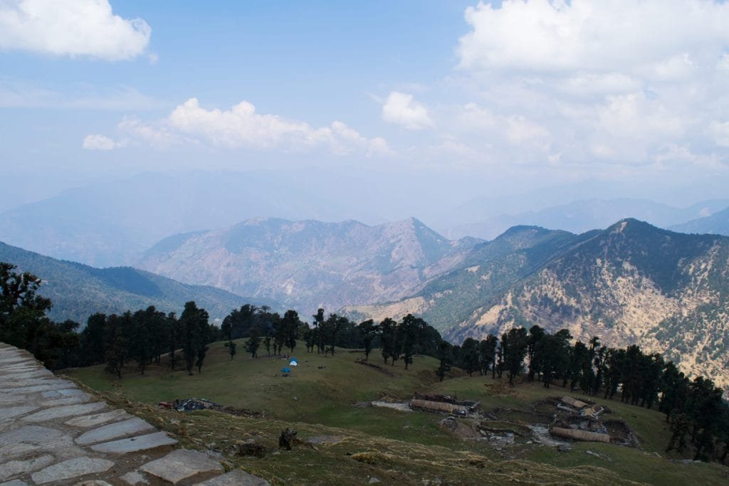
Segment 1: Chopta to Tungnath Temple (3.5 km | 2,680 m to 3,680 m): The first section is a well-engineered, broad stone-paved pathway with 11 sweeping hairpin switchbacks. Climbing through blooming red and pink rhododendron (Buransh) forests and high alpine pastures, hikers gain 1,000 vertical meters in roughly 2.5 to 3.5 hours. Paved resting shelters and handrails line the route. (Review complete temple history in our guide to Tungnath Height From Sea Level).
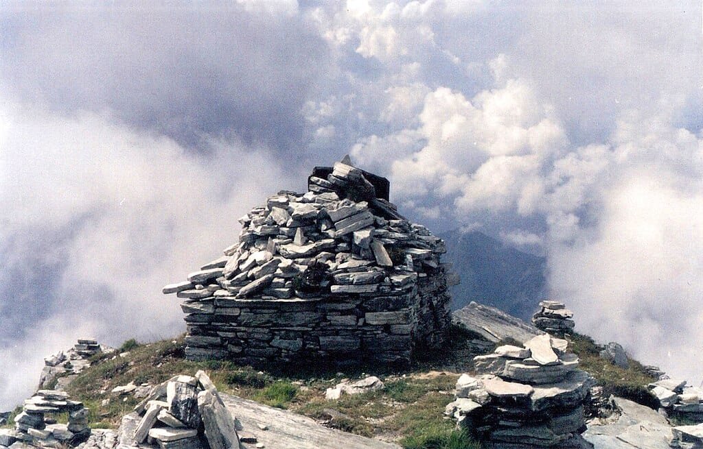
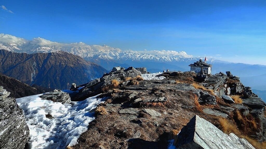
Segment 2: Tungnath to Chandrashila Summit (1.5 km | 3,680 m to 4,000 m): Leaving the stone paving of Tungnath behind, the final 1.5-kilometer stretch becomes an unpaved, steep alpine mountain trail climbing another 320 vertical meters (approx. 45 to 60 minutes). The path crosses loose shale, scree, and windswept rocky shoulders before arriving at the rocky summit cairn topped by a small stone shrine dedicated to Goddess Ganga.
The 4:00 AM Sunrise Push: Most trekkers start from Chopta or Tungnath around 4:00 AM with headlamps. Reaching the summit before 6:00 AM rewards hikers with the iconic alpenglow, where dawn sunlight bathes the massive Chaukhamba massif in brilliant shades of amber, gold, and crimson.
The 360-Degree Himalayan Panorama at 4,000 Meters
Because Chandrashila is an isolated summit ridge standing clear of obstructing high valleys, it offers one of the widest unbroken mountain horizons in Northern India:
Visible Himalayan Peak / Range
Summit Altitude (Meters)
Summit Altitude (Feet)
Visual Perspective From Chandrashila
Nanda Devi
7,816 m
25,643 ft
India’s second-highest summit rising prominently in the eastern horizon
Chaukhamba I, II, III, IV
7,138 m
23,418 ft
Colossal four-pillared snow fortress dominating the direct northern view
Trishul (Trisul)
7,120 m
23,359 ft
Distinct trident-shaped glaciated massif toward the east
Elevation Comparison: Chandrashila vs. Regional High Peaks
To appreciate Chandrashila’s 4,000-meter vantage point, observe how its elevation stacks up against other Himalayan passes, pilgrimage shrines, and ski resorts:
Climate, Weather & Seasonal Trekking Conditions at 4,000 m
Due to its high altitude, temperatures at the Chandrashila summit remain cold throughout the year, with rapid diurnal weather shifts:
Spring & Summer (April to June): The most popular trekking period. Daytime summit temperatures hover comfortably between 8°C and 16°C, with nighttime readings dropping to 2°C to 5°C. Snow along the trail thaws, while the lower valleys from Sari to Chopta bloom with scarlet rhododendrons.
Monsoon Caution (July to August): The Garhwal hills experience heavy cloudbursts. Dense cloud cover often blankets the summit, obscuring views. The stone path below Tungnath can become slick with moss, and mountain highways around Rudraprayag are prone to localized mudslides.
Autumn Crystal Window (September to November): The best season for photography and long-distance mountain viewing. The post-monsoon atmosphere is scrubbed clean of haze, offering razor-sharp summit visibility. Summit temperatures plunge at night, ranging from -2°C to 4°C.
Winter Snow Trekking (December to March): Chandrashila transforms into an alpine winter wonderland blanketed in 3 to 6 feet of snow. Daytime summit temperatures sit between -4°C and 4°C, while nighttime winds plunge temperatures down to -10°C to -15°C. The final 1.5 km ridge above Tungnath develops icy verglas, requiring microspikes, gaiters, and trekking poles.
Altitude Health & Acute Mountain Sickness (AMS) Protocol
Because hikers gain over 1,300 vertical meters within a single morning, the body must adjust to lower oxygen density:
Mandatory Acclimatization Night at Chopta (2,680 m): Do not drive directly from Rishikesh or Haridwar (approx. 350 m) and attempt the 4,000-meter summit on the same day. Spend at least one night sleeping at Chopta, Sari village, or Ukhimath to let your red blood cell count adjust naturally.
Pacing and Breathing: Match your walking pace to your breath. Rushing up the 11 switchbacks leads to rapid lactic acid accumulation and breathlessness. Take 60-second breathing breaks at designated stone shelters.
Hydration Essentials: Cold mountain air accelerates dehydration through breathing. Drink at least 3 liters of warm water or electral fluids daily. Avoid alcohol, caffeine, or sleeping pills.
Windchill Protection: Wind speeds at the exposed 4,000-meter summit ridge frequently exceed 40–50 km/h. Pack a three-layer clothing system: thermal innerwear, an insulating fleece mid-layer, and a windproof, waterproof outer shell jacket with a warm beanie and insulated gloves.
Route Planning & How to Reach Chopta Basecamp
Reaching the base of the Chandrashila trek involves traveling through the Alaknanda and Mandakini river valleys of Uttarakhand:
By Road via Rishikesh (Standard Route): Rishikesh → Devprayag (Ganga confluence) → Srinagar → Rudraprayag → Tilwara → Kund → Ukhimath → Chopta (~205 km / approx. 7 to 8 hours driving via NH-7 and the Kund-Chopta-Gopeshwar highway).
Alternative Scenic Route via Tehri: Rishikesh → Chamba → New Tehri (visit the massive reservoir featured in our guide to the Highest Dam in India (Tehri Dam)) → Ghansali → Mayali → Tilwara → Chopta (~215 km).
Nearest Airport: Jolly Grant Airport in Dehradun (DED) – located approximately 220 km from Chopta.
What is the exact chandrashila height from sea level?
Chandrashila Peak sits at an altitude of approximately 4,000 meters (13,123 feet) above sea level in the Garhwal Himalayas of Rudraprayag district, Uttarakhand.
How far is Chandrashila Peak from Tungnath Temple?
Chandrashila Peak is located approximately 1.5 kilometers beyond Tungnath Temple, climbing an additional 320 vertical meters along a steep rocky mountain trail.
What is the total trek distance from Chopta to Chandrashila?
The total one-way trek distance from Chopta to Chandrashila Peak is 5 kilometers (3.5 km from Chopta to Tungnath + 1.5 km from Tungnath to the summit), with a total vertical elevation gain of approximately 1,320 meters.
Which mountain peaks are visible from Chandrashila Summit?
The summit provides a 360-degree panorama of prominent Himalayan peaks including Nanda Devi (7,816 m), Trishul (7,120 m), Chaukhamba I-IV (7,138 m), Kedarnath Peak, Kedar Dome, and Bandarpunch.

Comments are closed.