

Chamoli Height From Sea Level – 9 Powerful Facts You Must Know
Chamoli Height From Sea Level (2026 Elevation, Valley Profiles & Himalayan Travel Guide) – Known as the “Abode of the Gods” (Devbhoomi), Chamoli is one of Uttarakhand’s most topographically diverse and spiritually revered districts in the Garhwal Himalayas. Spanning from riverbed confluences along the Alaknanda to glacier-draped peaks on the Indo-Tibetan border, the district encompasses a dramatic elevation spectrum.
While the district administrative headquarters at Gopeshwar sits at an altitude of approximately 1,450 to 1,550 meters (4,760 to 5,085 feet), Chamoli district as a whole ranges from 800 meters (2,625 feet) in the southern river valleys to a staggering 7,816 meters (25,643 feet) at the summit of Nanda Devi—India’s second-highest mountain peak. In this complete 2026 geographical guide, we break down Chamoli’s exact height in meters and feet, town-by-town elevations (Gopeshwar, Joshimath, Badrinath, Auli), climate variations, road routes along NH-7, and altitude sickness (AMS) safety tips.
 While staying in lower valley towns like Chamoli (1,000 m) or Gopeshwar (1,450 m) carries no risk of altitude sickness, ascending to Badrinath (3,133 m) or trekking to Hemkund Sahib (4,329 m) crosses the physiological threshold for Acute Mountain Sickness (AMS):
| Geographic / Settlement Point | Height in Meters (MSL) | Height in Feet (MSL) | Significance / Location |
|---|---|---|---|
| Chamoli Town (NH-7 Highway) | ~960 m – 1,100 m | 3,150 ft – 3,600 ft | Alaknanda River Valley Crossing |
| Gopeshwar (District HQ) | 1,450 m – 1,550 m | 4,760 ft – 5,085 ft | Administrative Center & Gopinath Temple |
| Joshimath (Jyotirmath) | 1,890 m | 6,200 ft | Adi Shankaracharya Math / Winter Seat |
| Auli Hill Station | 2,800 m – 3,050 m | 9,186 ft – 10,000 ft | International Ski Resort & Bugyals |
| Badrinath Dham | 3,133 m | 10,279 ft | Char Dham Pilgrimage / Alaknanda Banks |
| Valley of Flowers (UNESCO) | 3,658 m | 12,000 ft | Alpine Biosphere & Wild Flora |
| Tungnath Temple | 3,680 m | 12,073 ft | Highest Shiva Temple in the World |
| Hemkund Sahib Gurudwara | 4,329 m | 14,202 ft | High-Altitude Glacial Lake & Shrine |
| Nanda Devi Peak (Summit) | 7,816 m | 25,643 ft | Highest Point in District / 2nd in India |
Understanding Chamoli’s Topography: Town vs. District Elevation
When searching for “Chamoli height from sea level”, travelers often encounter conflicting numbers ranging from 1,000 meters to over 3,500 meters. This variation stems from the distinction between the town and the vast district territory:
- Chamoli Town (~1,000 m / 3,280 ft): Located directly along the Alaknanda Riverbed and National Highway 7 (Badrinath Highway). It serves as a transit stop connecting travelers to the upper Himalayas.
- Gopeshwar (~1,450 m – 1,550 m / 4,760 ft – 5,085 ft): The administrative headquarters of Chamoli district, situated 8.5 km uphill from Chamoli town. Perched on an open mountain ridge, it enjoys cooler weather and houses the historic 11th-century Gopinath Temple.
- Upper Himalayan Wilderness: The northern boundaries of Chamoli rise steeply into the Great Himalayan Range, hosting iconic massifs like Kamet (7,756 m), Trishul (7,120 m), Dronagiri (7,066 m), and Nanda Devi (7,816 m).
How Elevation Shapes Chamoli’s Climate & Seasons
Because elevation varies by more than 7,000 meters across the district, Chamoli transitions from subtropical river valley conditions to permafrost alpine tundra:- Summer (April to June): In Gopeshwar and Chamoli town, daytime temperatures range between 18°C and 28°C, offering a mild escape from northern India’s heat plains. Higher destinations like Badrinath and Auli experience cooler conditions between 8°C and 18°C.
- Monsoon (July to September): Moisture-heavy monsoon winds trigger intense rain across the lower valley ridges. Heavy rainfall often causes landslides and road blockages along the Joshimath–Rishikesh stretch of NH-7; cautious travel planning is essential.
- Autumn (October to November): Crisp mountain air, stable atmospheric pressure, and clear skies provide optimal panoramic views of snow-covered peaks like Chaukhamba and Nanda Devi.
- Winter (December to March): Regions above 2,200 meters (Auli, Badrinath, Hemkund Sahib) experience heavy snowfall. While Badrinath closes for the season, Auli transforms into India’s premier ski resort with sub-zero night temperatures ranging from -6°C to 5°C.
Major High-Altitude Landmarks in Chamoli District
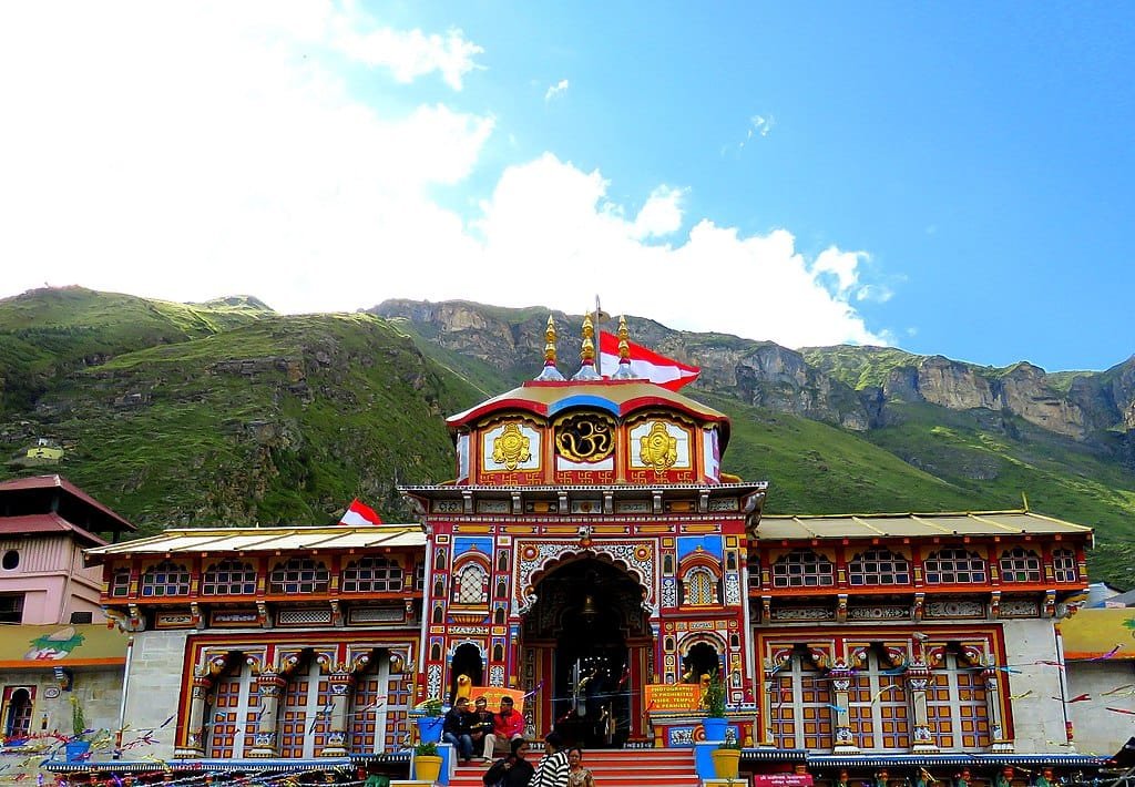
- Badrinath Dham (3,133 m / 10,279 ft): Nestled between the Nar and Narayana mountain ranges, this cornerstone of the Char Dham pilgrimage sits on the banks of the Alaknanda River.
- Auli (2,800 m / 9,186 ft): A skiing destination connected from Joshimath via a 4-kilometer ropeway, offering sweeping vistas of Nanda Devi, Mana Parvat, and Kamet.
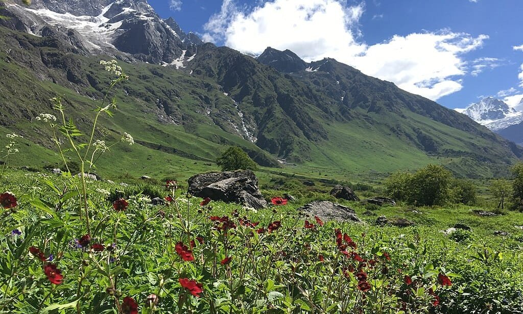
- Valley of Flowers National Park (3,658 m / 12,000 ft): A high-altitude Himalayan valley and UNESCO World Heritage Site, blooming from July to September with hundreds of rare alpine flora species, including the blue poppy and brahma kamal.
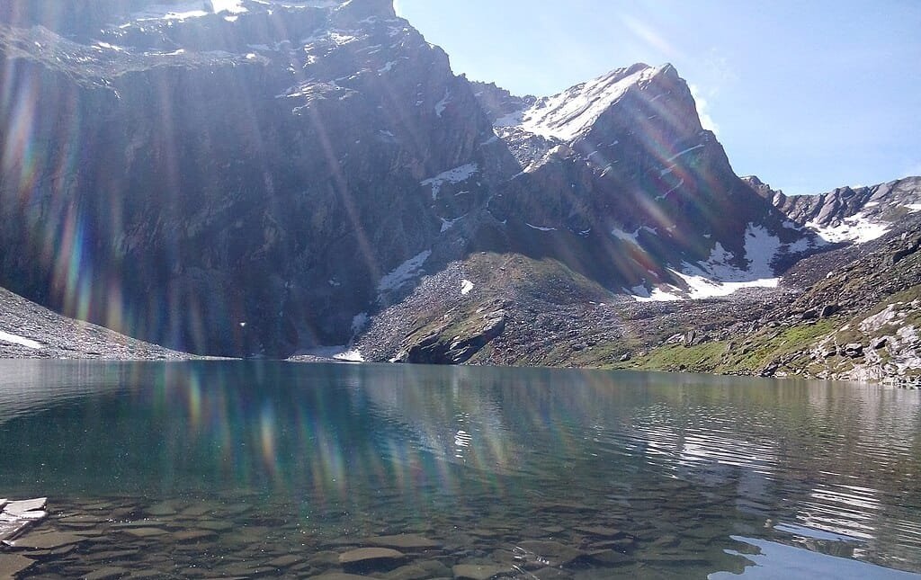
- Hemkund Sahib (4,329 m / 14,202 ft): A revered Sikh pilgrimage site beside a glacial lake encircled by seven mountain peaks, reached via an uphill trek from Ghangaria.
- Panch Prayag Confluences: Chamoli district contains three of the five sacred river confluences: Karnaprayag (Alaknanda meets Pindar at 780 m), Nandaprayag (Alaknanda meets Nandakini at 870 m), and Vishnuprayag (Alaknanda meets Dhauliganga at 1,372 m).
Altitude Sickness (AMS) & Acclimatization Guidelines
While staying in lower valley towns like Chamoli (1,000 m) or Gopeshwar (1,450 m) carries no risk of altitude sickness, ascending to Badrinath (3,133 m) or trekking to Hemkund Sahib (4,329 m) crosses the physiological threshold for Acute Mountain Sickness (AMS):
- Acclimatize in Joshimath: Spend at least one night in Joshimath (1,890 m) or Ghangaria (3,050 m) before ascending toward higher shrines. Avoid driving directly from Haridwar/Rishikesh to Badrinath in a single day.
- Hydration: Drink 3 to 4 liters of water and electrolyte solutions daily. Dehydration accelerates altitude headaches in dry mountain air.
- Watch for Symptoms: Persistent throbbing headaches, nausea, dizziness, and shortness of breath while resting are key warning signs of AMS. If symptoms worsen, descend immediately to a lower elevation.
How to Reach Chamoli: Transit & Highways
- By Road (NH-7 All-Weather Highway): The primary route connects via National Highway 7 through Rishikesh, Devprayag, Srinagar, Rudraprayag, and Karnaprayag straight to Chamoli town and Joshimath.
- Nearest Airport: Jolly Grant Airport, Dehradun (DED) – ~225 km from Chamoli town and ~270 km from Joshimath.
- Nearest Railway Station: Rishikesh / Yog Nagari Rishikesh Railway Station (~200 km) and Haridwar (~225 km), with the ongoing Rishikesh-Karnaprayag rail line set to provide direct train access into the district foothills.
Frequently Asked Questions (FAQs)
What is the exact height of Chamoli from sea level?
The administrative headquarters at Gopeshwar sits at an altitude of approximately 1,450 to 1,550 meters (4,760 to 5,085 feet), while Chamoli town along the highway lies at ~1,000 meters. The district as a whole spans from 800 meters to 7,816 meters (Nanda Devi summit).Which is the highest point in Chamoli district?
The highest point in Chamoli district is Nanda Devi, rising to 7,816 meters (25,643 feet) above sea level. It is the second-highest peak in India and the highest peak located entirely within Indian borders.What is the height of Badrinath and Auli compared to Chamoli?
Auli is located at 2,800 meters (9,186 feet), while Badrinath Dham is situated at 3,133 meters (10,279 feet), sitting significantly higher than Chamoli town and Gopeshwar.Explore More Himalayan Elevation & Hill Station Guides: Tungnath Height From Sea Level | Kedarnath Height From Sea Level | Highest Peak in South India | Yercaud Height From Sea Level | Guwahati Height From Sea Level
Comments are closed.